
3 Bus Route Map
View the 3 route map and see all 3 stops along the route. The map of 3 shows where the bus travels and the location of each stop, making it easy to understand the entire route at a glance.
Explore Cap Cotentin (Cherbourg, Agglo. du Cotentin) routes on the map and see where Cap Cotentin (Cherbourg, Agglo. du Cotentin) bus services operate. Use the 3 map to find bus stops and see how the 3 connects different areas along its trip.
All 3 stops on the map are displayed in route order, helping you follow the 3 bus from the first stop to the last.
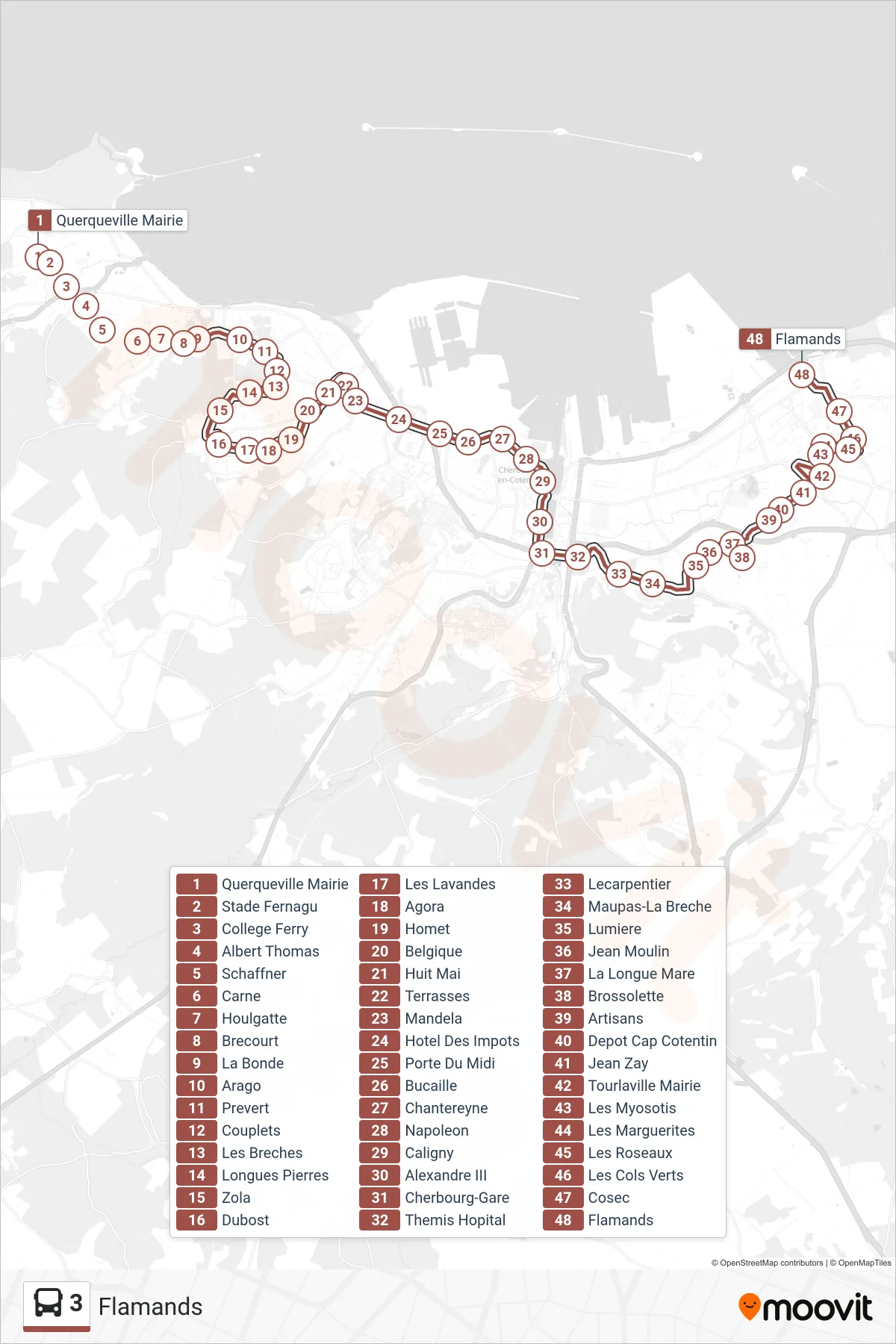
Stops list (3 - Flamands)
- Querqueville Mairie
- Stade Fernagu
- College Ferry
- Albert Thomas
- Schaffner
- Carne
- Houlgatte
- Brecourt
- La Bonde
- Arago
- Prevert
- Couplets
- Les Breches
- Longues Pierres
- Zola
- Dubost
- Les Lavandes
- Agora
- Homet
- Belgique
- Huit Mai
- Terrasses
- Mandela
- Hotel Des Impots
- Porte Du Midi
- Bucaille
- Chantereyne
- Napoleon
- Caligny
- Alexandre III
- Cherbourg-Gare
- Themis Hopital
- Lecarpentier
- Maupas-La Breche
- Lumiere
- Jean Moulin
- La Longue Mare
- Brossolette
- Artisans
- Depot Cap Cotentin
- Jean Zay
- Tourlaville Mairie
- Les Myosotis
- Les Marguerites
- Les Roseaux
- Les Cols Verts
- Cosec
- Flamands