
3 Bus Route Map
View the 3 route map and see all 3 stops along the route. The map of 3 shows where the bus travels and the location of each stop, making it easy to understand the entire route at a glance.
Explore Petaluma Transit routes on the map and see where Petaluma Transit bus services operate. Use the 3 map to find bus stops and see how the 3 connects different areas along its trip.
All 3 stops on the map are displayed in route order, helping you follow the 3 bus from the first stop to the last.
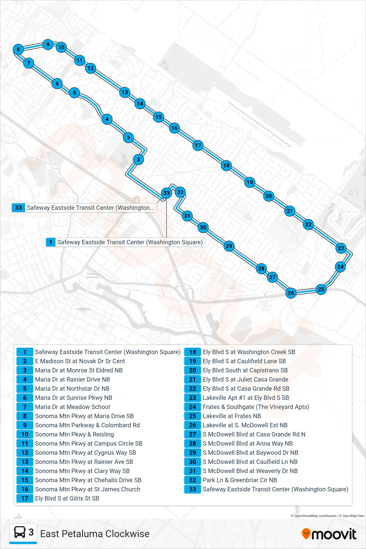
Stops list (3 - Loop)
- Safeway Eastside Transit Center (Washington Square)
- E Madison St at Novak Dr Sr Cent
- Maria Dr at Monroe St Eldred NB
- Maria Dr at Rainier Drive NB
- Maria Dr at Northstar Dr NB
- Maria Dr at Sunrise Pkwy NB
- Maria Dr at Meadow School
- Sonoma Mtn Pkwy at Maria Drive SB
- Sonoma Mtn Parkway & Colombard Rd
- Sonoma Mtn Pkwy & Reisling
- Sonoma Mtn Pkwy at Campus Circle SB
- Sonoma Mtn Pkwy at Cygnus Way SB
- Sonoma Mtn Pkwy at Rainier Ave SB
- Sonoma Mtn Pkwy at Clary Way SB
- Sonoma Mtn Pkwy at Chehalis Drive SB
- Sonoma Mtn Pkwy at St James Church
- Ely Blvd S at Gilrix St SB
- Ely Blvd S at Washington Creek SB
- Ely Blvd S at Caulifield Lane SB
- Ely Blvd South at Capistrano SB
- Ely Blvd S at Juliet Casa Grande
- Ely Blvd S at Casa Grande Rd SB
- Lakeville Apt #1 at Ely Blvd S SB
- Frates & Southgate (The Vineyard Apts)
- Lakeville at Frates NB
- Lakeville at S. McDowell Ext NB
- S McDowell Blvd at Casa Grande Rd N
- S McDowell Blvd at Anna Way NB
- S McDowell Blvd at Baywood Dr NB
- S McDowell Blvd at Caulfield Ln NB
- S McDowell Blvd at Weaverly Dr NB
- Park Ln & Greenbriar Cir NB
- Safeway Eastside Transit Center (Washington Square)