
3 Bus Route Map
View the 3 route map and see all 3 stops along the route. The map of 3 shows where the bus travels and the location of each stop, making it easy to understand the entire route at a glance.
Explore Stadtverkehr Tüb. routes on the map and see where Stadtverkehr Tüb. bus services operate. Use the 3 map to find bus stops and see how the 3 connects different areas along its trip.
All 3 stops on the map are displayed in route order, helping you follow the 3 bus from the first stop to the last.
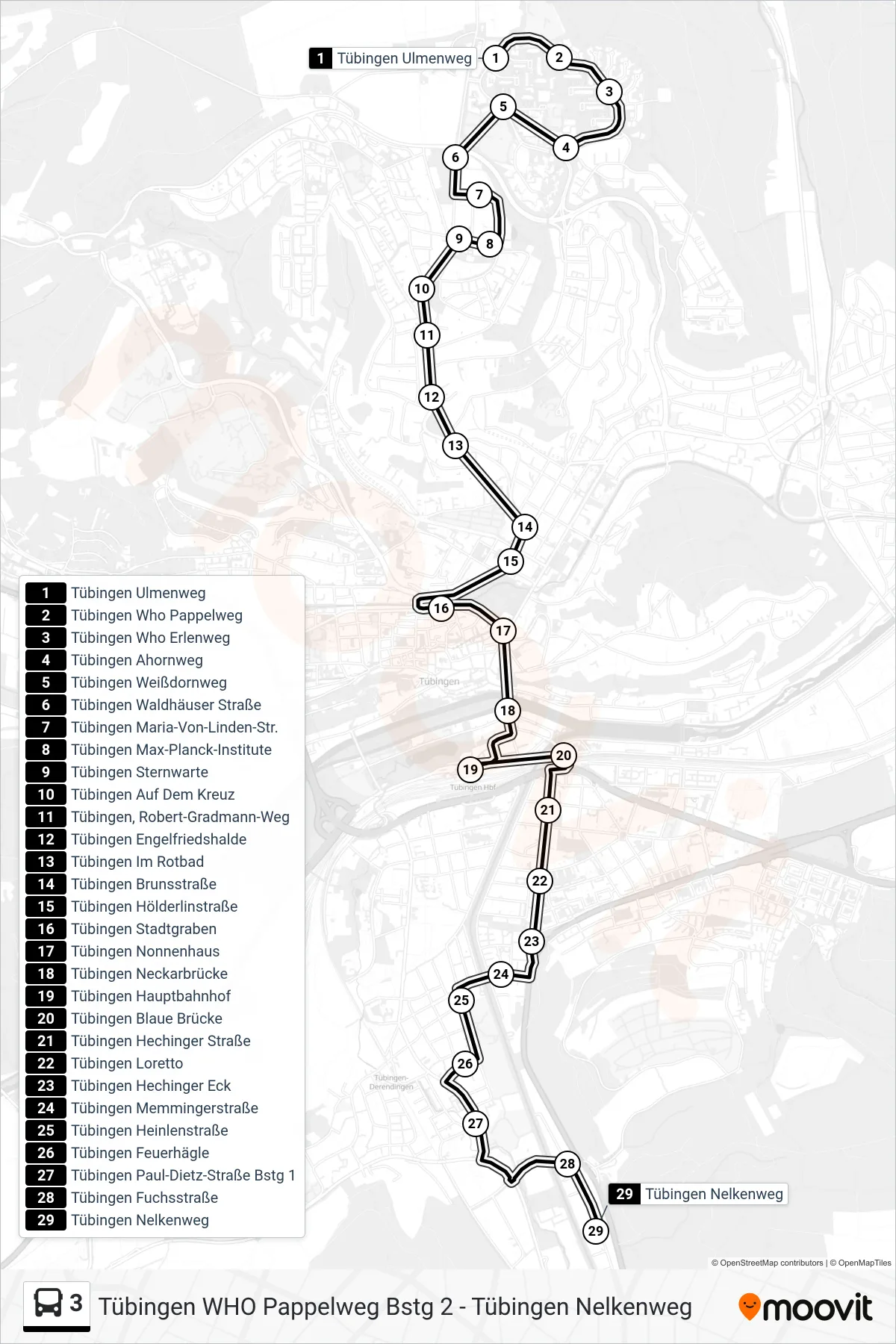
Stops list (3 - Tübingen Nelkenweg)
- Tübingen Ulmenweg
- Tübingen Who Pappelweg
- Tübingen Who Erlenweg
- Tübingen Ahornweg
- Tübingen Weißdornweg
- Tübingen Waldhäuser Straße
- Tübingen Maria-Von-Linden-Str.
- Tübingen Max-Planck-Institute
- Tübingen Sternwarte
- Tübingen Auf Dem Kreuz
- Tübingen, Robert-Gradmann-Weg
- Tübingen Engelfriedshalde
- Tübingen Im Rotbad
- Tübingen Brunsstraße
- Tübingen Hölderlinstraße
- Tübingen Stadtgraben
- Tübingen Nonnenhaus
- Tübingen Neckarbrücke
- Tübingen Hauptbahnhof
- Tübingen Blaue Brücke
- Tübingen Hechinger Straße
- Tübingen Loretto
- Tübingen Hechinger Eck
- Tübingen Memmingerstraße
- Tübingen Heinlenstraße
- Tübingen Feuerhägle
- Tübingen Paul-Dietz-Straße Bstg 1
- Tübingen Fuchsstraße
- Tübingen Nelkenweg