
30 Bus Route Map
View the 30 route map and see all 30 stops along the route. The map of 30 shows where the bus travels and the location of each stop, making it easy to understand the entire route at a glance.
Explore Prato and Province - Tuscan Bus Lines routes on the map and see where Prato and Province - Tuscan Bus Lines bus services operate. Use the 30 map to find bus stops and see how the 30 connects different areas along its trip.
All 30 stops on the map are displayed in route order, helping you follow the 30 bus from the first stop to the last.
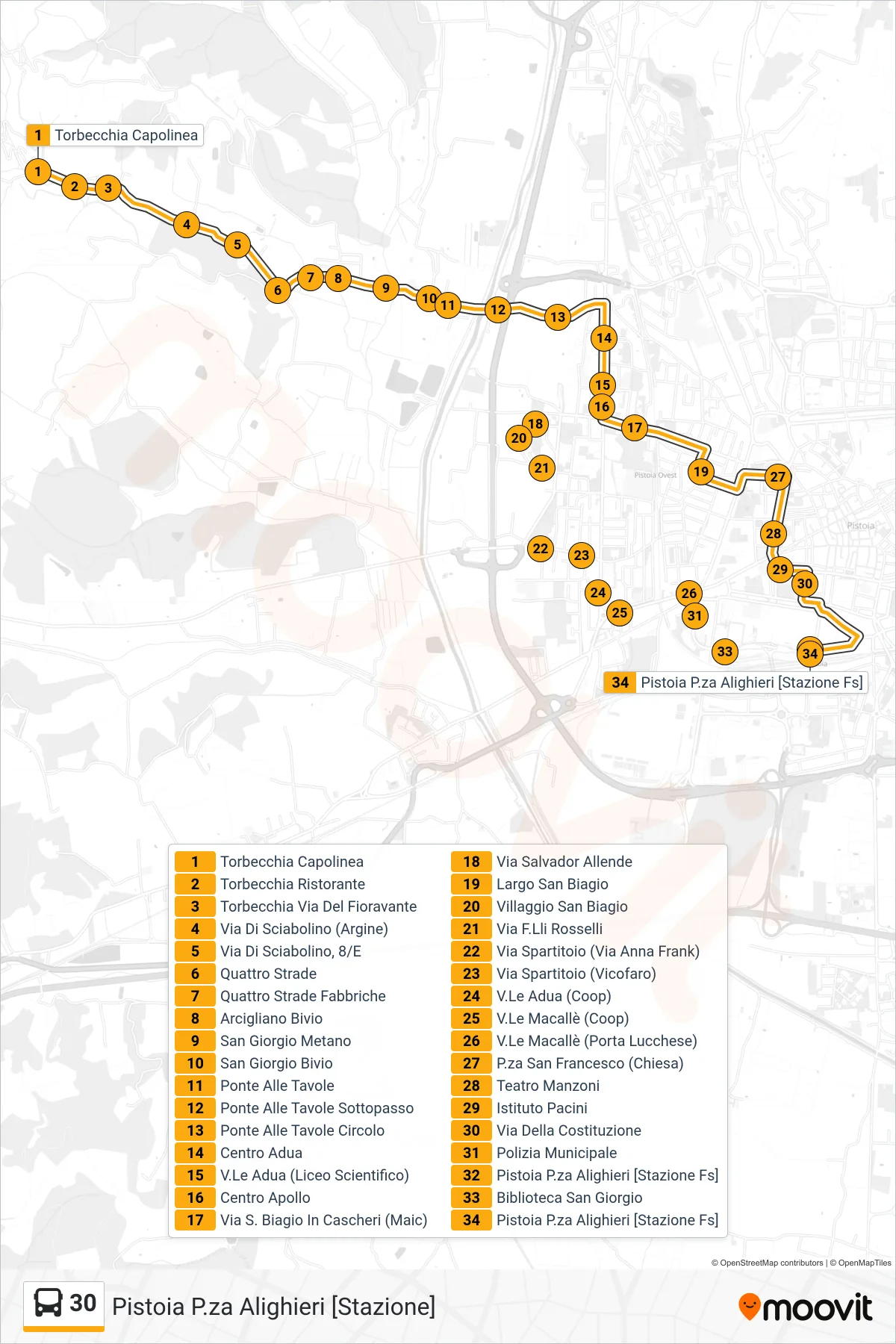
Stops list (30 - Pistoia P.za Alighieri [Stazione])
- Torbecchia Terminal
- Torbecchia Restaurant
- Torbecchia Fioravante Street
- Sciabolino Street (Embankment)
- Via Di Sciabolino, 8/E
- Four Roads
- Quattro Strade Fabbriche
- Arcigliano Junction
- San Giorgio Gas Station
- San Giorgio Junction
- Ponte Alle Tavole
- Ponte Alle Tavole Underpass
- Ponte Alle Tavole Circle
- Adua Center
- Adua Avenue (Science High School)
- Apollo Center
- Via San Biagio In Cascheri (Maic)
- Salvador Allende Street
- San Biagio Square
- San Biagio Village
- F.Lli Rosselli Street
- Via Spartitoio (Via Anna Frank)
- Spartitoio Street (Vicofaro)
- Adua Avenue (Coop)
- Macalle Avenue (Coop)
- Macalle Avenue (Lucchese Gate)
- San Francesco Square (Church)
- Manzoni Theater
- Pacini Institute
- Della Costituzione Street
- Municipal Police
- Pistoia Alighieri Square [Railway Station]
- San Giorgio Library
- Pistoia Alighieri Square [Railway Station]