
30 Bus Route Map
View the 30 route map and see all 30 stops along the route. The map of 30 shows where the bus travels and the location of each stop, making it easy to understand the entire route at a glance.
Explore Superbus routes on the map and see where Superbus bus services operate. Use the 30 map to find bus stops and see how the 30 connects different areas along its trip.
All 30 stops on the map are displayed in route order, helping you follow the 30 bus from the first stop to the last.
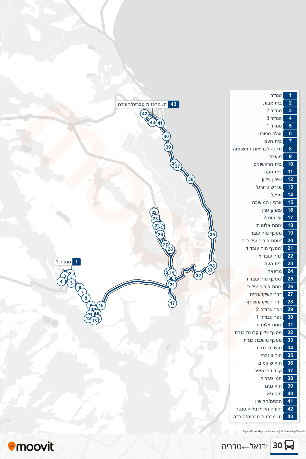
Stops list (30 - Yavne'el→Tiberias)
- Smadar 1
- Retirement Home
- Smadar 2
- Smadar 3
- Smadar 1
- Sports Hall
- Beit Ha'am
- Family Health Center
- Council
- Beit HaRishonim
- Beit Ha'am
- Upper Housing
- Soccer Field
- Factory
- Colony Archive
- Goren Park
- Alumot 2
- Alumot Junction
- Neve Oved Junction
- Poriya Illit D Junction
- Neve Oved D Junction
- Neve Oved A
- Beit Ha'am
- Clinic
- Neve Oved D Junction
- Poriya Illit Junction
- HaShaked Road/HaZayit
- HaShaked Road/HaShizaf
- Work Village 2
- Work Village 1
- Alumot Junction
- מסעף עליון קבוצת כנרת
- Kinneret Colony Junction
- Kinneret Colony
- Tzinbari Beach
- Shikmim Beach
- Rabbi Meir's Tomb
- Tiberias Hot Springs
- Ganim Beach
- Hof Guy
- HaBanim/HaKishon
- Yehuda Halevi/Duniloff Center
- Tiberias Central Station/Drop Off