
30 Bus Route Map
View the 30 route map and see all 30 stops along the route. The map of 30 shows where the bus travels and the location of each stop, making it easy to understand the entire route at a glance.
Explore Nazareth Travel and Tourism routes on the map and see where Nazareth Travel and Tourism bus services operate. Use the 30 map to find bus stops and see how the 30 connects different areas along its trip.
All 30 stops on the map are displayed in route order, helping you follow the 30 bus from the first stop to the last.
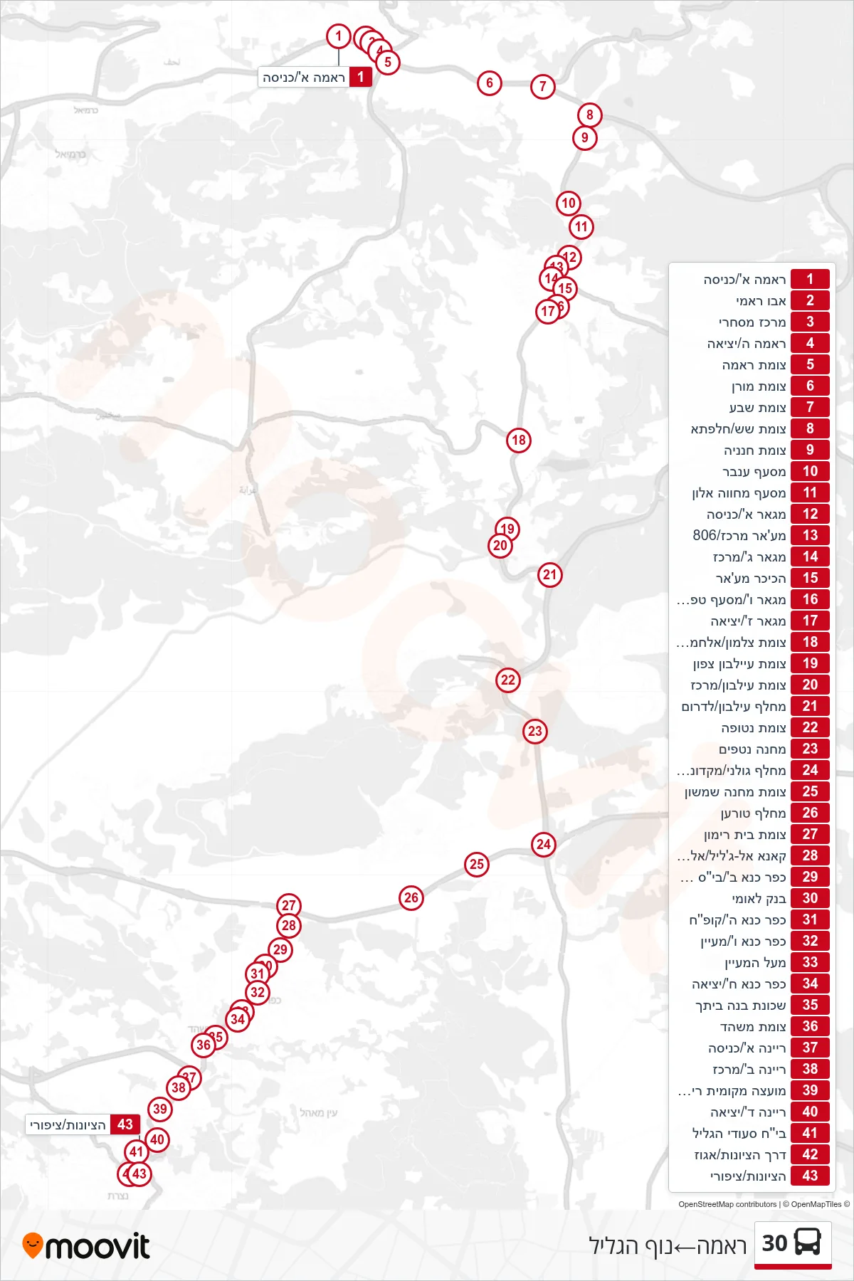
Stops list (30 - Rama→Nof HaGalil)
- Rama A/Entrance
- Abu Rami
- Commercial Center
- Rama Exit
- Rama Junction
- Moran Junction
- Seven Junction
- Shesh Junction/Halafta
- Hananya Junction
- Inbar Junction
- Mahane Alon Junction
- Maghar A/Entrance
- Maghar Center/806
- Maghar C/Center
- Ma'gar Square
- Maghar VI/Tfahot Junction
- Maghar Z/Exit
- Zalmon/Al-Hamra Junction
- Eilabun North Junction
- Eilabun Junction/Center
- Eilabun Interchange/South
- Netofa Junction
- Camp Netafim
- Golani Junction/McDonalds West
- Camp Shimshon Junction
- Toran Junction
- Beit Rimon Junction
- Kana Al-Jalil/Al-Mahdar
- Kafr Kanna B/Middle School A
- Bank Leumi
- Kfar Kana E/Health Clinic
- Kfar Kana F/Spring
- Above the Spring
- Kfar Kana H/Exit
- Build Your Home Neighborhood
- Mashhad Junction
- Reina A/Entrance
- Reina B/Center
- Reina Local Council
- Reina D/Exit
- Saudi Galilee Hospital
- Derech HaTzionut/Egoz
- HaTzionut/Tzipori