
30 Bus Route Map
View the 30 route map and see all 30 stops along the route. The map of 30 shows where the bus travels and the location of each stop, making it easy to understand the entire route at a glance.
Explore C-TRAN routes on the map and see where C-TRAN bus services operate. Use the 30 map to find bus stops and see how the 30 connects different areas along its trip.
All 30 stops on the map are displayed in route order, helping you follow the 30 bus from the first stop to the last.
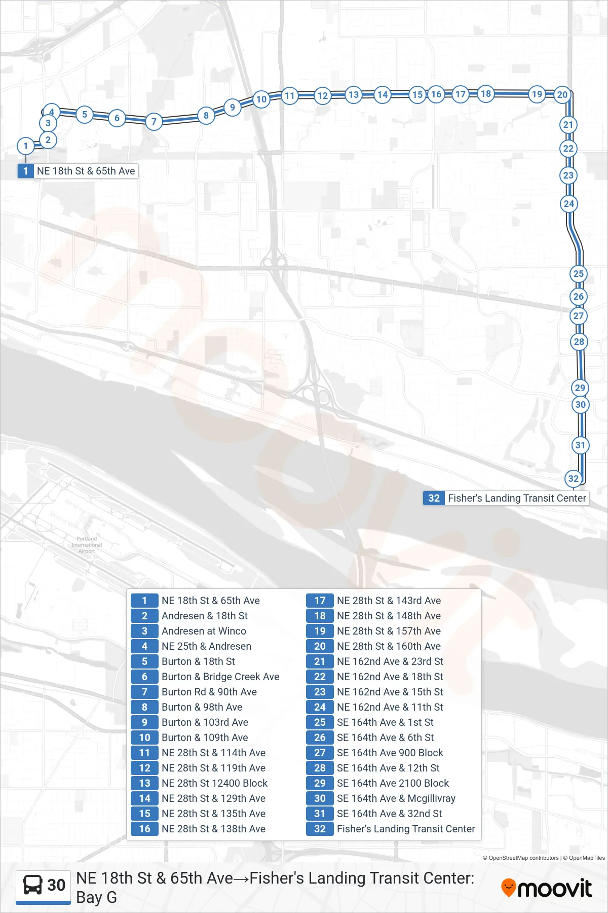
Stops list (30 - NE 18th St & 65th Ave→Fisher's Landing Transit Center: Bay G)
- NE 18th St & 65th Ave
- Andresen & 18th St
- Andresen at Winco
- NE 25th & Andresen
- Burton & 18th St
- Burton & Bridge Creek Ave
- Burton Rd & 90th Ave
- Burton & 98th Ave
- Burton & 103rd Ave
- Burton & 109th Ave
- NE 28th St & 114th Ave
- NE 28th St & 119th Ave
- NE 28th St 12400 Block
- NE 28th St & 129th Ave
- NE 28th St & 135th Ave
- NE 28th St & 138th Ave
- NE 28th St & 143rd Ave
- NE 28th St & 148th Ave
- NE 28th St & 157th Ave
- NE 28th St & 160th Ave
- NE 162nd Ave & 23rd St
- NE 162nd Ave & 18th St
- NE 162nd Ave & 15th St
- NE 162nd Ave & 11th St
- SE 164th Ave & 1st St
- SE 164th Ave & 6th St
- SE 164th Ave 900 Block
- SE 164th Ave & 12th St
- SE 164th Ave 2100 Block
- SE 164th Ave & Mcgillivray
- SE 164th Ave & 32nd St
- Fisher's Landing Transit Center
Change direction
- Route Map - 30 - Broadway & Evergreen Blvd→Fisher's Landing Transit Center: Bay G
- Route Map - 30 - Broadway & Evergreen Blvd→Fisher's Landing Transit Center: Bay E
- Route Map - 30 - E 18th St & 65th Ave→Broadway & Evergreen Blvd
- Route Map - 30 - Fisher's Landing Transit Center: Bay G→Broadway & Evergreen Blvd