
30 Bus Route Map
View the 30 route map and see all 30 stops along the route. The map of 30 shows where the bus travels and the location of each stop, making it easy to understand the entire route at a glance.
Explore MUNI routes on the map and see where MUNI bus services operate. Use the 30 map to find bus stops and see how the 30 connects different areas along its trip.
All 30 stops on the map are displayed in route order, helping you follow the 30 bus from the first stop to the last.
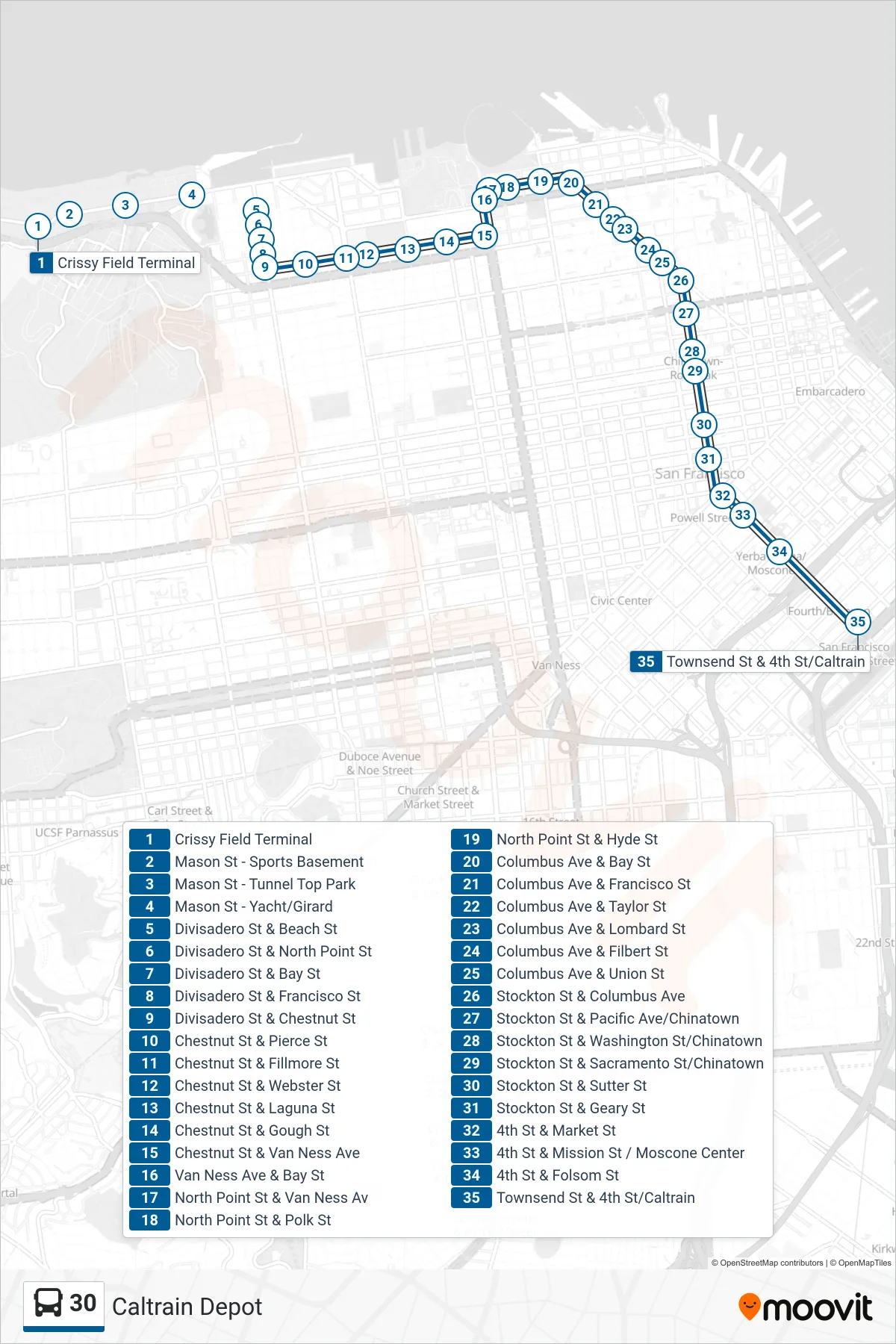
Stops list (30 - Caltrain Depot)
- Crissy Field Terminal
- Mason St - Sports Basement
- Mason St - Tunnel Top Park
- Mason St - Yacht/Girard
- Divisadero St & Beach St
- Divisadero St & North Point St
- Divisadero St & Bay St
- Divisadero St & Francisco St
- Divisadero St & Chestnut St
- Chestnut St & Pierce St
- Chestnut St & Fillmore St
- Chestnut St & Webster St
- Chestnut St & Laguna St
- Chestnut St & Gough St
- Chestnut St & Van Ness Ave
- Van Ness Ave & Bay St
- North Point St & Van Ness Av
- North Point St & Polk St
- North Point St & Hyde St
- Columbus Ave & Bay St
- Columbus Ave & Francisco St
- Columbus Ave & Taylor St
- Columbus Ave & Lombard St
- Columbus Ave & Filbert St
- Columbus Ave & Union St
- Stockton St & Columbus Ave
- Stockton St & Pacific Ave/Chinatown
- Stockton St & Washington St/Chinatown
- Stockton St & Sacramento St/Chinatown
- Stockton St & Sutter St
- Stockton St & Geary St
- 4th St & Market St
- 4th St & Mission St / Moscone Center
- 4th St & Folsom St
- Townsend St & 4th St/Caltrain