
30 Bus Route Map
View the 30 route map and see all 30 stops along the route. The map of 30 shows where the bus travels and the location of each stop, making it easy to understand the entire route at a glance.
Explore AC Transit routes on the map and see where AC Transit bus services operate. Use the 30 map to find bus stops and see how the 30 connects different areas along its trip.
All 30 stops on the map are displayed in route order, helping you follow the 30 bus from the first stop to the last.
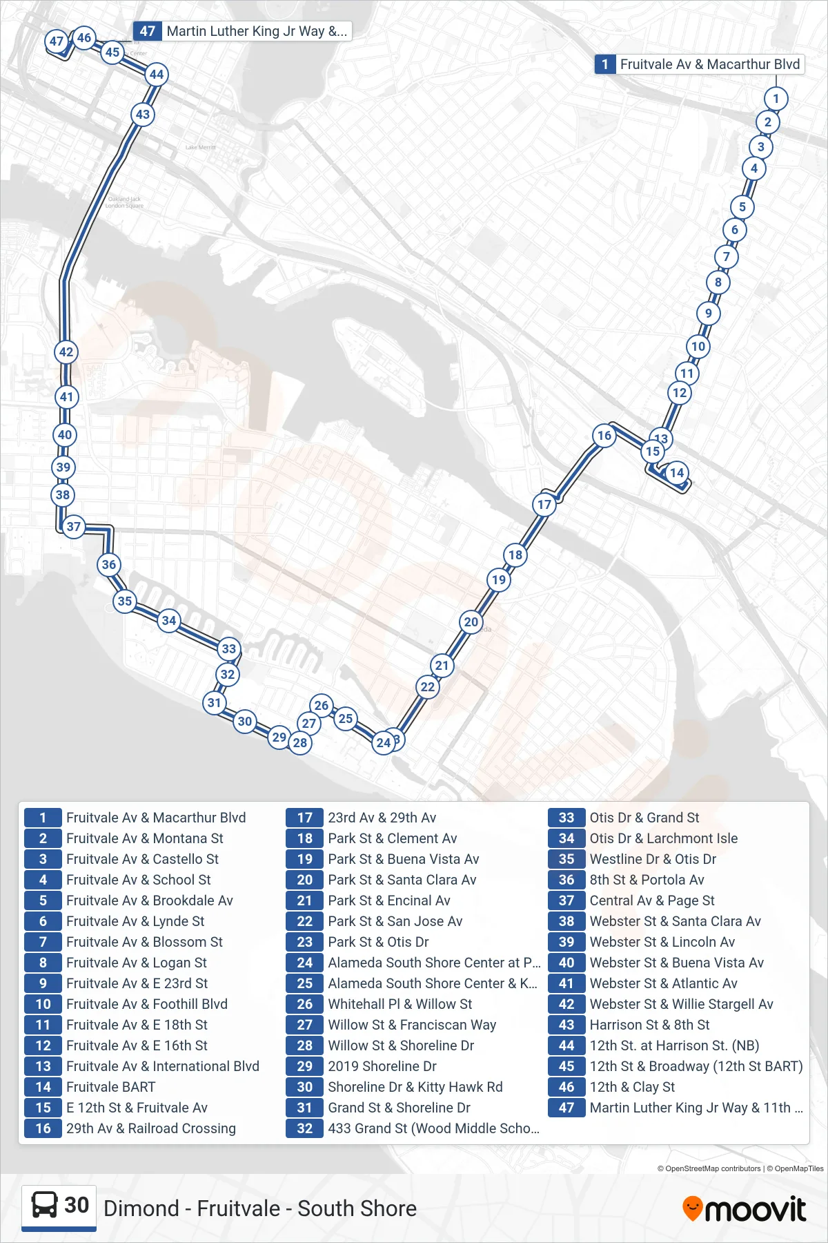
Stops list (30 - Downtown Oakland)
- Fruitvale Av & Macarthur Blvd
- Fruitvale Av & Montana St
- Fruitvale Av & Castello St
- Fruitvale Av & School St
- Fruitvale Av & Brookdale Av
- Fruitvale Av & Lynde St
- Fruitvale Av & Blossom St
- Fruitvale Av & Logan St
- Fruitvale Av & E 23rd St
- Fruitvale Av & Foothill Blvd
- Fruitvale Av & E 18th St
- Fruitvale Av & E 16th St
- Fruitvale Av & International Blvd
- Fruitvale BART
- E 12th St & Fruitvale Av
- 29th Av & Railroad Crossing
- 23rd Av & 29th Av
- Park St & Clement Av
- Park St & Buena Vista Av
- Park St & Santa Clara Av
- Park St & Encinal Av
- Park St & San Jose Av
- Park St & Otis Dr
- Alameda South Shore Center at Park St
- Alameda South Shore Center & Kohl's
- Whitehall Pl & Willow St
- Willow St & Franciscan Way
- Willow St & Shoreline Dr
- 2019 Shoreline Dr
- Shoreline Dr & Kitty Hawk Rd
- Grand St & Shoreline Dr
- 433 Grand St (Wood Middle School)
- Otis Dr & Grand St
- Otis Dr & Larchmont Isle
- Westline Dr & Otis Dr
- 8th St & Portola Av
- Central Av & Page St
- Webster St & Santa Clara Av
- Webster St & Lincoln Av
- Webster St & Buena Vista Av
- Webster St & Atlantic Av
- Webster St & Willie Stargell Av
- Harrison St & 8th St
- 12th St. at Harrison St. (NB)
- 12th St & Broadway (12th St BART)
- 12th & Clay St
- Martin Luther King Jr Way & 11th St