
30 Bus Route Map
View the 30 route map and see all 30 stops along the route. The map of 30 shows where the bus travels and the location of each stop, making it easy to understand the entire route at a glance.
Explore DASH - Alexandria routes on the map and see where DASH - Alexandria bus services operate. Use the 30 map to find bus stops and see how the 30 connects different areas along its trip.
All 30 stops on the map are displayed in route order, helping you follow the 30 bus from the first stop to the last.
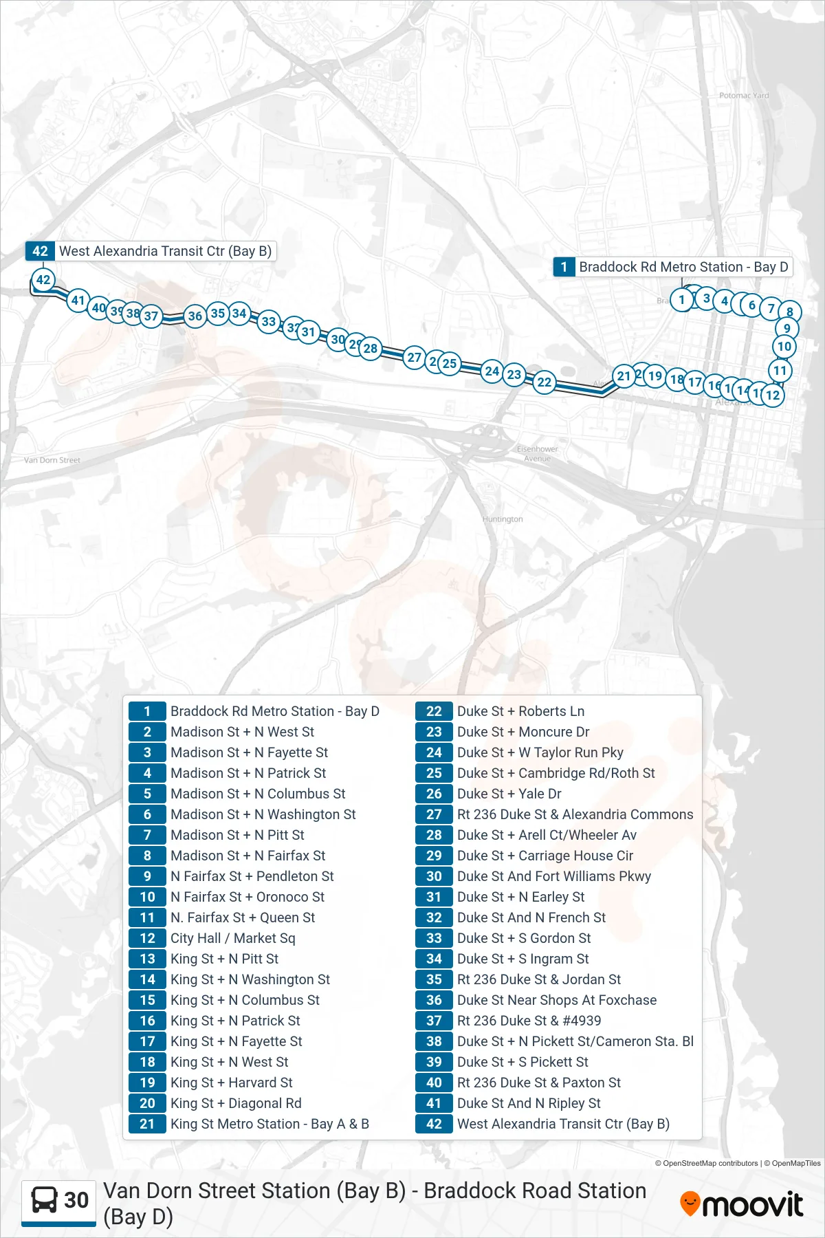
Stops list (30 - West Alexandria Transit Center (Short Trip))
- Braddock Rd Metro Station - Bay D
- Madison St + N West St
- Madison St + N Fayette St
- Madison St + N Patrick St
- Madison St + N Columbus St
- Madison St + N Washington St
- Madison St + N Pitt St
- Madison St + N Fairfax St
- N Fairfax St + Pendleton St
- N Fairfax St + Oronoco St
- N. Fairfax St + Queen St
- City Hall / Market Sq
- King St + N Pitt St
- King St + N Washington St
- King St + N Columbus St
- King St + N Patrick St
- King St + N Fayette St
- King St + N West St
- King St + Harvard St
- King St + Diagonal Rd
- King St Metro Station - Bay A & B
- Duke St + Roberts Ln
- Duke St + Moncure Dr
- Duke St + W Taylor Run Pky
- Duke St + Cambridge Rd/Roth St
- Duke St + Yale Dr
- Rt 236 Duke St & Alexandria Commons
- Duke St + Arell Ct/Wheeler Av
- Duke St + Carriage House Cir
- Duke St And Fort Williams Pkwy
- Duke St + N Earley St
- Duke St And N French St
- Duke St + S Gordon St
- Duke St + S Ingram St
- Rt 236 Duke St & Jordan St
- Duke St Near Shops At Foxchase
- Rt 236 Duke St & #4939
- Duke St + N Pickett St/Cameron Sta. Bl
- Duke St + S Pickett St
- Rt 236 Duke St & Paxton St
- Duke St And N Ripley St
- West Alexandria Transit Ctr (Bay B)