
300 Bus Route Map
View the 300 route map and see all 300 stops along the route. The map of 300 shows where the bus travels and the location of each stop, making it easy to understand the entire route at a glance.
Explore GoTriangle routes on the map and see where GoTriangle bus services operate. Use the 300 map to find bus stops and see how the 300 connects different areas along its trip.
All 300 stops on the map are displayed in route order, helping you follow the 300 bus from the first stop to the last.
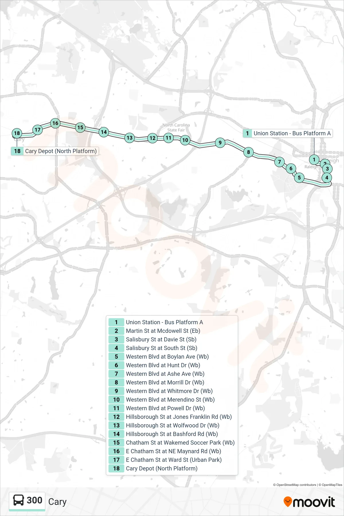
Stops list (300 - Cary)
- Union Station - Bus Platform A
- Martin St at Mcdowell St (Eb)
- Salisbury St at Davie St (Sb)
- Salisbury St at South St (Sb)
- Western Blvd at Boylan Ave (Wb)
- Western Blvd at Hunt Dr (Wb)
- Western Blvd at Ashe Ave (Wb)
- Western Blvd at Morrill Dr (Wb)
- Western Blvd at Whitmore Dr (Wb)
- Western Blvd at Merendino St (Wb)
- Western Blvd at Powell Dr (Wb)
- Hillsborough St at Jones Franklin Rd (Wb)
- Hillsborough St at Wolfwood Dr (Wb)
- Hillsborough St at Bashford Rd (Wb)
- Chatham St at Wakemed Soccer Park (Wb)
- E Chatham St at NE Maynard Rd (Wb)
- E Chatham St at Ward St (Urban Park)
- Cary Depot (North Platform)