
302 Bus Route Map
View the 302 route map and see all 302 stops along the route. The map of 302 shows where the bus travels and the location of each stop, making it easy to understand the entire route at a glance.
Explore Bus Bayreuth routes on the map and see where Bus Bayreuth bus services operate. Use the 302 map to find bus stops and see how the 302 connects different areas along its trip.
All 302 stops on the map are displayed in route order, helping you follow the 302 bus from the first stop to the last.
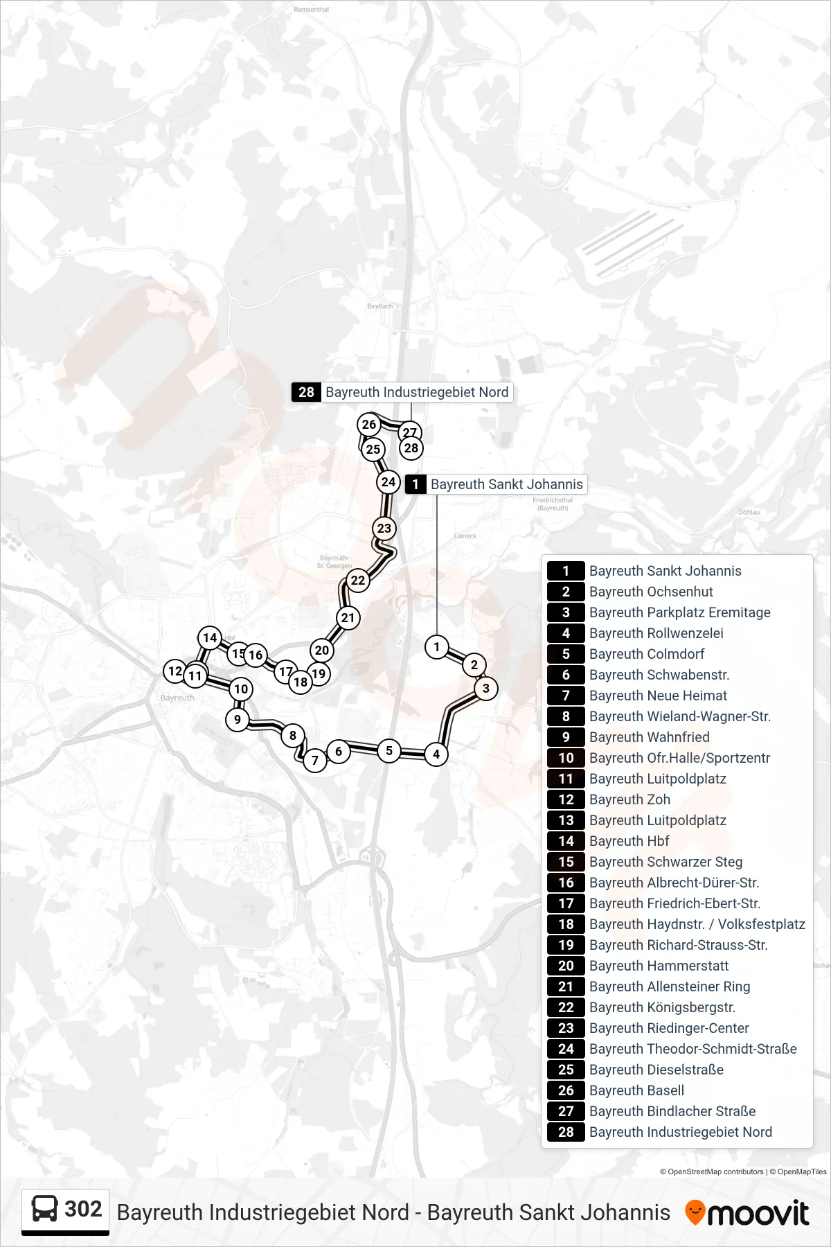
Stops list (302 - Bayreuth Industriegebiet Nord)
- Bayreuth Sankt Johannis
- Bayreuth Ochsenhut
- Bayreuth Parkplatz Eremitage
- Bayreuth Rollwenzelei
- Bayreuth Colmdorf
- Bayreuth Schwabenstr.
- Bayreuth Neue Heimat
- Bayreuth Wieland-Wagner-Str.
- Bayreuth Wahnfried
- Bayreuth Ofr.Halle/Sportzentr
- Bayreuth Luitpoldplatz
- Bayreuth Zoh
- Bayreuth Luitpoldplatz
- Bayreuth Hbf
- Bayreuth Schwarzer Steg
- Bayreuth Albrecht-Dürer-Str.
- Bayreuth Friedrich-Ebert-Str.
- Bayreuth Haydnstr. / Volksfestplatz
- Bayreuth Richard-Strauss-Str.
- Bayreuth Hammerstatt
- Bayreuth Allensteiner Ring
- Bayreuth Königsbergstr.
- Bayreuth Riedinger-Center
- Bayreuth Theodor-Schmidt-Straße
- Bayreuth Dieselstraße
- Bayreuth Basell
- Bayreuth Bindlacher Straße
- Bayreuth Industriegebiet Nord
Change direction
- Route Map - 302 - Z O H\Nüber Aichig
- Route Map - 302 - Bayreuth Zoh
- Route Map - 302 - Bayreuth Hammerstatt
- Route Map - 302 - St. Johannis (Eremitage)
- Route Map - 302 - Bayreuth Sankt Johannis
- Route Map - 302 - Direktbus W W G -\Nm W G - Berufsschule
- Route Map - 302 - Bayreuth Zoh
- Route Map - 302 - Direktbus\Nw W G - M W G
- Route Map - 302 - Bayreuth Ass / A.-Schw.-Schule
- Route Map - 302 - Z O H
- Route Map - 302 - Industriegebiet Nord
- Route Map - 302 - W W G/M W G/Berufsschule
- Route Map - 302 - Z O H