
302 Tram Route Map
View the 302 route map and see all 302 stops along the route. The map of 302 shows where the tram travels and the location of each stop, making it easy to understand the entire route at a glance.
Explore BOGESTRA STRAB routes on the map and see where BOGESTRA STRAB tram services operate. Use the 302 map to find tram stations and see how the 302 connects different areas along its trip.
All 302 stops on the map are displayed in route order, helping you follow the 302 tram from the first station to the last.
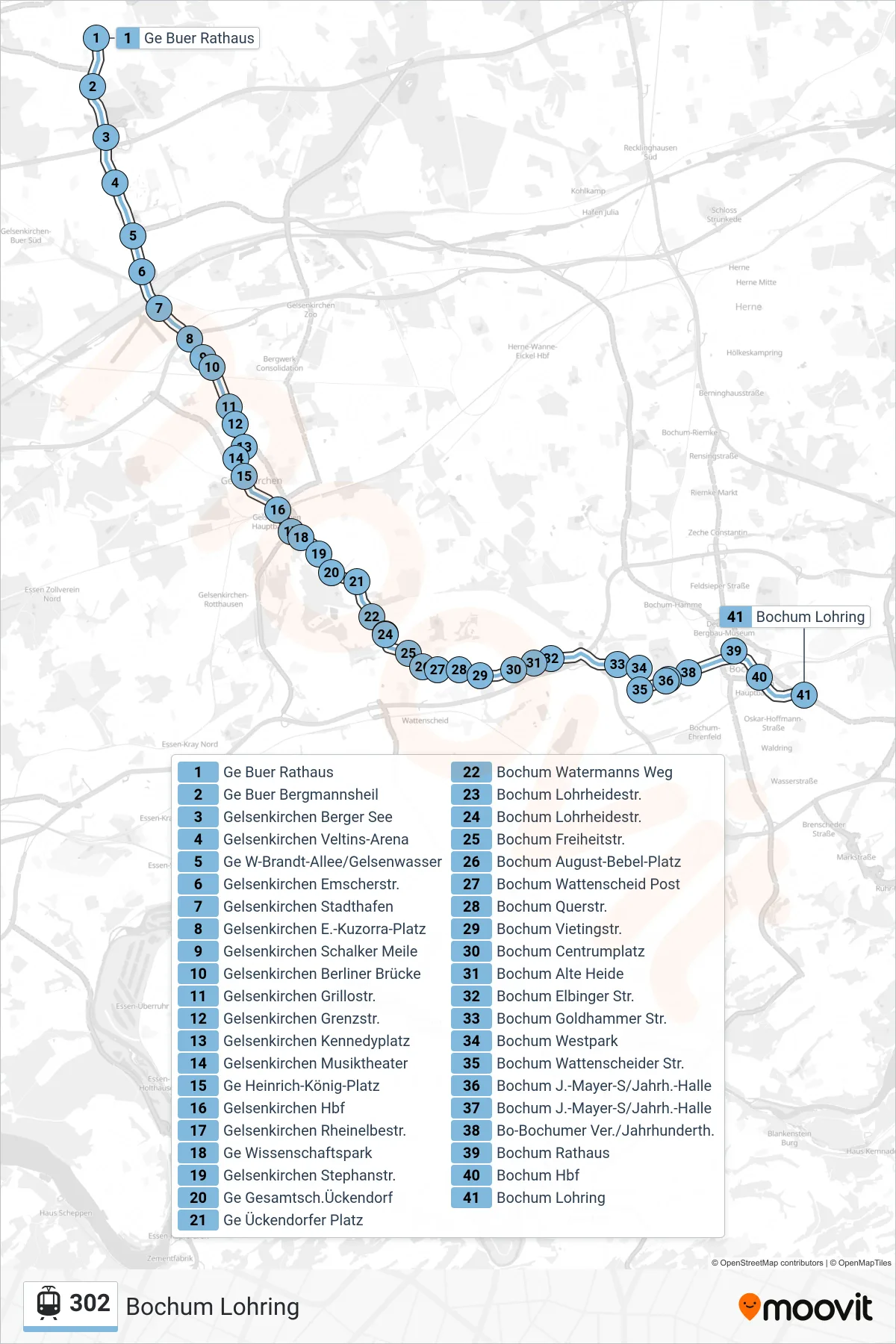
Stops list (302 - Bochum Lohring)
- Ge Buer Rathaus
- Ge Buer Bergmannsheil
- Gelsenkirchen Berger See
- Gelsenkirchen Veltins-Arena
- Ge W-Brandt-Allee/Gelsenwasser
- Gelsenkirchen Emscherstr.
- Gelsenkirchen Stadthafen
- Gelsenkirchen E.-Kuzorra-Platz
- Gelsenkirchen Schalker Meile
- Gelsenkirchen Berliner Brücke
- Gelsenkirchen Grillostr.
- Gelsenkirchen Grenzstr.
- Gelsenkirchen Kennedyplatz
- Gelsenkirchen Musiktheater
- Ge Heinrich-König-Platz
- Gelsenkirchen Hbf
- Gelsenkirchen Rheinelbestr.
- Ge Wissenschaftspark
- Gelsenkirchen Stephanstr.
- Ge Gesamtsch.Ückendorf
- Ge Ückendorfer Platz
- Bochum Watermanns Weg
- Bochum Lohrheidestr.
- Bochum Lohrheidestr.
- Bochum Freiheitstr.
- Bochum August-Bebel-Platz
- Bochum Wattenscheid Post
- Bochum Querstr.
- Bochum Vietingstr.
- Bochum Centrumplatz
- Bochum Alte Heide
- Bochum Elbinger Str.
- Bochum Goldhammer Str.
- Bochum Westpark
- Bochum Wattenscheider Str.
- Bochum J.-Mayer-S/Jahrh.-Halle
- Bochum J.-Mayer-S/Jahrh.-Halle
- Bo-Bochumer Ver./Jahrhunderth.
- Bochum Rathaus
- Bochum Hbf
- Bochum Lohring
Change direction
- Route Map - 302 - Gelsenkirchen Hbf
- Route Map - 302 - Bochum Wattenscheider Str.
- Route Map - 302 - Bochum Lohrheidestr.
- Route Map - 302 - Gelsenkirchen E.-Kuzorra-Platz
- Route Map - 302 - Gelsenkirchen Musiktheater
- Route Map - 302 - Bochum, O-Werk
- Route Map - 302 - Gelsenkirchen Rheinelbestr.
- Route Map - 302 - Gelsenkirchen Kennedyplatz
- Route Map - 302 - Bochum Langendreer
- Route Map - 302 - Ge Buer Rathaus
- Route Map - 302 - Gelsenkirchen Hbf
- Route Map - 302 - Ge Heinrich-König-Platz
- Route Map - 302 - Bochum Wattenscheider Str.