
31 Bus Route Map
View the 31 route map and see all 31 stops along the route. The map of 31 shows where the bus travels and the location of each stop, making it easy to understand the entire route at a glance.
Explore Birmingham routes on the map and see where Birmingham bus services operate. Use the 31 map to find bus stops and see how the 31 connects different areas along its trip.
All 31 stops on the map are displayed in route order, helping you follow the 31 bus from the first stop to the last.
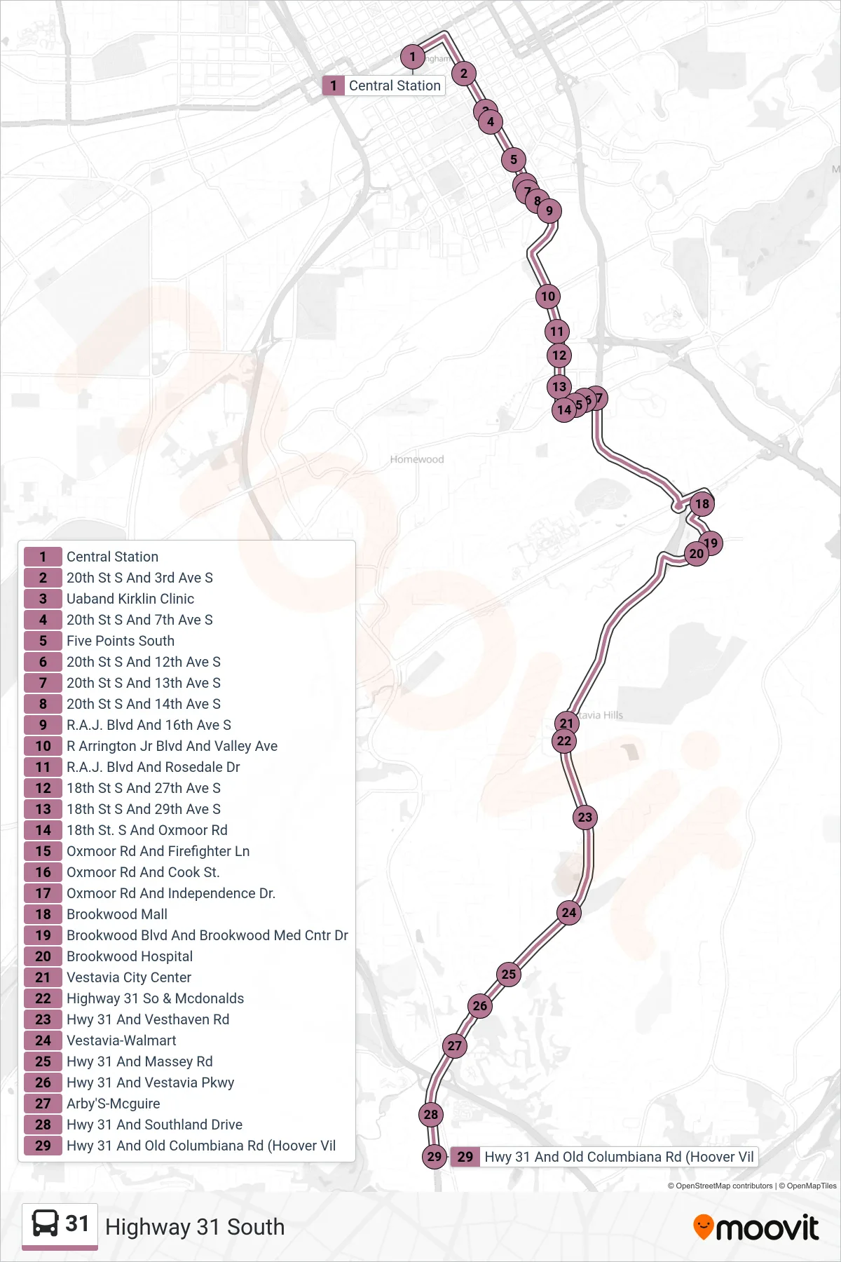
Stops list (31 - Central Station→Hwy 31 And Old Columbiana Rd (Hoover Vil)
- Central Station
- 20th St S And 3rd Ave S
- Uaband Kirklin Clinic
- 20th St S And 7th Ave S
- Five Points South
- 20th St S And 12th Ave S
- 20th St S And 13th Ave S
- 20th St S And 14th Ave S
- R.A.J. Blvd And 16th Ave S
- R Arrington Jr Blvd And Valley Ave
- R.A.J. Blvd And Rosedale Dr
- 18th St S And 27th Ave S
- 18th St S And 29th Ave S
- 18th St. S And Oxmoor Rd
- Oxmoor Rd And Firefighter Ln
- Oxmoor Rd And Cook St.
- Oxmoor Rd And Independence Dr.
- Brookwood Mall
- Brookwood Blvd And Brookwood Med Cntr Dr
- Brookwood Hospital
- Vestavia City Center
- Highway 31 So & Mcdonalds
- Hwy 31 And Vesthaven Rd
- Vestavia-Walmart
- Hwy 31 And Massey Rd
- Hwy 31 And Vestavia Pkwy
- Arby'S-Mcguire
- Hwy 31 And Southland Drive
- Hwy 31 And Old Columbiana Rd (Hoover Vil