
31 Bus Route Map
View the 31 route map and see all 31 stops along the route. The map of 31 shows where the bus travels and the location of each stop, making it easy to understand the entire route at a glance.
Explore Franklin Regional Transit Authority routes on the map and see where Franklin Regional Transit Authority bus services operate. Use the 31 map to find bus stops and see how the 31 connects different areas along its trip.
All 31 stops on the map are displayed in route order, helping you follow the 31 bus from the first stop to the last.
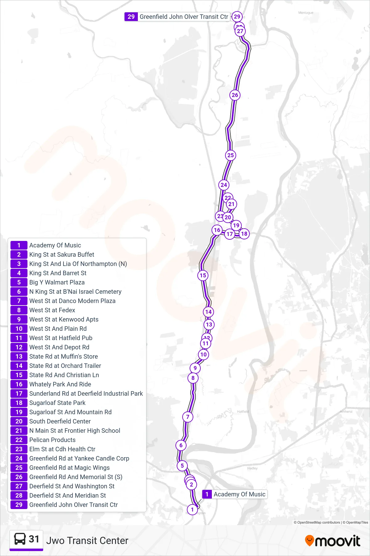
Stops list (31 - Jwo Transit Center)
- Academy Of Music
- King St at Sakura Buffet
- King St And Lia Of Northampton (N)
- King St And Barret St
- Big Y Walmart Plaza
- N King St at B'Nai Israel Cemetery
- West St at Danco Modern Plaza
- West St at Fedex
- West St at Kenwood Apts
- West St And Plain Rd
- West St at Hatfield Pub
- West St And Depot Rd
- State Rd at Muffin's Store
- State Rd at Orchard Trailer
- State Rd And Christian Ln
- Whately Park And Ride
- Sunderland Rd at Deerfield Industrial Park
- Sugarloaf State Park
- Sugarloaf St And Mountain Rd
- South Deerfield Center
- N Main St at Frontier High School
- Pelican Products
- Elm St at Cdh Health Ctr
- Greenfield Rd at Yankee Candle Corp
- Greenfield Rd at Magic Wings
- Greenfield Rd And Memorial St (S)
- Deerfield St And Washington St
- Deerfield St And Meridian St
- Greenfield John Olver Transit Ctr