
31 Bus Route Map
View the 31 route map and see all 31 stops along the route. The map of 31 shows where the bus travels and the location of each stop, making it easy to understand the entire route at a glance.
Explore Verkehrsbetriebe Mittelrhein VREM routes on the map and see where Verkehrsbetriebe Mittelrhein VREM bus services operate. Use the 31 map to find bus stops and see how the 31 connects different areas along its trip.
All 31 stops on the map are displayed in route order, helping you follow the 31 bus from the first stop to the last.
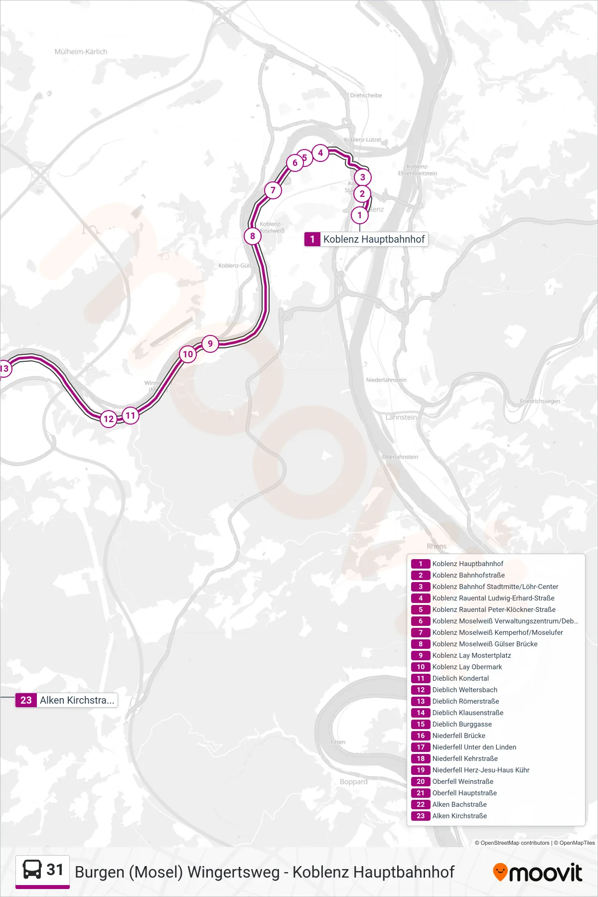
Stops list (31 - Alken Kirchstraße)
- Koblenz Hauptbahnhof
- Koblenz Bahnhofstraße
- Koblenz Bahnhof Stadtmitte/Löhr-Center
- Koblenz Rauental Ludwig-Erhard-Straße
- Koblenz Rauental Peter-Klöckner-Straße
- Koblenz Moselweiß Verwaltungszentrum/Debeka
- Koblenz Moselweiß Kemperhof/Moselufer
- Koblenz Moselweiß Gülser Brücke
- Koblenz Lay Mostertplatz
- Koblenz Lay Obermark
- Dieblich Kondertal
- Dieblich Weltersbach
- Dieblich Römerstraße
- Dieblich Klausenstraße
- Dieblich Burggasse
- Niederfell Brücke
- Niederfell Unter den Linden
- Niederfell Kehrstraße
- Niederfell Herz-Jesu-Haus Kühr
- Oberfell Weinstraße
- Oberfell Hauptstraße
- Alken Bachstraße
- Alken Kirchstraße