
31 Bus Route Map
View the 31 route map and see all 31 stops along the route. The map of 31 shows where the bus travels and the location of each stop, making it easy to understand the entire route at a glance.
Explore The S routes on the map and see where The S bus services operate. Use the 31 map to find bus stops and see how the 31 connects different areas along its trip.
All 31 stops on the map are displayed in route order, helping you follow the 31 bus from the first stop to the last.
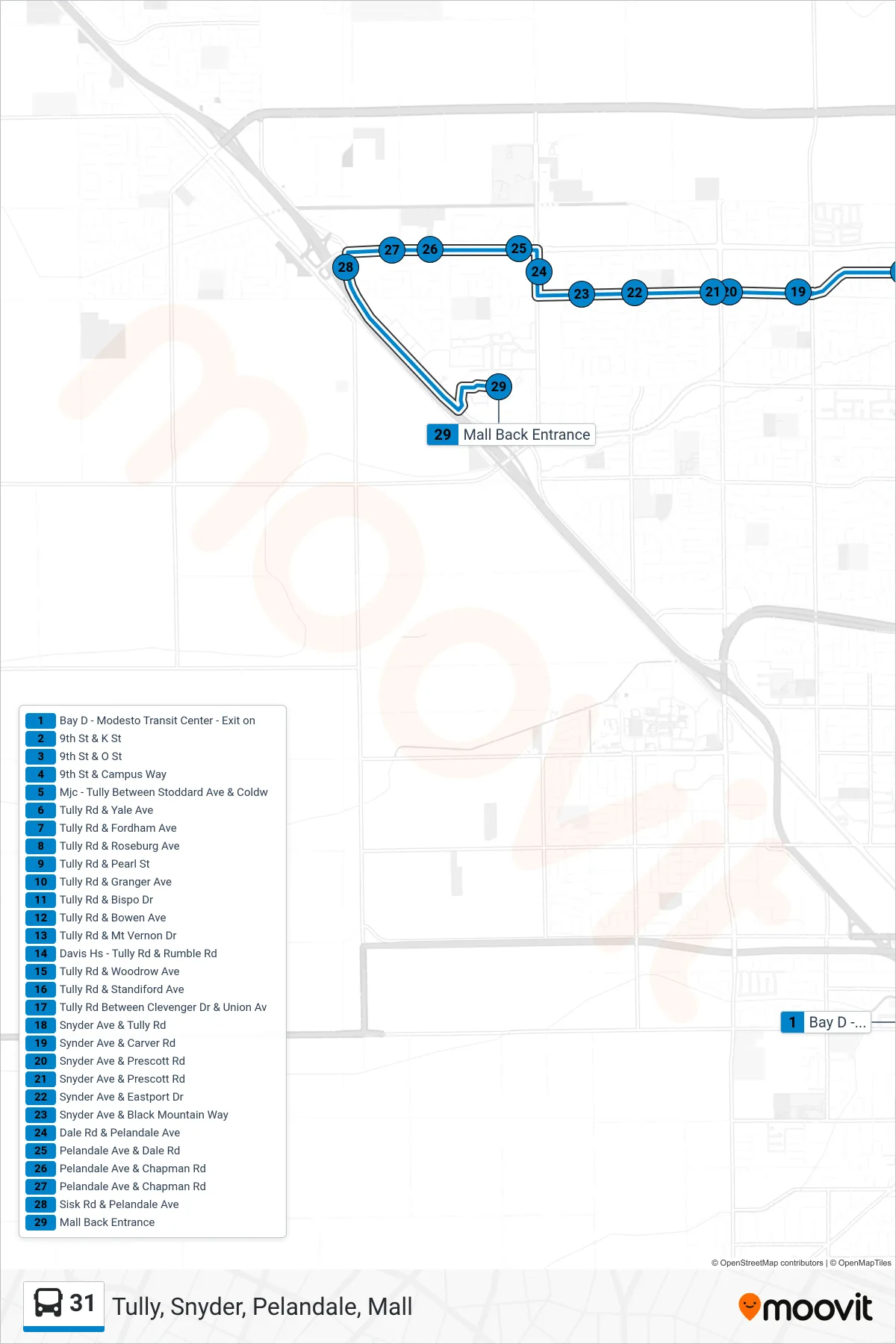
Stops list (31 - Tully, Snyder, Pelandale, Mall)
- Bay D - Modesto Transit Center - Exit on
- 9th St & K St
- 9th St & O St
- 9th St & Campus Way
- Mjc - Tully Between Stoddard Ave & Coldw
- Tully Rd & Yale Ave
- Tully Rd & Fordham Ave
- Tully Rd & Roseburg Ave
- Tully Rd & Pearl St
- Tully Rd & Granger Ave
- Tully Rd & Bispo Dr
- Tully Rd & Bowen Ave
- Tully Rd & Mt Vernon Dr
- Davis Hs - Tully Rd & Rumble Rd
- Tully Rd & Woodrow Ave
- Tully Rd & Standiford Ave
- Tully Rd Between Clevenger Dr & Union Av
- Snyder Ave & Tully Rd
- Synder Ave & Carver Rd
- Snyder Ave & Prescott Rd
- Snyder Ave & Prescott Rd
- Synder Ave & Eastport Dr
- Snyder Ave & Black Mountain Way
- Dale Rd & Pelandale Ave
- Pelandale Ave & Dale Rd
- Pelandale Ave & Chapman Rd
- Pelandale Ave & Chapman Rd
- Sisk Rd & Pelandale Ave
- Mall Back Entrance