
31 Bus Route Map
View the 31 route map and see all 31 stops along the route. The map of 31 shows where the bus travels and the location of each stop, making it easy to understand the entire route at a glance.
Explore Niederrheinische VKB routes on the map and see where Niederrheinische VKB bus services operate. Use the 31 map to find bus stops and see how the 31 connects different areas along its trip.
All 31 stops on the map are displayed in route order, helping you follow the 31 bus from the first stop to the last.
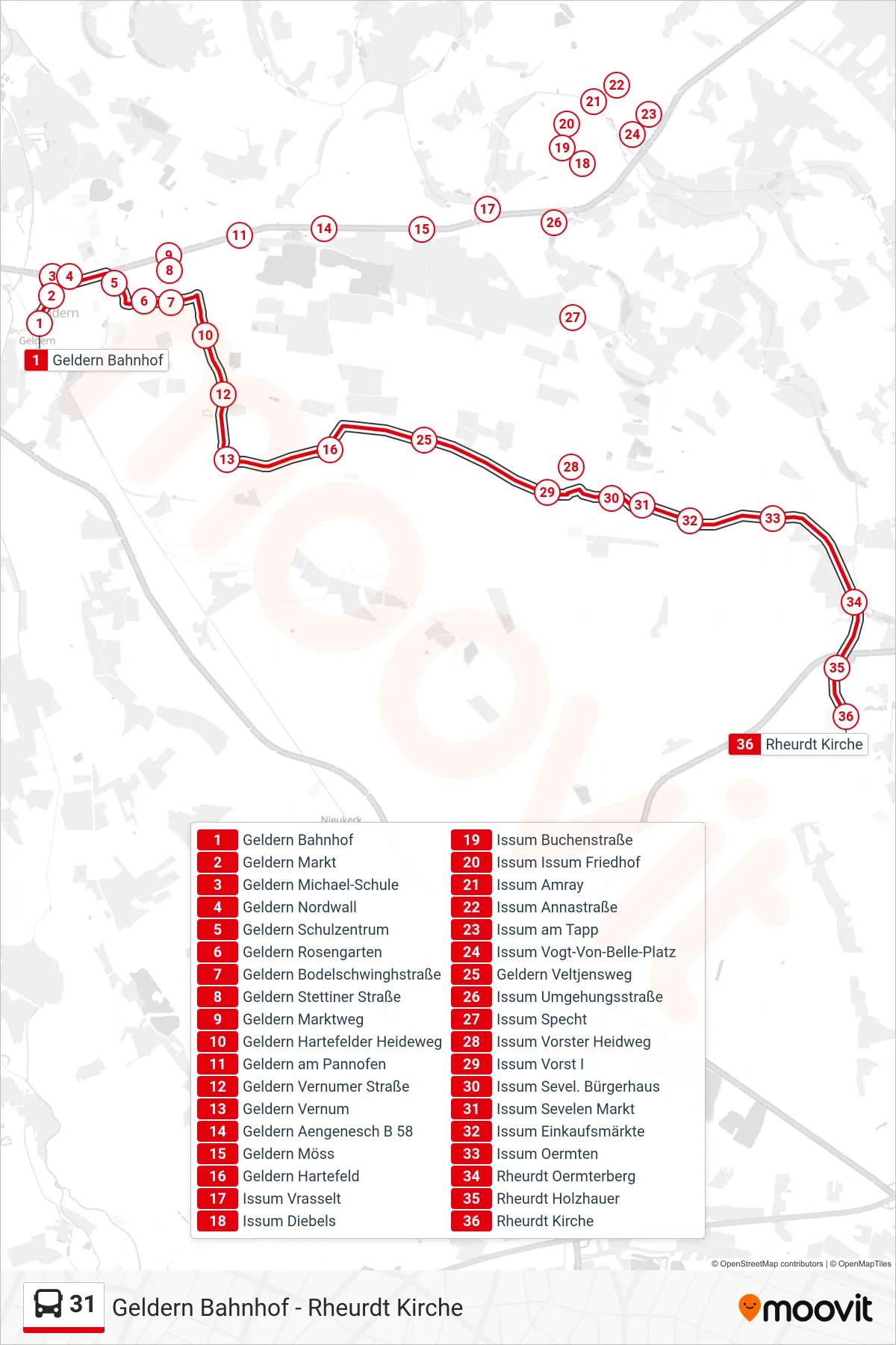
Stops list (31 - Rheurdt Kirche)
- Geldern Bahnhof
- Geldern Markt
- Geldern Michael-Schule
- Geldern Nordwall
- Geldern Schulzentrum
- Geldern Rosengarten
- Geldern Bodelschwinghstraße
- Geldern Stettiner Straße
- Geldern Marktweg
- Geldern Hartefelder Heideweg
- Geldern am Pannofen
- Geldern Vernumer Straße
- Geldern Vernum
- Geldern Aengenesch B 58
- Geldern Möss
- Geldern Hartefeld
- Issum Vrasselt
- Issum Diebels
- Issum Buchenstraße
- Issum Issum Friedhof
- Issum Amray
- Issum Annastraße
- Issum am Tapp
- Issum Vogt-Von-Belle-Platz
- Geldern Veltjensweg
- Issum Umgehungsstraße
- Issum Specht
- Issum Vorster Heidweg
- Issum Vorst I
- Issum Sevel. Bürgerhaus
- Issum Sevelen Markt
- Issum Einkaufsmärkte
- Issum Oermten
- Rheurdt Oermterberg
- Rheurdt Holzhauer
- Rheurdt Kirche