
31 Bus Route Map
View the 31 route map and see all 31 stops along the route. The map of 31 shows where the bus travels and the location of each stop, making it easy to understand the entire route at a glance.
Explore Schweizer Reisen routes on the map and see where Schweizer Reisen bus services operate. Use the 31 map to find bus stops and see how the 31 connects different areas along its trip.
All 31 stops on the map are displayed in route order, helping you follow the 31 bus from the first stop to the last.
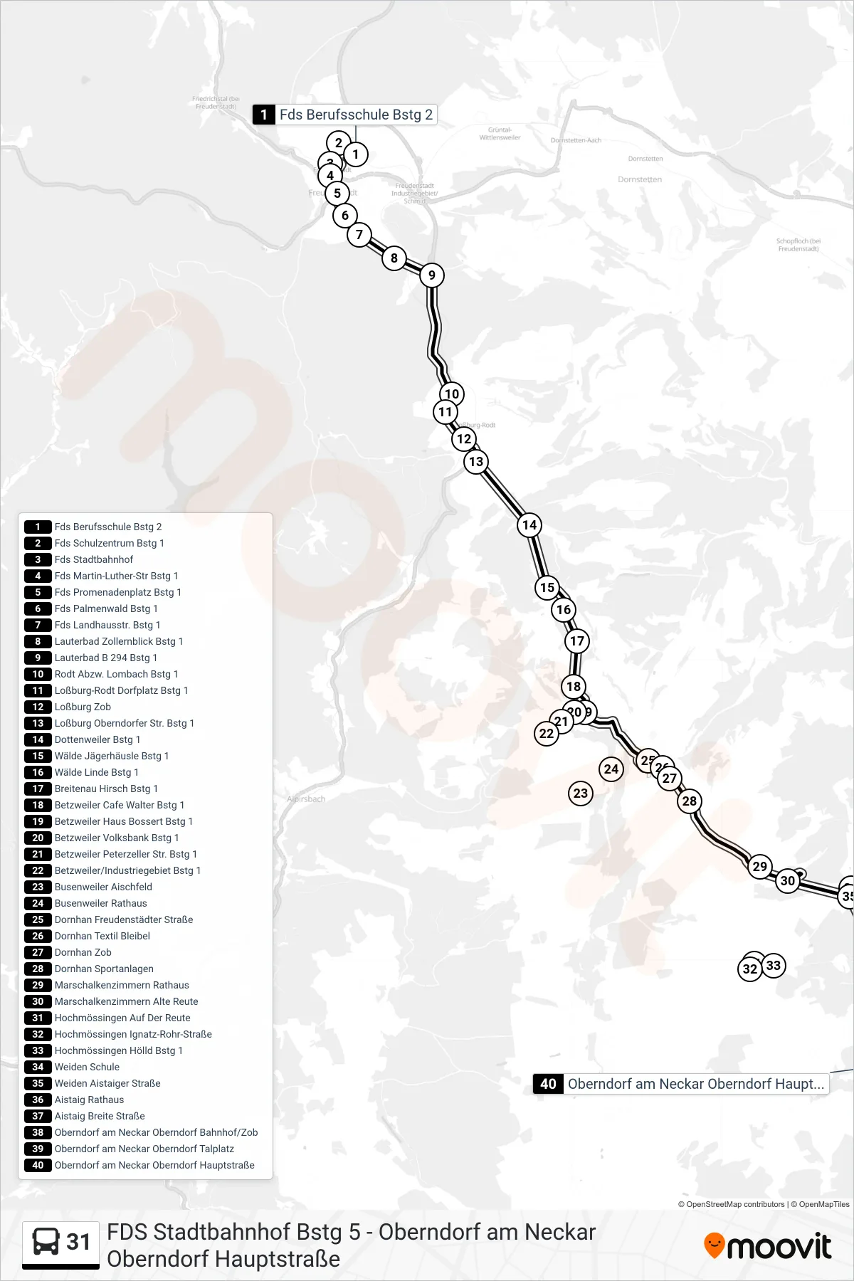
Stops list (31 - Oberndorf am Neckar Oberndorf Hauptstraße)
- Fds Berufsschule Bstg 2
- Fds Schulzentrum Bstg 1
- Fds Stadtbahnhof
- Fds Martin-Luther-Str Bstg 1
- Fds Promenadenplatz Bstg 1
- Fds Palmenwald Bstg 1
- Fds Landhausstr. Bstg 1
- Lauterbad Zollernblick Bstg 1
- Lauterbad B 294 Bstg 1
- Rodt Abzw. Lombach Bstg 1
- Loßburg-Rodt Dorfplatz Bstg 1
- Loßburg Zob
- Loßburg Oberndorfer Str. Bstg 1
- Dottenweiler Bstg 1
- Wälde Jägerhäusle Bstg 1
- Wälde Linde Bstg 1
- Breitenau Hirsch Bstg 1
- Betzweiler Cafe Walter Bstg 1
- Betzweiler Haus Bossert Bstg 1
- Betzweiler Volksbank Bstg 1
- Betzweiler Peterzeller Str. Bstg 1
- Betzweiler/Industriegebiet Bstg 1
- Busenweiler Aischfeld
- Busenweiler Rathaus
- Dornhan Freudenstädter Straße
- Dornhan Textil Bleibel
- Dornhan Zob
- Dornhan Sportanlagen
- Marschalkenzimmern Rathaus
- Marschalkenzimmern Alte Reute
- Hochmössingen Auf Der Reute
- Hochmössingen Ignatz-Rohr-Straße
- Hochmössingen Hölld Bstg 1
- Weiden Schule
- Weiden Aistaiger Straße
- Aistaig Rathaus
- Aistaig Breite Straße
- Oberndorf am Neckar Oberndorf Bahnhof/Zob
- Oberndorf am Neckar Oberndorf Talplatz
- Oberndorf am Neckar Oberndorf Hauptstraße
Change direction
- Route Map - 31 - Dornhan Zob
- Route Map - 31 - Fds Marktplatz Post
- Route Map - 31 - Hochmössingen Hölld
- Route Map - 31 - Hochmössingen Ignatz-Rohr-Straße
- Route Map - 31 - Fds Stadtbahnhof
- Route Map - 31 - Betzweiler Cafe Walter
- Route Map - 31 - Dornhan Zob
- Route Map - 31 - Fds Berufsschule
- Route Map - 31 - Fds Oberlinweg
- Route Map - 31 - Oberndorf am Neckar Oberndorf Bahnhof/Zob
- Route Map - 31 - Loßburg Zob