
31 Bus Route Map
View the 31 route map and see all 31 stops along the route. The map of 31 shows where the bus travels and the location of each stop, making it easy to understand the entire route at a glance.
Explore Montgomery County Ride On routes on the map and see where Montgomery County Ride On bus services operate. Use the 31 map to find bus stops and see how the 31 connects different areas along its trip.
All 31 stops on the map are displayed in route order, helping you follow the 31 bus from the first stop to the last.
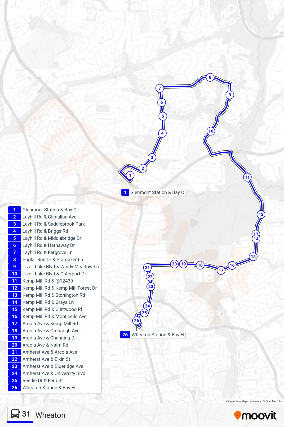
Stops list (31 - Wheaton)
- Glenmont Station & Bay C
- Layhill Rd & Glenallan Ave
- Layhill Rd & Saddlebrook Park
- Layhill Rd & Briggs Rd
- Layhill Rd & Middlebridge Dr
- Layhill Rd & Hathaway Dr
- Layhill Rd & Fargrove Ln
- Poplar Run Dr & Stargazer Ln
- Tivoli Lake Blvd & Windy Meadow Ln
- Tivoli Lake Blvd & Osterport Dr
- Kemp Mill Rd & @12439
- Kemp Mill Rd & Kemp Mill Forest Dr
- Kemp Mill Rd & Stonington Rd
- Kemp Mill Rd & Grays Ln
- Kemp Mill Rd & Clintwood Pl
- Kemp Mill Rd & Monticello Ave
- Arcola Ave & Kemp Mill Rd
- Arcola Ave & Orebaugh Ave
- Arcola Ave & Channing Dr
- Arcola Ave & Nairn Rd
- Amherst Ave & Arcola Ave
- Amherst Ave & Elkin St
- Amherst Ave & Blueridge Ave
- Amherst Ave & University Blvd
- Reedie Dr & Fern St
- Wheaton Station & Bay H