
310 Bus Route Map
View the 310 route map and see all 310 stops along the route. The map of 310 shows where the bus travels and the location of each stop, making it easy to understand the entire route at a glance.
Explore GoTriangle routes on the map and see where GoTriangle bus services operate. Use the 310 map to find bus stops and see how the 310 connects different areas along its trip.
All 310 stops on the map are displayed in route order, helping you follow the 310 bus from the first stop to the last.
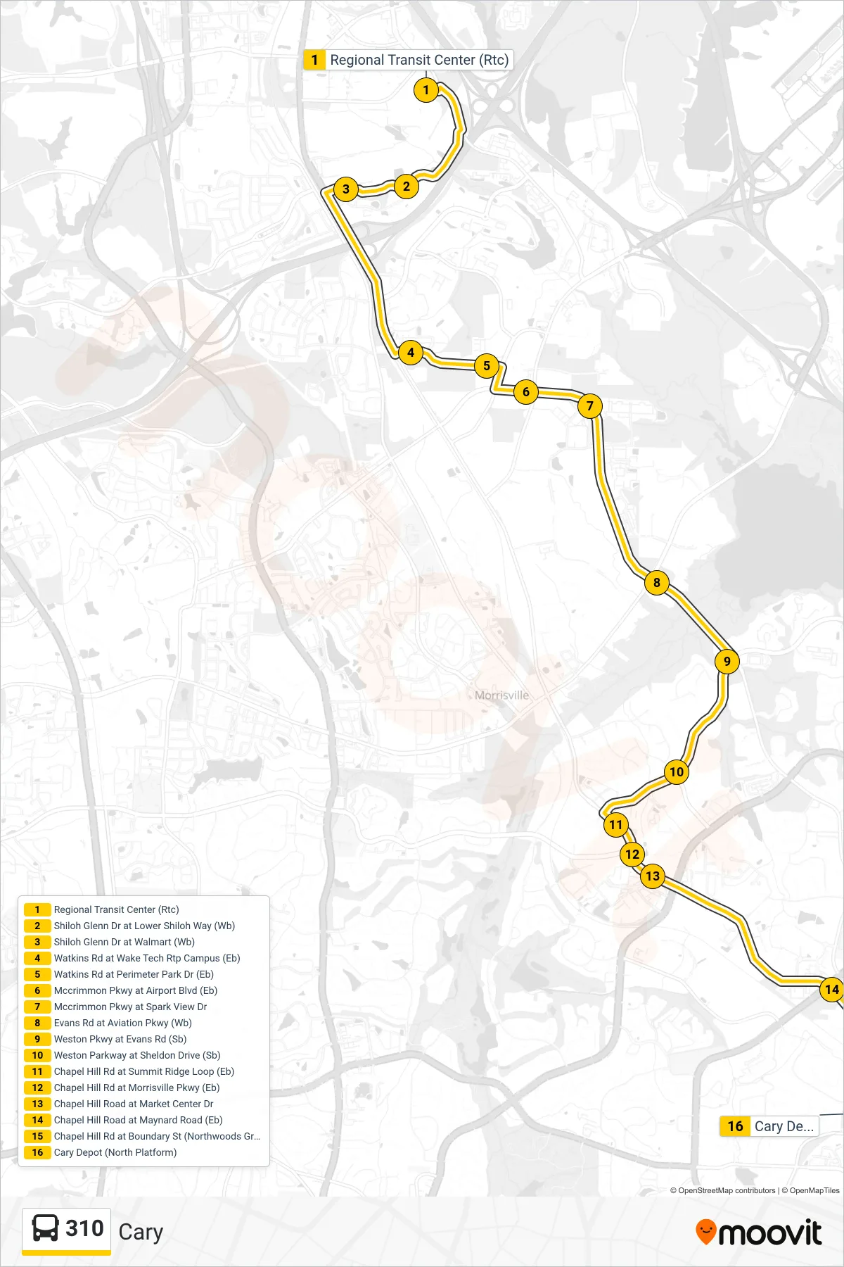
Stops list (310 - Cary)
- Regional Transit Center (Rtc)
- Shiloh Glenn Dr at Lower Shiloh Way (Wb)
- Shiloh Glenn Dr at Walmart (Wb)
- Watkins Rd at Wake Tech Rtp Campus (Eb)
- Watkins Rd at Perimeter Park Dr (Eb)
- Mccrimmon Pkwy at Airport Blvd (Eb)
- Mccrimmon Pkwy at Spark View Dr
- Evans Rd at Aviation Pkwy (Wb)
- Weston Pkwy at Evans Rd (Sb)
- Weston Parkway at Sheldon Drive (Sb)
- Chapel Hill Rd at Summit Ridge Loop (Eb)
- Chapel Hill Rd at Morrisville Pkwy (Eb)
- Chapel Hill Road at Market Center Dr
- Chapel Hill Road at Maynard Road (Eb)
- Chapel Hill Rd at Boundary St (Northwoods Greenway) (Eb)
- Cary Depot (North Platform)