
310 Bus Route Map
View the 310 route map and see all 310 stops along the route. The map of 310 shows where the bus travels and the location of each stop, making it easy to understand the entire route at a glance.
Explore OVAG Oberbergische Verkehrsgesellschaft mbH routes on the map and see where OVAG Oberbergische Verkehrsgesellschaft mbH bus services operate. Use the 310 map to find bus stops and see how the 310 connects different areas along its trip.
All 310 stops on the map are displayed in route order, helping you follow the 310 bus from the first stop to the last.
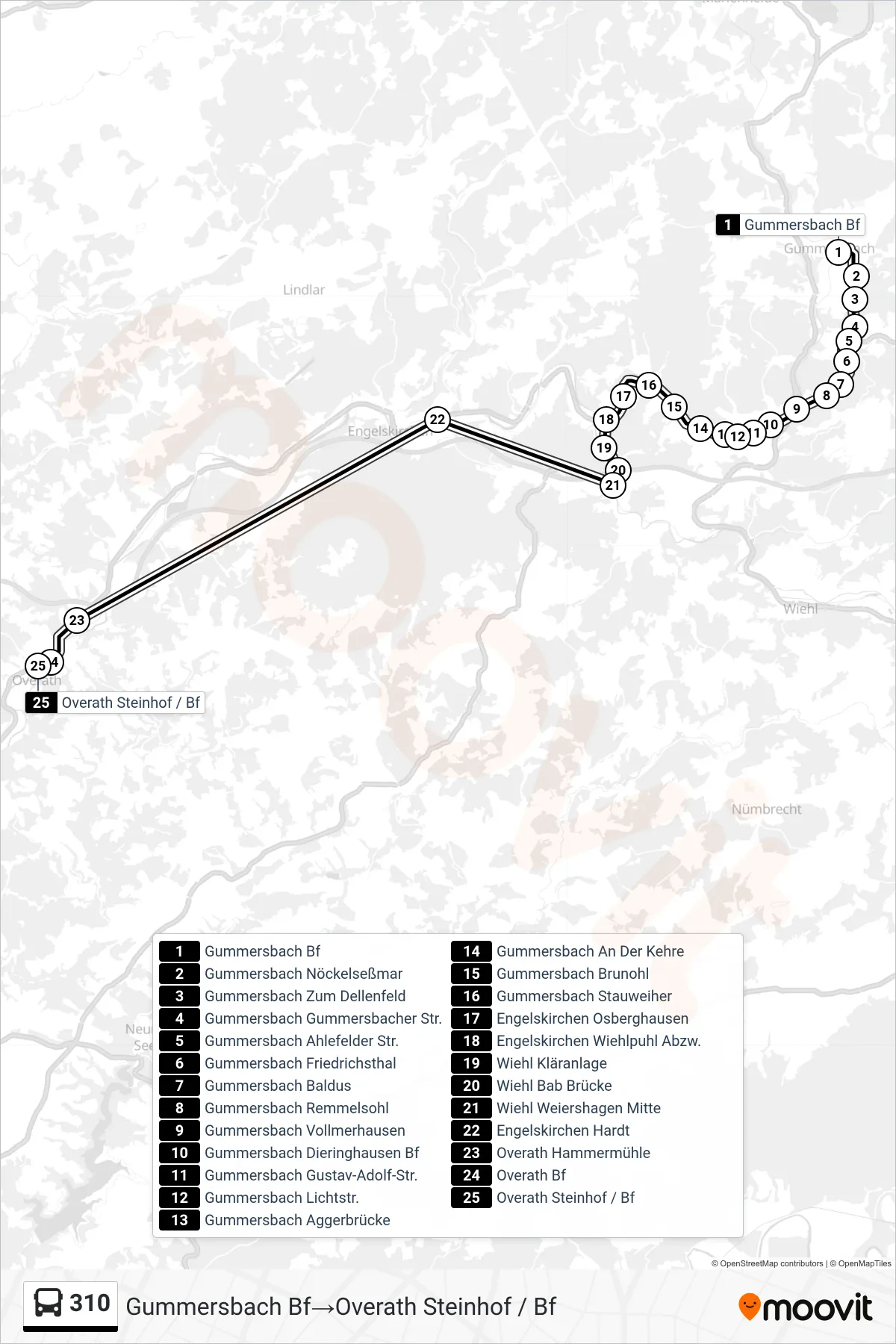
Stops list (310 - Gummersbach Bf→Overath Steinhof / Bf)
- Gummersbach Bf
- Gummersbach Nöckelseßmar
- Gummersbach Zum Dellenfeld
- Gummersbach Gummersbacher Str.
- Gummersbach Ahlefelder Str.
- Gummersbach Friedrichsthal
- Gummersbach Baldus
- Gummersbach Remmelsohl
- Gummersbach Vollmerhausen
- Gummersbach Dieringhausen Bf
- Gummersbach Gustav-Adolf-Str.
- Gummersbach Lichtstr.
- Gummersbach Aggerbrücke
- Gummersbach An Der Kehre
- Gummersbach Brunohl
- Gummersbach Stauweiher
- Engelskirchen Osberghausen
- Engelskirchen Wiehlpuhl Abzw.
- Wiehl Kläranlage
- Wiehl Bab Brücke
- Wiehl Weiershagen Mitte
- Engelskirchen Hardt
- Overath Hammermühle
- Overath Bf
- Overath Steinhof / Bf
Change direction
- Route Map - 310 - Overath Steinhof / Bf→Gummersbach Bf
- Route Map - 310 - Gummersbach Bf→Overath Schulzentrum/Cyriax
- Route Map - 310 - Gummersbach Bf→Overath Bf
- Route Map - 310 - Overath Bf→Overath Vilkerath
- Route Map - 310 - Engelskirchen Hardt→Engelskirchen Loope Kirche
- Route Map - 310 - Overath Vilkerath→Overath Bf
- Route Map - 310 - Engelskirchen Loope Kirche→Engelskirchen Hardt
- Route Map - 310 - Overath Bf→Gummersbach Bf