
31A Bus Route Map
View the 31A route map and see all 31A stops along the route. The map of 31A shows where the bus travels and the location of each stop, making it easy to understand the entire route at a glance.
Explore Transport Board routes on the map and see where Transport Board bus services operate. Use the 31A map to find bus stops and see how the 31A connects different areas along its trip.
All 31A stops on the map are displayed in route order, helping you follow the 31A bus from the first stop to the last.
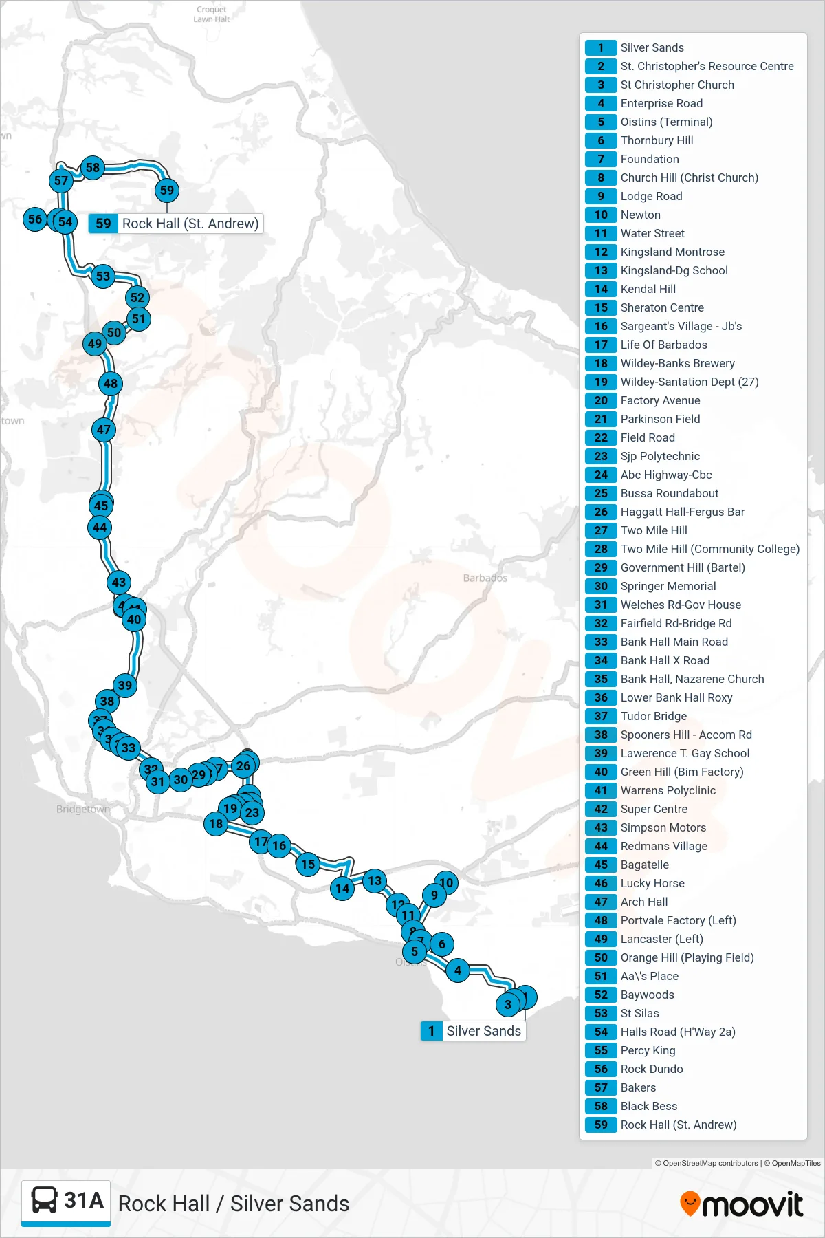
Stops list (31A - Oistins To Rock Hall)
- Silver Sands
- St. Christopher's Resource Centre
- St Christopher Church
- Enterprise Road
- Oistins (Terminal)
- Thornbury Hill
- Foundation
- Church Hill (Christ Church)
- Lodge Road
- Newton
- Water Street
- Kingsland Montrose
- Kingsland-Dg School
- Kendal Hill
- Sheraton Centre
- Sargeant's Village - Jb's
- Life Of Barbados
- Wildey-Banks Brewery
- Wildey-Santation Dept (27)
- Factory Avenue
- Parkinson Field
- Field Road
- Sjp Polytechnic
- Abc Highway-Cbc
- Bussa Roundabout
- Haggatt Hall-Fergus Bar
- Two Mile Hill
- Two Mile Hill (Community College)
- Government Hill (Bartel)
- Springer Memorial
- Welches Rd-Gov House
- Fairfield Rd-Bridge Rd
- Bank Hall Main Road
- Bank Hall X Road
- Bank Hall, Nazarene Church
- Lower Bank Hall Roxy
- Tudor Bridge
- Spooners Hill - Accom Rd
- Lawerence T. Gay School
- Green Hill (Bim Factory)
- Warrens Polyclinic
- Super Centre
- Simpson Motors
- Redmans Village
- Bagatelle
- Lucky Horse
- Arch Hall
- Portvale Factory (Left)
- Lancaster (Left)
- Orange Hill (Playing Field)
- Aa\'s Place
- Baywoods
- St Silas
- Halls Road (H'Way 2a)
- Percy King
- Rock Dundo
- Bakers
- Black Bess
- Rock Hall (St. Andrew)