
32 Bus Route Map
View the 32 route map and see all 32 stops along the route. The map of 32 shows where the bus travels and the location of each stop, making it easy to understand the entire route at a glance.
Explore Franklin Regional Transit Authority routes on the map and see where Franklin Regional Transit Authority bus services operate. Use the 32 map to find bus stops and see how the 32 connects different areas along its trip.
All 32 stops on the map are displayed in route order, helping you follow the 32 bus from the first stop to the last.
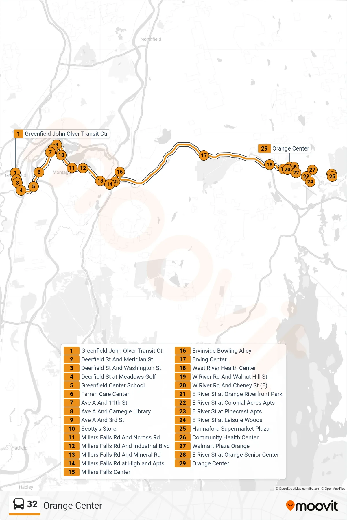
Stops list (32 - Orange Center)
- Greenfield John Olver Transit Ctr
- Deerfield St And Meridian St
- Deerfield St And Washington St
- Deerfield St at Meadows Golf
- Greenfield Center School
- Farren Care Center
- Ave A And 11th St
- Ave A And Carnegie Library
- Ave A And 3rd St
- Scotty's Store
- Millers Falls Rd And Ncross Rd
- Millers Falls Rd And Industrial Blvd
- Millers Falls Rd And Mineral Rd
- Millers Falls Rd at Highland Apts
- Millers Falls Center
- Ervinside Bowling Alley
- Erving Center
- West River Health Center
- W River Rd And Walnut Hill St
- W River Rd And Cheney St (E)
- E River St at Orange Riverfront Park
- E River St at Colonial Acres Apts
- E River St at Pinecrest Apts
- E River St at Leisure Woods
- Hannaford Supermarket Plaza
- Community Health Center
- Walmart Plaza Orange
- E River St at Orange Senior Center
- Orange Center