
33 Bus Route Map
View the 33 route map and see all 33 stops along the route. The map of 33 shows where the bus travels and the location of each stop, making it easy to understand the entire route at a glance.
Explore ATMA S.c.p.a. routes on the map and see where ATMA S.c.p.a. bus services operate. Use the 33 map to find bus stops and see how the 33 connects different areas along its trip.
All 33 stops on the map are displayed in route order, helping you follow the 33 bus from the first stop to the last.
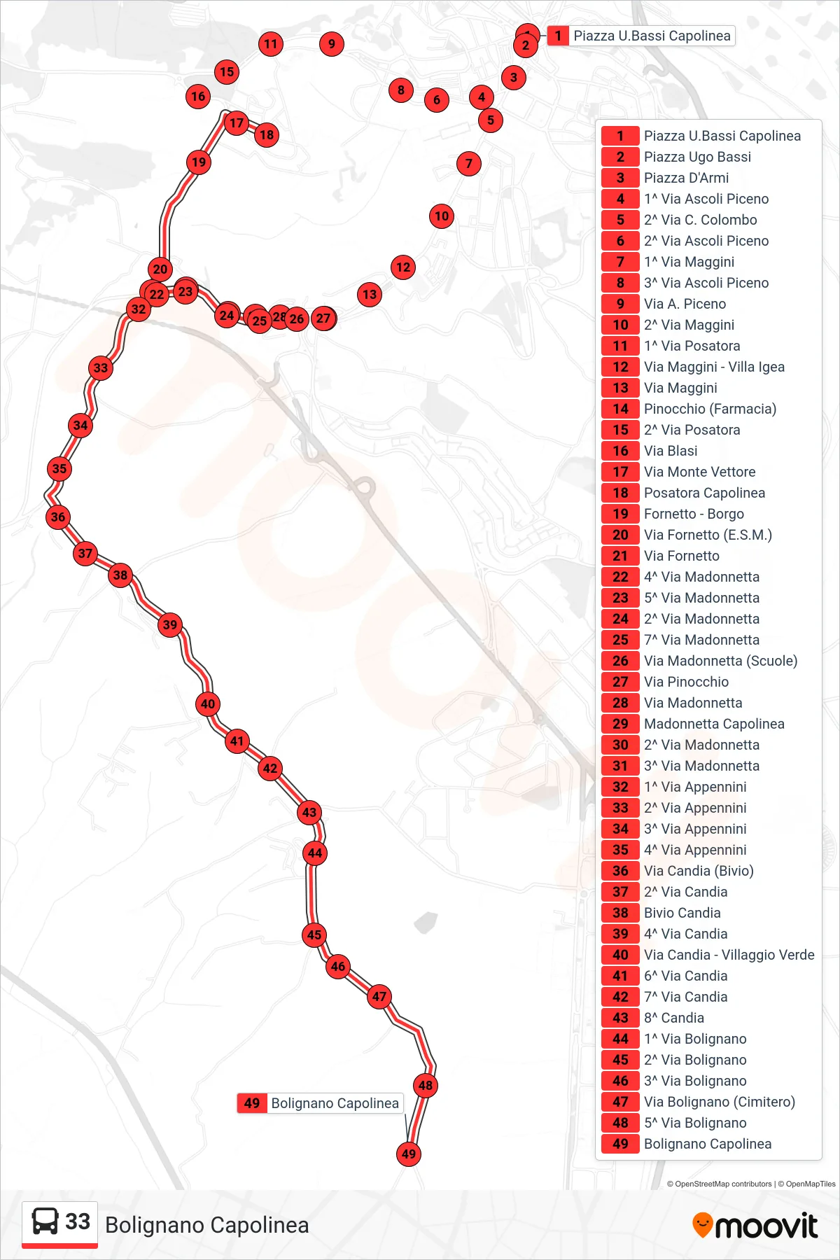
Stops list (33 - Bolignano Terminal)
- Piazza U.Bassi Terminal
- Ugo Bassi Square
- Arms Square
- 1st Via Ascoli Piceno
- 2nd Columbus Street
- 2nd Ascoli Piceno Street
- 1st Via Maggini
- 3rd Ascoli Piceno Street
- Via A. Piceno
- 2nd Maggini Street
- 1st Posatora Street
- Maggini Street - Villa Igea
- Maggini Street
- Pinocchio (Pharmacy)
- 2nd Posatora Street
- Blasi Street
- Monte Vettore Street
- Posatora Terminal
- Fornetto - Village
- Via Fornetto (ESM)
- Fornetto Street
- 4th Madonnetta Street
- 5th Madonnetta Street
- 2nd Madonnetta Street
- 7th Via Madonnetta
- Via Madonnetta (Schools)
- Pinocchio Street
- Madonnetta Street
- Madonnetta Terminal
- 2nd Madonnetta Street
- 3rd Madonnetta Street
- 1st Via Appennini
- 2nd Via Appennini
- 3rd Appennini Street
- 4th Via Appennini
- Via Candia (Junction)
- 2nd Candia Street
- Candia Junction
- 4th Candia Road
- Via Candia - Green Village
- 6th Via Candia
- 7th Via Candia
- 8th Candia
- 1st Bolignano Street
- 2nd Bolignano Street
- 3rd Via Bolignano
- Via Bolignano (Cemetery)
- 5th Bolignano Street
- Bolignano Terminal