
33 Bus Route Map
View the 33 route map and see all 33 stops along the route. The map of 33 shows where the bus travels and the location of each stop, making it easy to understand the entire route at a glance.
Explore Arezzo, Florence and Provinces - Tuscan Bus Lines routes on the map and see where Arezzo, Florence and Provinces - Tuscan Bus Lines bus services operate. Use the 33 map to find bus stops and see how the 33 connects different areas along its trip.
All 33 stops on the map are displayed in route order, helping you follow the 33 bus from the first stop to the last.
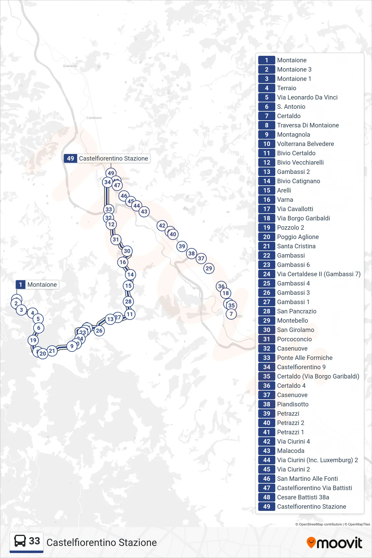
Stops list (33 - Castelfiorentino Station)
- Montaione
- Montaione 3
- Montaione 1
- Terraio
- Leonardo Da Vinci Street
- Saint Antonio
- Pozzolo 2
- Montaione Cross
- Poggio Aglione
- Santa Cristina
- Montagnola
- Volterrana Belvedere
- Gambassi
- Gambassi 6
- Certaldese II Street (Gambassi 7)
- Gambassi 4
- Gambassi 3
- Gambassi 2
- Gambassi 1
- Certaldo Junction
- San Pancrazio
- Arelli
- Catignano Junction
- Varna
- Saint Jerome
- Vecchiarelli Junction
- Certaldo
- Certaldo (Via Borgo Garibaldi)
- Certaldo 4
- Piandisotto
- Petrazzi
- Petrazzi 2
- Petrazzi 1
- Cavallotti Street
- Borgo Garibaldi Street
- Montebello
- Casenuove
- Via Ciurini 4
- Porcoconcio
- Casenuove
- Ponte Alle Formiche
- Castelfiorentino 9
- Malacoda
- Via Ciurini (Luxemburg Junction) 2
- Via Ciurini 2
- San Martino at the Springs
- Castelfiorentino Battisti Street
- 38a Cesare Battisti
- Castelfiorentino Station