
33 Bus Route Map
View the 33 route map and see all 33 stops along the route. The map of 33 shows where the bus travels and the location of each stop, making it easy to understand the entire route at a glance.
Explore Mainzer Mobilität routes on the map and see where Mainzer Mobilität bus services operate. Use the 33 map to find bus stops and see how the 33 connects different areas along its trip.
All 33 stops on the map are displayed in route order, helping you follow the 33 bus from the first stop to the last.
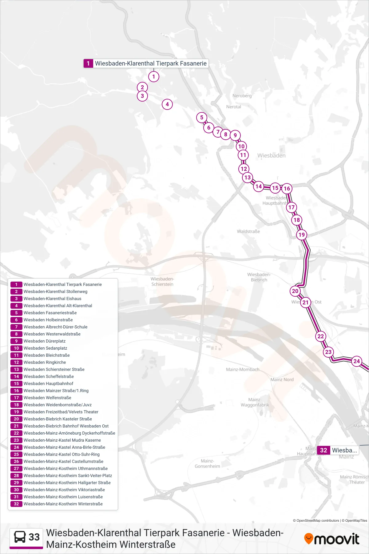
Stops list (33 - Kostheim)
- Wiesbaden-Klarenthal Tierpark Fasanerie
- Wiesbaden-Klarenthal Stollenweg
- Wiesbaden-Klarenthal Eishaus
- Wiesbaden-Klarenthal Alt-Klarenthal
- Wiesbaden Fasaneriestraße
- Wiesbaden Holbeinstraße
- Wiesbaden Albrecht-Dürer-Schule
- Wiesbaden Westerwaldstraße
- Wiesbaden Dürerplatz
- Wiesbaden Sedanplatz
- Wiesbaden Bleichstraße
- Wiesbaden Ringkirche
- Wiesbaden Schiersteiner Straße
- Wiesbaden Scheffelstraße
- Wiesbaden Hauptbahnhof
- Wiesbaden Mainzer Straße/1.Ring
- Wiesbaden Welfenstraße
- Wiesbaden Weidenbornstraße/Juvz
- Wiesbaden Freizeitbad/Velvets Theater
- Wiesbaden-Biebrich Kasteler Straße
- Wiesbaden-Biebrich Bahnhof Wiesbaden Ost
- Wiesbaden-Mainz-Amöneburg Dyckerhoffstraße
- Wiesbaden-Mainz-Kastel Mudra Kaserne
- Wiesbaden-Mainz-Kastel Anna-Birle-Straße
- Wiesbaden-Mainz-Kastel Otto-Suhr-Ring
- Wiesbaden-Mainz-Kastel Castellumstraße
- Wiesbaden-Mainz-Kostheim Uthmannstraße
- Wiesbaden-Mainz-Kostheim Sankt-Veiter-Platz
- Wiesbaden-Mainz-Kostheim Hallgarter Straße
- Wiesbaden-Mainz-Kostheim Viktoriastraße
- Wiesbaden-Mainz-Kostheim Luisenstraße
- Wiesbaden-Mainz-Kostheim Winterstraße