
33 Bus Route Map
View the 33 route map and see all 33 stops along the route. The map of 33 shows where the bus travels and the location of each stop, making it easy to understand the entire route at a glance.
Explore Regionalbuslinien routes on the map and see where Regionalbuslinien bus services operate. Use the 33 map to find bus stops and see how the 33 connects different areas along its trip.
All 33 stops on the map are displayed in route order, helping you follow the 33 bus from the first stop to the last.
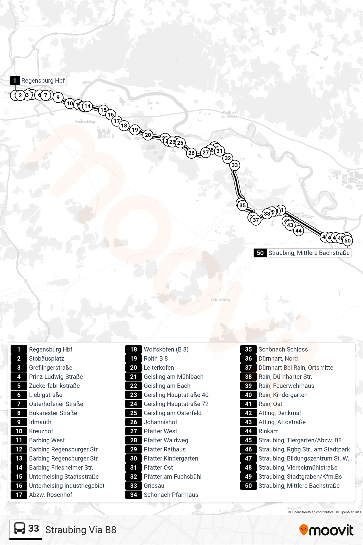
Stops list (33 - Straubing Via B8)
- Regensburg Hbf
- Stobäusplatz
- Greflingerstraße
- Prinz-Ludwig-Straße
- Zuckerfabrikstraße
- Liebigstraße
- Osterhofener Straße
- Bukarester Straße
- Irlmauth
- Kreuzhof
- Barbing West
- Barbing Regensburger Str.
- Barbing Regensburger Str.
- Barbing Friesheimer Str.
- Unterheising Staatsstraße
- Unterheising Industriegebiet
- Abzw. Rosenhof
- Wolfskofen (B 8)
- Roith B 8
- Leiterkofen
- Geisling am Mühlbach
- Geisling am Bach
- Geisling Hauptstraße 40
- Geisling Hauptstraße 72
- Geisling am Osterfeld
- Johannishof
- Pfatter West
- Pfatter Waldweg
- Pfatter Rathaus
- Pfatter Kindergarten
- Pfatter Ost
- Pfatter am Fuchsbühl
- Griesau
- Schönach Pfarrhaus
- Schönach Schloss
- Dürnhart, Nord
- Dürnhart Bei Rain, Ortsmitte
- Rain, Dürnharter Str.
- Rain, Feuerwehrhaus
- Rain, Kindergarten
- Rain, Ost
- Atting, Denkmal
- Atting, Attostraße
- Rinkam
- Straubing, Tiergarten/Abzw. B8
- Straubing, Rgbg Str., am Stadtpark
- Straubing, Bildungszentrum St. Wolfgang
- Straubing, Viereckmühlstraße
- Straubing, Stadtgraben/Kfm.Bs
- Straubing, Mittlere Bachstraße
Change direction
- Route Map - 33 - Abzw. Rosenhof Via Unterheising
- Route Map - 33 - Herfurth
- Route Map - 33 - Regensburg Hbf
- Route Map - 33 - Barbing West
- Route Map - 33 - Schönach Via B8
- Route Map - 33 - Geisling am Osterfeld
- Route Map - 33 - Neutraubling Pommernstraße
- Route Map - 33 - Schönach Hauptstraße
- Route Map - 33 - Pfatter Ost