
33 Bus Route Map
View the 33 route map and see all 33 stops along the route. The map of 33 shows where the bus travels and the location of each stop, making it easy to understand the entire route at a glance.
Explore Rīgas satiksme routes on the map and see where Rīgas satiksme bus services operate. Use the 33 map to find bus stops and see how the 33 connects different areas along its trip.
All 33 stops on the map are displayed in route order, helping you follow the 33 bus from the first stop to the last.
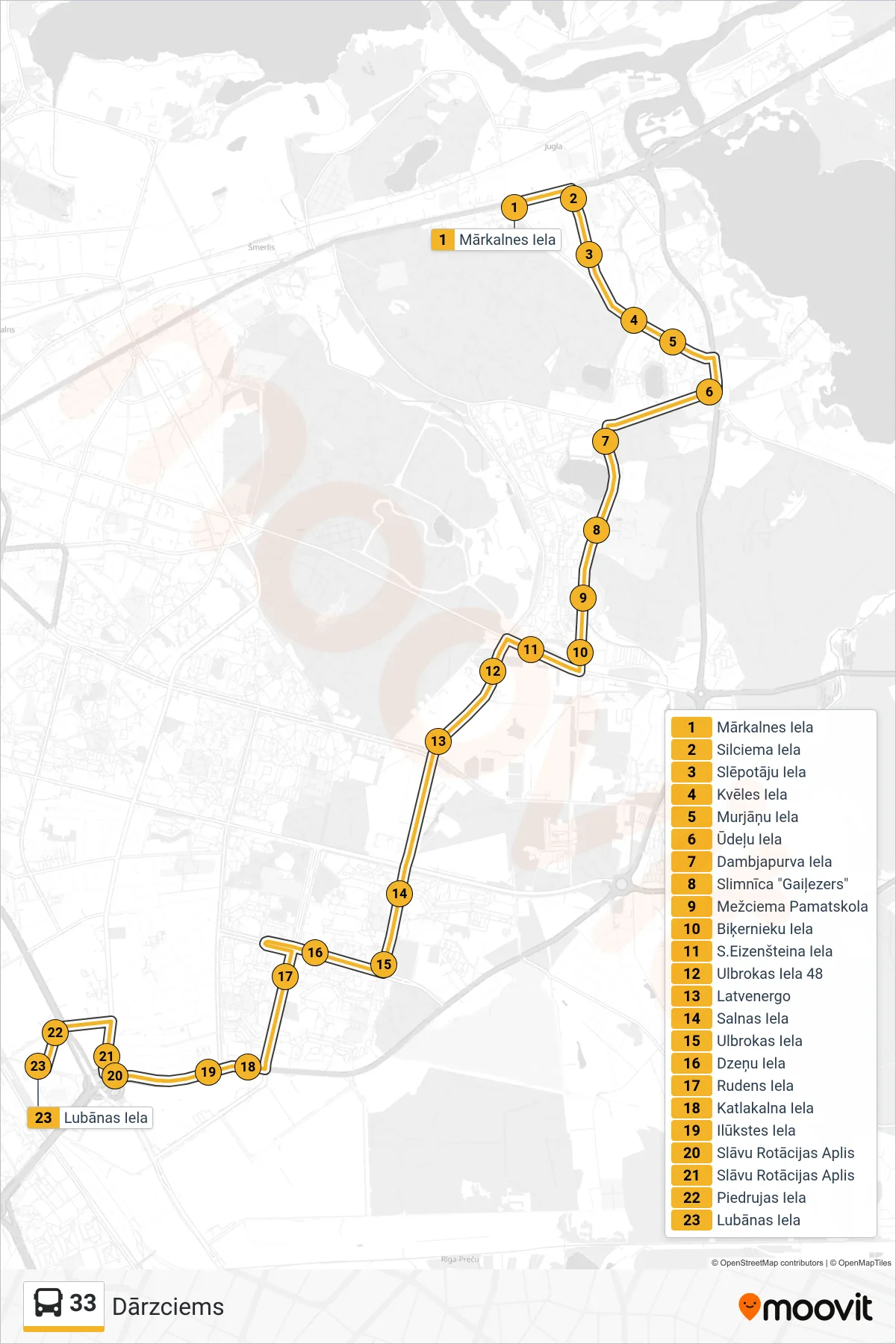
Stops list (33 - Dārzciems)
- Mārkalnes Iela
- Silciema Iela
- Slēpotāju Iela
- Kvēles Iela
- Murjāņu Iela
- Ūdeļu Iela
- Dambjapurva Iela
- Slimnīca "Gaiļezers"
- Mežciema Pamatskola
- Biķernieku Iela
- S.Eizenšteina Iela
- Ulbrokas Iela 48
- Latvenergo
- Salnas Iela
- Ulbrokas Iela
- Dzeņu Iela
- Rudens Iela
- Katlakalna Iela
- Ilūkstes Iela
- Slāvu Rotācijas Aplis
- Slāvu Rotācijas Aplis
- Piedrujas Iela
- Lubānas Iela