
33 Bus Route Map
View the 33 route map and see all 33 stops along the route. The map of 33 shows where the bus travels and the location of each stop, making it easy to understand the entire route at a glance.
Explore MUNI routes on the map and see where MUNI bus services operate. Use the 33 map to find bus stops and see how the 33 connects different areas along its trip.
All 33 stops on the map are displayed in route order, helping you follow the 33 bus from the first stop to the last.
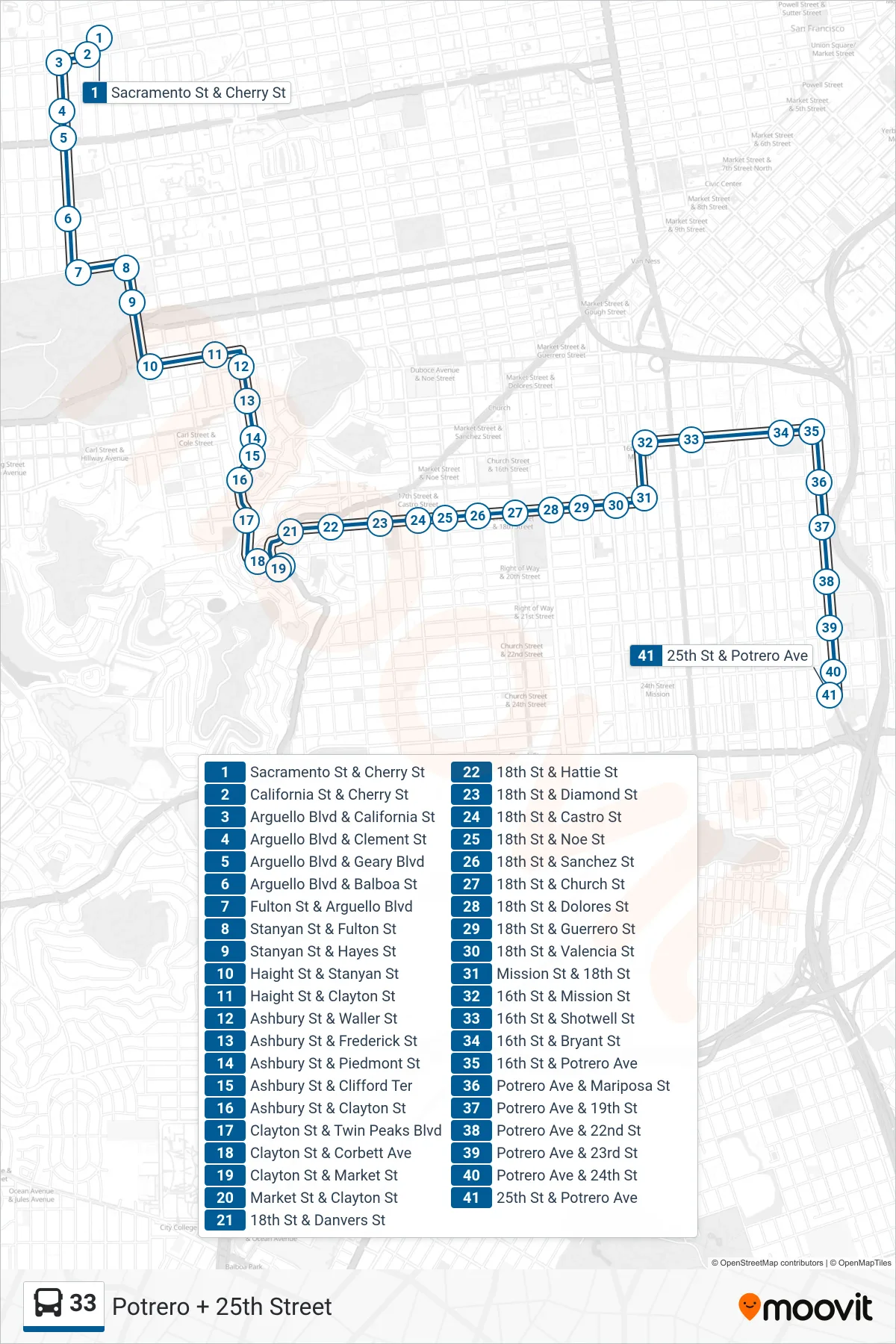
Stops list (33 - Potrero + 25th Street)
- Sacramento St & Cherry St
- California St & Cherry St
- Arguello Blvd & California St
- Arguello Blvd & Clement St
- Arguello Blvd & Geary Blvd
- Arguello Blvd & Balboa St
- Fulton St & Arguello Blvd
- Stanyan St & Fulton St
- Stanyan St & Hayes St
- Haight St & Stanyan St
- Haight St & Clayton St
- Ashbury St & Waller St
- Ashbury St & Frederick St
- Ashbury St & Piedmont St
- Ashbury St & Clifford Ter
- Ashbury St & Clayton St
- Clayton St & Twin Peaks Blvd
- Clayton St & Corbett Ave
- Clayton St & Market St
- Market St & Clayton St
- 18th St & Danvers St
- 18th St & Hattie St
- 18th St & Diamond St
- 18th St & Castro St
- 18th St & Noe St
- 18th St & Sanchez St
- 18th St & Church St
- 18th St & Dolores St
- 18th St & Guerrero St
- 18th St & Valencia St
- Mission St & 18th St
- 16th St & Mission St
- 16th St & Shotwell St
- 16th St & Bryant St
- 16th St & Potrero Ave
- Potrero Ave & Mariposa St
- Potrero Ave & 19th St
- Potrero Ave & 22nd St
- Potrero Ave & 23rd St
- Potrero Ave & 24th St
- 25th St & Potrero Ave