
33 Bus Route Map
View the 33 route map and see all 33 stops along the route. The map of 33 shows where the bus travels and the location of each stop, making it easy to understand the entire route at a glance.
Explore Petaluma Transit routes on the map and see where Petaluma Transit bus services operate. Use the 33 map to find bus stops and see how the 33 connects different areas along its trip.
All 33 stops on the map are displayed in route order, helping you follow the 33 bus from the first stop to the last.
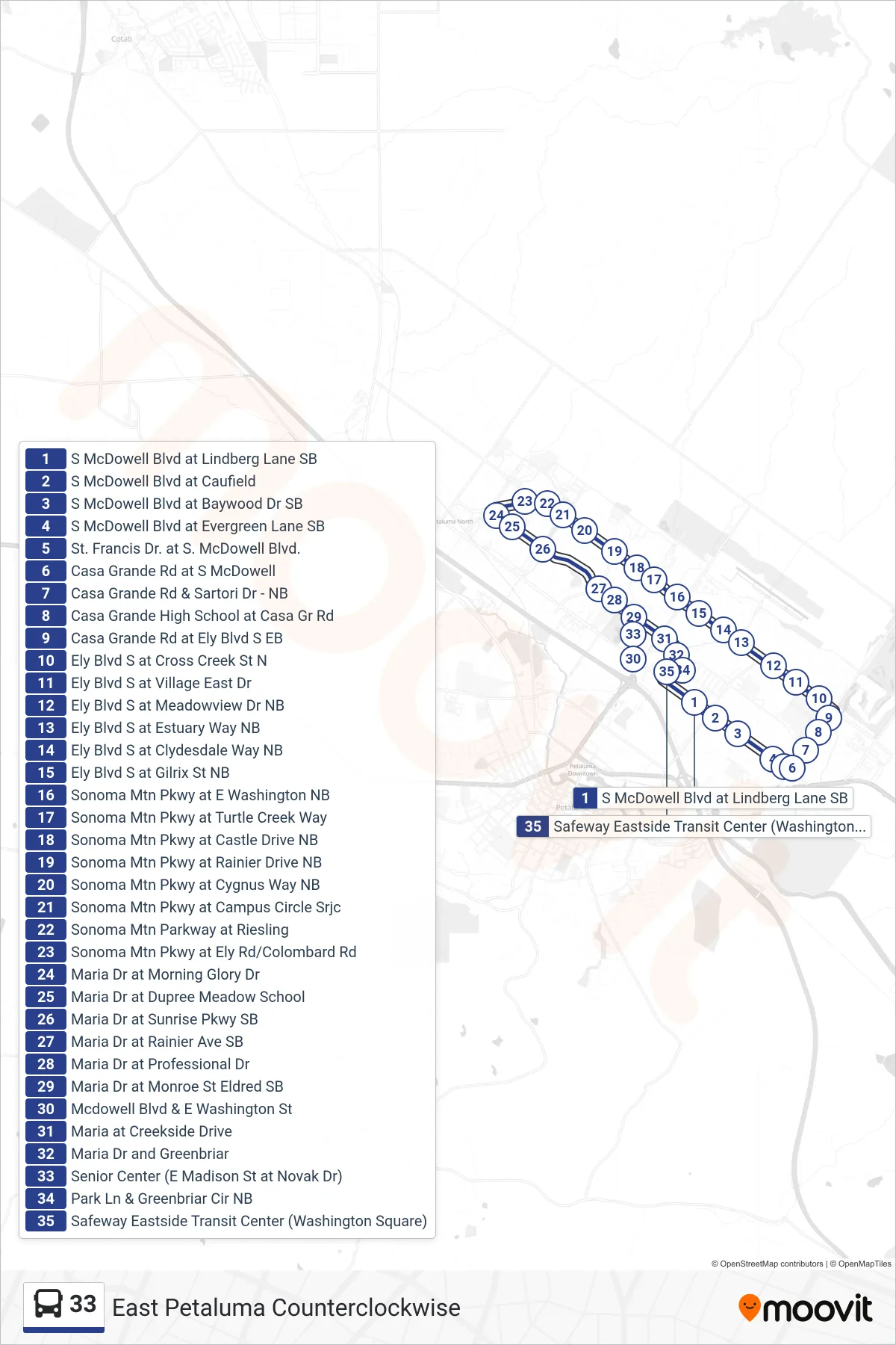
Stops list (33 - Loop)
- S McDowell Blvd at Lindberg Lane SB
- S McDowell Blvd at Caufield
- S McDowell Blvd at Baywood Dr SB
- S McDowell Blvd at Evergreen Lane SB
- St. Francis Dr. at S. McDowell Blvd.
- Casa Grande Rd at S McDowell
- Casa Grande Rd & Sartori Dr - NB
- Casa Grande High School at Casa Gr Rd
- Casa Grande Rd at Ely Blvd S EB
- Ely Blvd S at Cross Creek St N
- Ely Blvd S at Village East Dr
- Ely Blvd S at Meadowview Dr NB
- Ely Blvd S at Estuary Way NB
- Ely Blvd S at Clydesdale Way NB
- Ely Blvd S at Gilrix St NB
- Sonoma Mtn Pkwy at E Washington NB
- Sonoma Mtn Pkwy at Turtle Creek Way
- Sonoma Mtn Pkwy at Castle Drive NB
- Sonoma Mtn Pkwy at Rainier Drive NB
- Sonoma Mtn Pkwy at Cygnus Way NB
- Sonoma Mtn Pkwy at Campus Circle Srjc
- Sonoma Mtn Parkway at Riesling
- Sonoma Mtn Pkwy at Ely Rd/Colombard Rd
- Maria Dr at Morning Glory Dr
- Maria Dr at Dupree Meadow School
- Maria Dr at Sunrise Pkwy SB
- Maria Dr at Rainier Ave SB
- Maria Dr at Professional Dr
- Maria Dr at Monroe St Eldred SB
- Mcdowell Blvd & E Washington St
- Maria at Creekside Drive
- Maria Dr and Greenbriar
- Senior Center (E Madison St at Novak Dr)
- Park Ln & Greenbriar Cir NB
- Safeway Eastside Transit Center (Washington Square)