
330 Bus Route Map
View the 330 route map and see all 330 stops along the route. The map of 330 shows where the bus travels and the location of each stop, making it easy to understand the entire route at a glance.
Explore Kavim routes on the map and see where Kavim bus services operate. Use the 330 map to find bus stops and see how the 330 connects different areas along its trip.
All 330 stops on the map are displayed in route order, helping you follow the 330 bus from the first stop to the last.
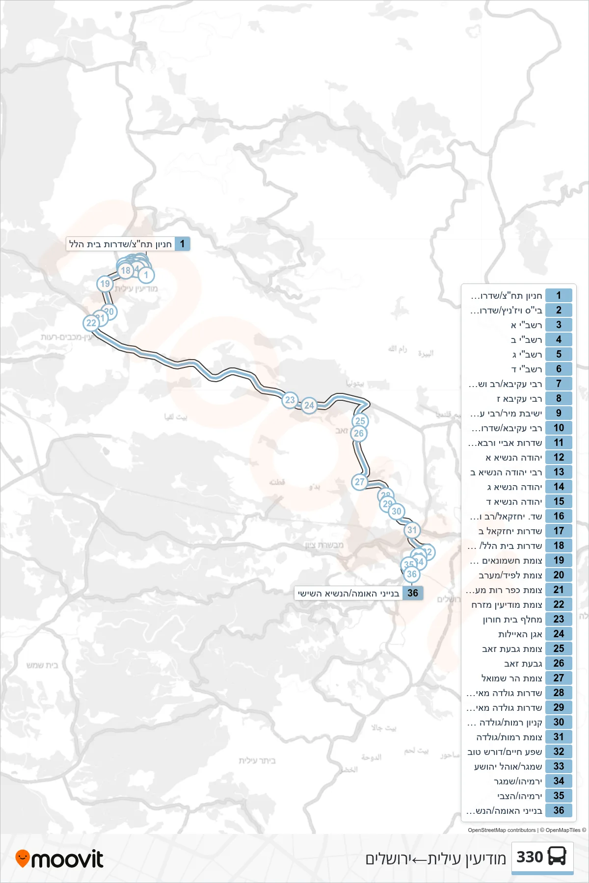
Stops list (330 - Modi'in Illit→Jerusalem)
- Transit Parking/Beit Hillel Boulevard
- Vizhnitz School/Abaye VeRava Boulevard
- Rashbi A
- Rashbi B
- Rashbi C
- Rashbi D
- Rabbi Akiva/Rav VeShmuel
- Rabbi Akiva G
- Mir Yeshiva/Rabbi Akiva
- Rabbi Akiva/Abaye VeRava Boulevard
- Abaye VeRava Ave/Rabbi Akiva
- Yehuda HaNasi A
- Rabbi Yehuda HaNasi 2
- Yehuda HaNasi C
- Yehuda HaNasi D
- Yechezkel/Rav and Shmuel Boulevard
- Yechezkel B Boulevard
- Beit Hillel Boulevard/City Exit
- Hashmonaim South Junction
- Lapid Junction/West
- Kfar Ruth West Junction
- Modi'in East Junction
- Beit Horon Interchange
- Agan HaAyalot
- Givat Zeev Junction
- Givat Ze'ev
- Har Shmuel Junction
- Golda Meir Blvd/Atzel Poet
- Golda Meir Boulevard/Abraham Recanati
- Zionist Congress/Golda
- Ramot Mall/Golda Meir
- Ramot Junction/Golda
- Shefa Chaim/Doresh Tov
- Shamgar/Ohel Yehoshua
- Yirmiyahu/Shamgar
- Yirmiyahu/HaTzvi
- Binyanei HaUma/HaNasi HaShishi