
330 Bus Route Map
View the 330 route map and see all 330 stops along the route. The map of 330 shows where the bus travels and the location of each stop, making it easy to understand the entire route at a glance.
Explore VER routes on the map and see where VER bus services operate. Use the 330 map to find bus stops and see how the 330 connects different areas along its trip.
All 330 stops on the map are displayed in route order, helping you follow the 330 bus from the first stop to the last.
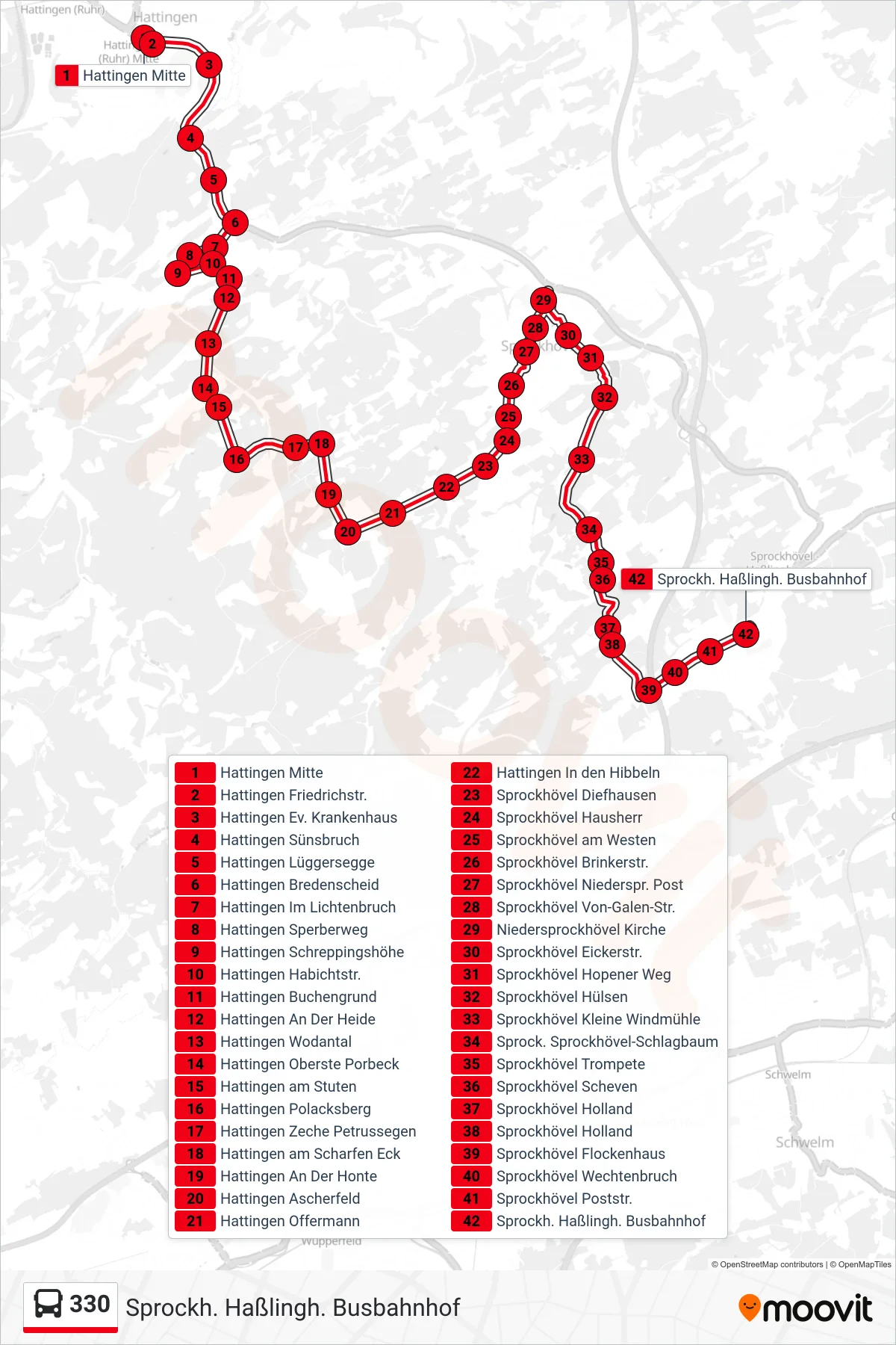
Stops list (330 - Sprockh. Haßlingh. Busbahnhof)
- Hattingen Mitte
- Hattingen Friedrichstr.
- Hattingen Ev. Krankenhaus
- Hattingen Sünsbruch
- Hattingen Lüggersegge
- Hattingen Bredenscheid
- Hattingen Im Lichtenbruch
- Hattingen Sperberweg
- Hattingen Schreppingshöhe
- Hattingen Habichtstr.
- Hattingen Buchengrund
- Hattingen An Der Heide
- Hattingen Wodantal
- Hattingen Oberste Porbeck
- Hattingen am Stuten
- Hattingen Polacksberg
- Hattingen Zeche Petrussegen
- Hattingen am Scharfen Eck
- Hattingen An Der Honte
- Hattingen Ascherfeld
- Hattingen Offermann
- Hattingen In den Hibbeln
- Sprockhövel Diefhausen
- Sprockhövel Hausherr
- Sprockhövel am Westen
- Sprockhövel Brinkerstr.
- Sprockhövel Niederspr. Post
- Sprockhövel Von-Galen-Str.
- Niedersprockhövel Kirche
- Sprockhövel Eickerstr.
- Sprockhövel Hopener Weg
- Sprockhövel Hülsen
- Sprockhövel Kleine Windmühle
- Sprock. Sprockhövel-Schlagbaum
- Sprockhövel Trompete
- Sprockhövel Scheven
- Sprockhövel Holland
- Sprockhövel Holland
- Sprockhövel Flockenhaus
- Sprockhövel Wechtenbruch
- Sprockhövel Poststr.
- Sprockh. Haßlingh. Busbahnhof