
332 Bus Route Map
View the 332 route map and see all 332 stops along the route. The map of 332 shows where the bus travels and the location of each stop, making it easy to understand the entire route at a glance.
Explore PACE routes on the map and see where PACE bus services operate. Use the 332 map to find bus stops and see how the 332 connects different areas along its trip.
All 332 stops on the map are displayed in route order, helping you follow the 332 bus from the first stop to the last.
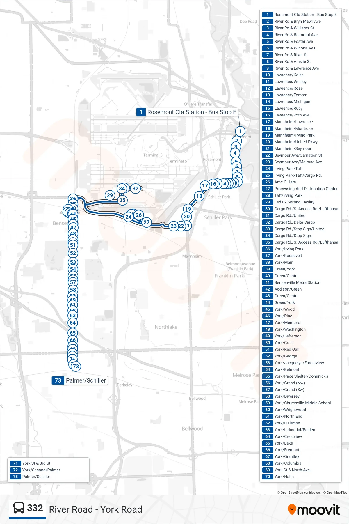
Stops list (332 - Palmer/Schiller)
- Rosemont Cta Station - Bus Stop E
- River Rd & Bryn Mawr Ave
- River Rd & Williams St
- River Rd & Balmoral Ave
- River Rd & Foster Ave
- River Rd & Winona Av E
- River Rd & River St
- River Rd & Ainslie St
- River Rd & Lawrence Ave
- Lawrence/Kolze
- Lawrence/Wesley
- Lawrence/Rose
- Lawrence/Forster
- Lawrence/Michigan
- Lawrence/Ruby
- Lawrence/25th Ave.
- Mannheim/Lawrence
- Mannheim/Montrose
- Mannheim/Irving Park
- Mannheim/United Pkwy.
- Mannheim/Seymour
- Seymour Ave/Carnation St
- Seymour Ave/Melrose Ave
- Irving Park/Taft
- Irving Park/Taft/Cargo Rd.
- Amc O'Hare
- Processing And Distribution Center
- Taft/Irving Park
- Fed Ex Sorting Facility
- Cargo Rd./S. Access Rd./Lufthansa
- Cargo Rd./United
- Cargo Rd./Delta Cargo
- Cargo Rd./Stop Sign/United
- Cargo Rd./Stop Sign
- Cargo Rd./S. Access Rd./Lufthansa
- York/Irving Park
- York/Roosevelt
- York/Main
- Green/York
- Green/Center
- Bensenville Metra Station
- Addison/Green
- Green/Center
- Green/York
- York/Wood
- York/Pine
- York/Memorial
- York/Washington
- York/Jefferson
- York/Crest
- York/Red Oak
- York/George
- York/Jacquelyn/Forestview
- York/Belmont
- York/Pace Shelter/Dominick's
- York/Grand (Nw)
- York/Grand (Sw)
- York/Diversey
- York/Churchville Middle School
- York/Wrightwood
- York/North End
- York/Fullerton
- York/Industrial/Belden
- York/Crestview
- York/Lake
- York/Fremont
- York/Grantley
- York/Columbia
- York St & North Ave
- York/Hahn
- York St & 3rd St
- York/Second/Palmer
- Palmer/Schiller