
332 Bus Route Map
View the 332 route map and see all 332 stops along the route. The map of 332 shows where the bus travels and the location of each stop, making it easy to understand the entire route at a glance.
Explore Kavim routes on the map and see where Kavim bus services operate. Use the 332 map to find bus stops and see how the 332 connects different areas along its trip.
All 332 stops on the map are displayed in route order, helping you follow the 332 bus from the first stop to the last.
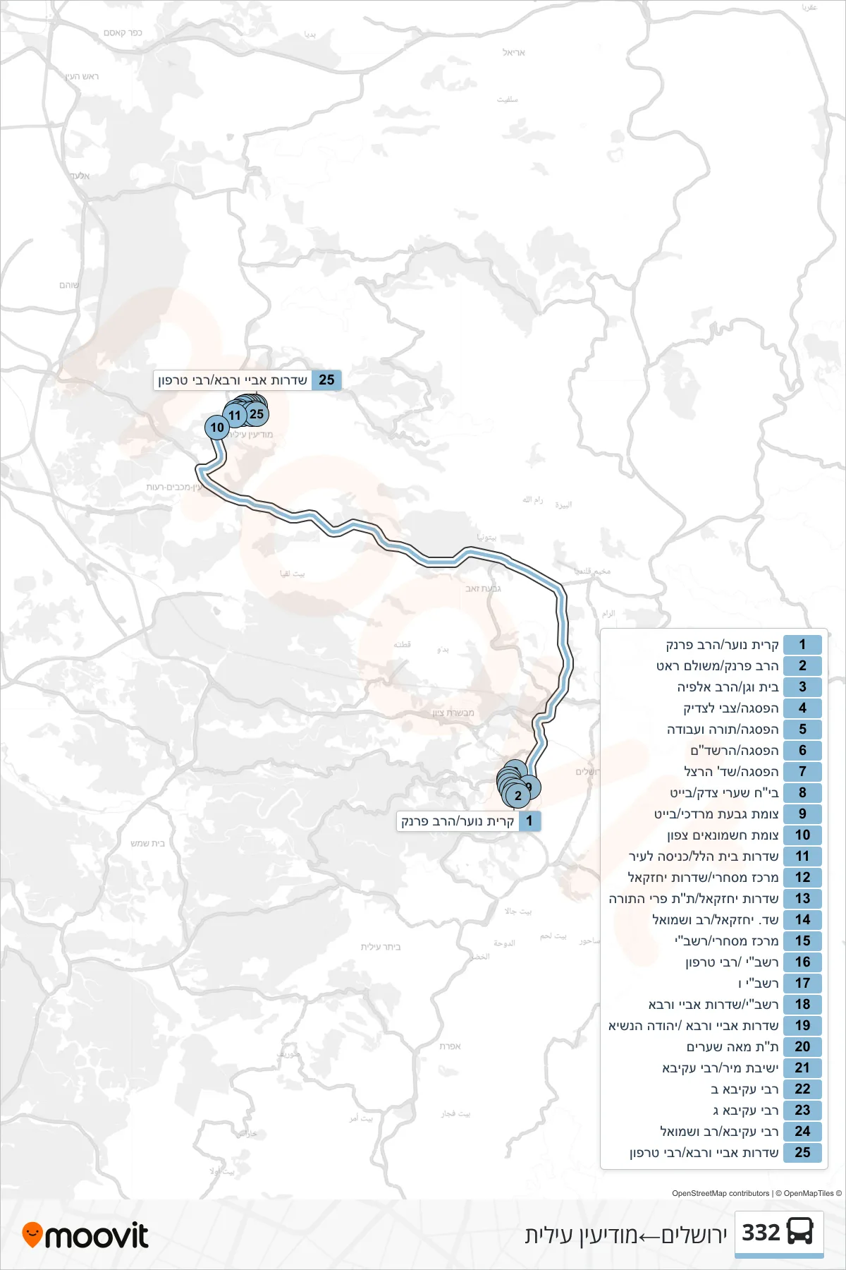
Stops list (332 - Jerusalem→Modi'in Illit)
- Kiryat Noar/Rabbi Frank
- Rabbi Frank/Meshulam Rat
- Beit Vegan/HaRav Alfia
- HaPisga/Tzvi LaTzadik
- HaPisga/Torah VeAvoda
- HaPisga/HaRashdam
- HaPisga/Herzl Boulevard
- Shaare Zedek Hospital/Bait
- Givat Mordechai/Beit Junction
- Hashmonaim North Junction
- Beit Hillel Boulevard/City Entrance
- Commercial Center/Yechezkel Boulevard
- Yechezkel Boulevard/Pri HaTorah
- Yechezkel/Rav and Shmuel Boulevard
- Commercial Center/Rashbi
- Rashbi/Rabbi Tarfon
- Rashbi F
- Rashbi/Abaye VeRava Boulevard
- Abaye VeRava Boulevard/Yehuda HaNasi
- Talmud Torah Meah Shearim
- Mir Yeshiva/Rabbi Akiva
- Rabbi Akiva B
- Rabbi Akiva C
- Rabbi Akiva/Rav VeShmuel
- Abaye VeRava Boulevard/Rabbi Tarfon