
339 Bus Route Map
View the 339 route map and see all 339 stops along the route. The map of 339 shows where the bus travels and the location of each stop, making it easy to understand the entire route at a glance.
Explore BOGESTRA BUS routes on the map and see where BOGESTRA BUS bus services operate. Use the 339 map to find bus stops and see how the 339 connects different areas along its trip.
All 339 stops on the map are displayed in route order, helping you follow the 339 bus from the first stop to the last.
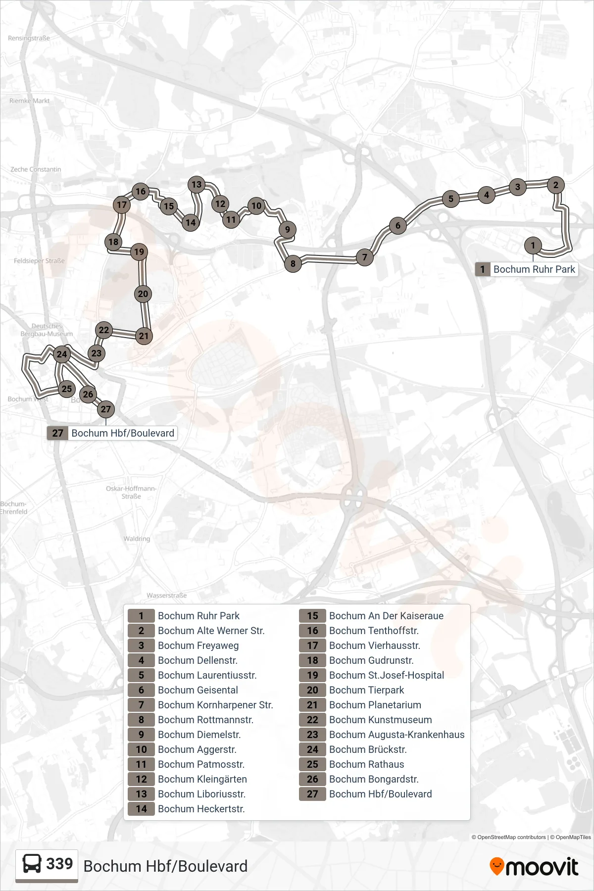
Stops list (339 - Bochum Hbf/Boulevard)
- Bochum Ruhr Park
- Bochum Alte Werner Str.
- Bochum Freyaweg
- Bochum Dellenstr.
- Bochum Laurentiusstr.
- Bochum Geisental
- Bochum Kornharpener Str.
- Bochum Rottmannstr.
- Bochum Diemelstr.
- Bochum Aggerstr.
- Bochum Patmosstr.
- Bochum Kleingärten
- Bochum Liboriusstr.
- Bochum Heckertstr.
- Bochum An Der Kaiseraue
- Bochum Tenthoffstr.
- Bochum Vierhausstr.
- Bochum Gudrunstr.
- Bochum St.Josef-Hospital
- Bochum Tierpark
- Bochum Planetarium
- Bochum Kunstmuseum
- Bochum Augusta-Krankenhaus
- Bochum Brückstr.
- Bochum Rathaus
- Bochum Bongardstr.
- Bochum Hbf/Boulevard