
33A Bus Route Map
View the 33A route map and see all 33A stops along the route. The map of 33A shows where the bus travels and the location of each stop, making it easy to understand the entire route at a glance.
Explore Go-Ahead Ireland routes on the map and see where Go-Ahead Ireland bus services operate. Use the 33A map to find bus stops and see how the 33A connects different areas along its trip.
All 33A stops on the map are displayed in route order, helping you follow the 33A bus from the first stop to the last.
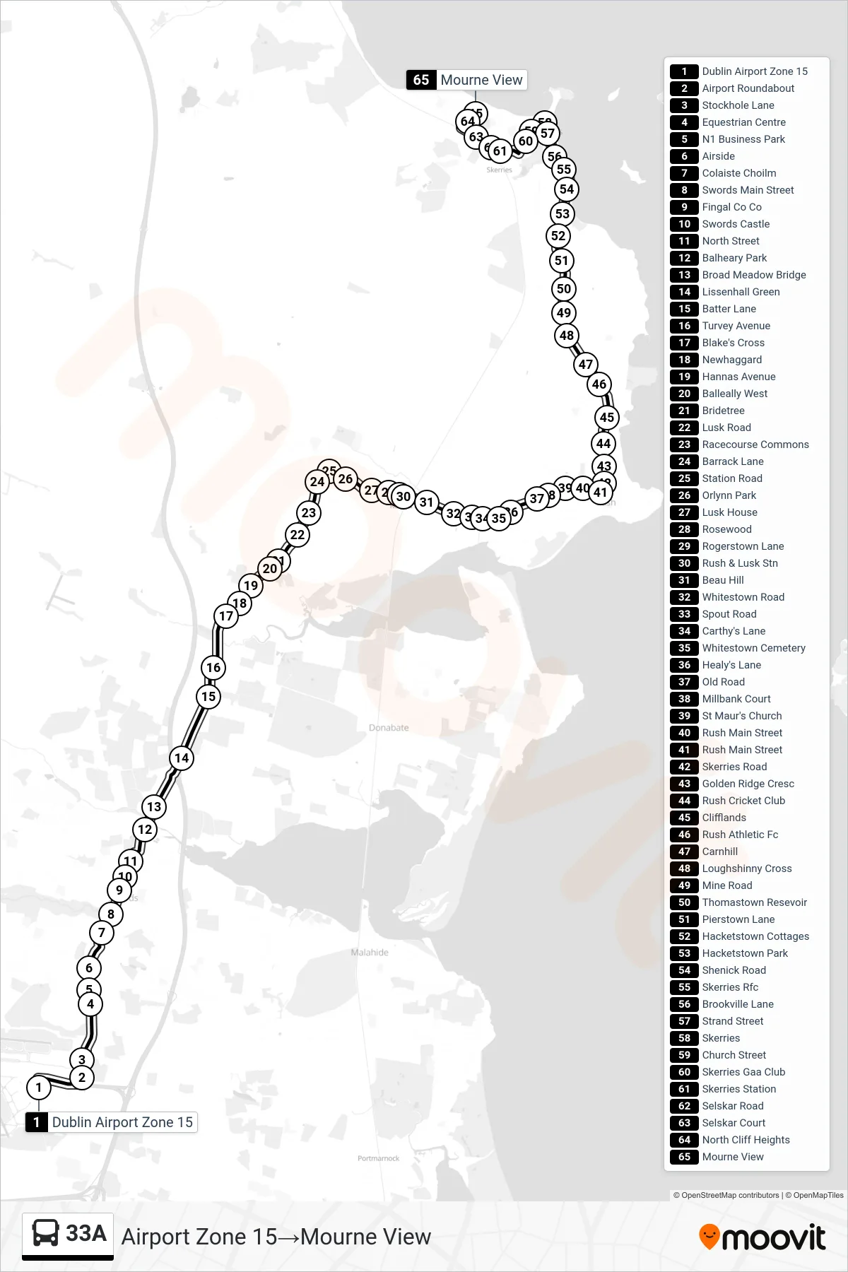
Stops list (33A - Airport Zone 15→Mourne View)
- Dublin Airport Zone 15
- Airport Roundabout
- Stockhole Lane
- Equestrian Centre
- N1 Business Park
- Airside
- Colaiste Choilm
- Swords Main Street
- Fingal Co Co
- Swords Castle
- North Street
- Balheary Park
- Broad Meadow Bridge
- Lissenhall Green
- Batter Lane
- Turvey Avenue
- Blake's Cross
- Newhaggard
- Hannas Avenue
- Balleally West
- Bridetree
- Lusk Road
- Racecourse Commons
- Barrack Lane
- Station Road
- Orlynn Park
- Lusk House
- Rosewood
- Rogerstown Lane
- Rush & Lusk Stn
- Beau Hill
- Whitestown Road
- Spout Road
- Carthy's Lane
- Whitestown Cemetery
- Healy's Lane
- Old Road
- Millbank Court
- St Maur's Church
- Rush Main Street
- Rush Main Street
- Skerries Road
- Golden Ridge Cresc
- Rush Cricket Club
- Clifflands
- Rush Athletic Fc
- Carnhill
- Loughshinny Cross
- Mine Road
- Thomastown Resevoir
- Pierstown Lane
- Hacketstown Cottages
- Hacketstown Park
- Shenick Road
- Skerries Rfc
- Brookville Lane
- Strand Street
- Skerries
- Church Street
- Skerries Gaa Club
- Skerries Station
- Selskar Road
- Selskar Court
- North Cliff Heights
- Mourne View