
34 Bus Route Map
View the 34 route map and see all 34 stops along the route. The map of 34 shows where the bus travels and the location of each stop, making it easy to understand the entire route at a glance.
Explore Rhode Island Public Transit Authority routes on the map and see where Rhode Island Public Transit Authority bus services operate. Use the 34 map to find bus stops and see how the 34 connects different areas along its trip.
All 34 stops on the map are displayed in route order, helping you follow the 34 bus from the first stop to the last.
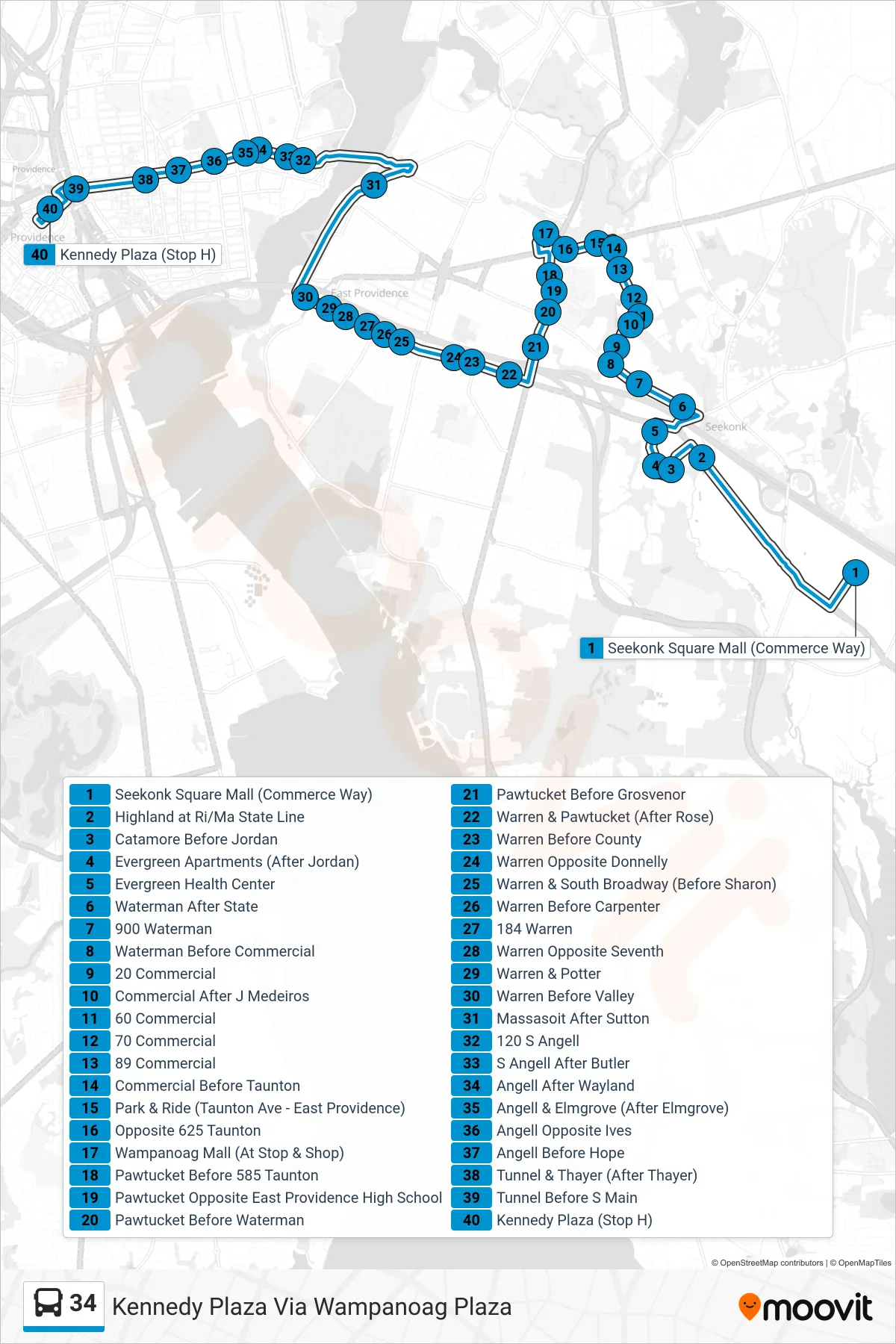
Stops list (34 - Kennedy Plaza Via Wampanoag Plaza)
- Seekonk Square Mall (Commerce Way)
- Highland at Ri/Ma State Line
- Catamore Before Jordan
- Evergreen Apartments (After Jordan)
- Evergreen Health Center
- Waterman After State
- 900 Waterman
- Waterman Before Commercial
- 20 Commercial
- Commercial After J Medeiros
- 60 Commercial
- 70 Commercial
- 89 Commercial
- Commercial Before Taunton
- Park & Ride (Taunton Ave - East Providence)
- Opposite 625 Taunton
- Wampanoag Mall (At Stop & Shop)
- Pawtucket Before 585 Taunton
- Pawtucket Opposite East Providence High School
- Pawtucket Before Waterman
- Pawtucket Before Grosvenor
- Warren & Pawtucket (After Rose)
- Warren Before County
- Warren Opposite Donnelly
- Warren & South Broadway (Before Sharon)
- Warren Before Carpenter
- 184 Warren
- Warren Opposite Seventh
- Warren & Potter
- Warren Before Valley
- Massasoit After Sutton
- 120 S Angell
- S Angell After Butler
- Angell After Wayland
- Angell & Elmgrove (After Elmgrove)
- Angell Opposite Ives
- Angell Before Hope
- Tunnel & Thayer (After Thayer)
- Tunnel Before S Main
- Kennedy Plaza (Stop H)