
34 Bus Route Map
View the 34 route map and see all 34 stops along the route. The map of 34 shows where the bus travels and the location of each stop, making it easy to understand the entire route at a glance.
Explore Romano Regional Bus Lines s.p.a. routes on the map and see where Romano Regional Bus Lines s.p.a. bus services operate. Use the 34 map to find bus stops and see how the 34 connects different areas along its trip.
All 34 stops on the map are displayed in route order, helping you follow the 34 bus from the first stop to the last.
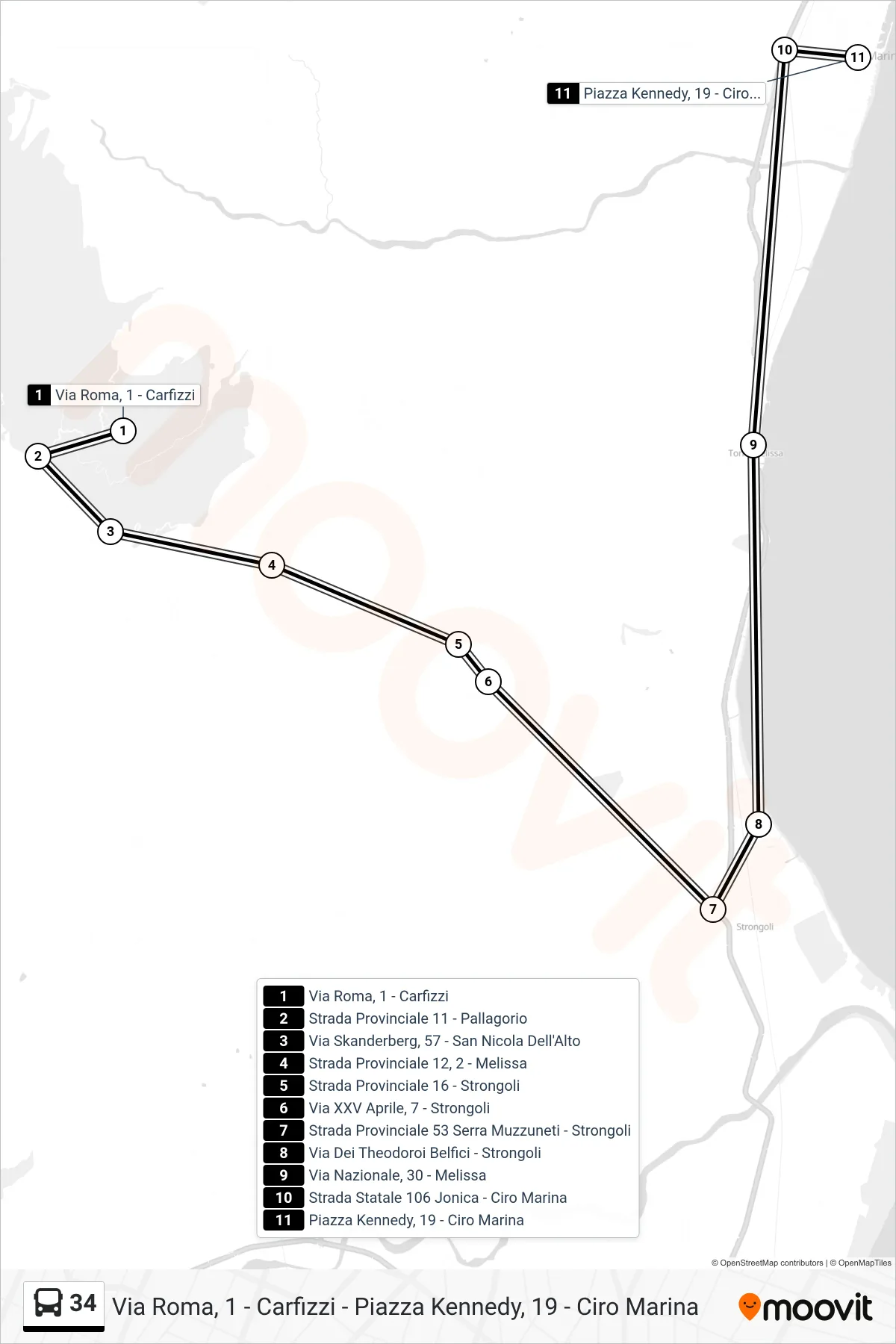
Stops list (34 - Kennedy Square, 19 - Ciro Marina)
- Roma Street 1 - Carfizzi
- Provincial Road 11 - Pallagorio
- Skanderberg Street, 57 - San Nicola Dell'Alto
- Provincial Road 12, 2 - Melissa
- Provincial Road 16 - Strongoli
- XXV April Street, 7 - Strongoli
- Provincial Road 53 Serra Muzzuneti - Strongoli
- Via Dei Theodoroi Belfici - Strongoli
- National Road, 30 - Melissa
- Jonica State Road 106 - Ciro Marina
- Kennedy Square, 19 - Ciro Marina