
34 S-Bahn Route Map
View the 34 route map and see all 34 stops along the route. The map of 34 shows where the S-Bahn travels and the location of each stop, making it easy to understand the entire route at a glance.
Explore ALV Oberhessen routes on the map and see where ALV Oberhessen S-Bahn services operate. Use the 34 map to find S-Bahn stations and see how the 34 connects different areas along its trip.
All 34 stops on the map are displayed in route order, helping you follow the 34 S-Bahn from the first station to the last.
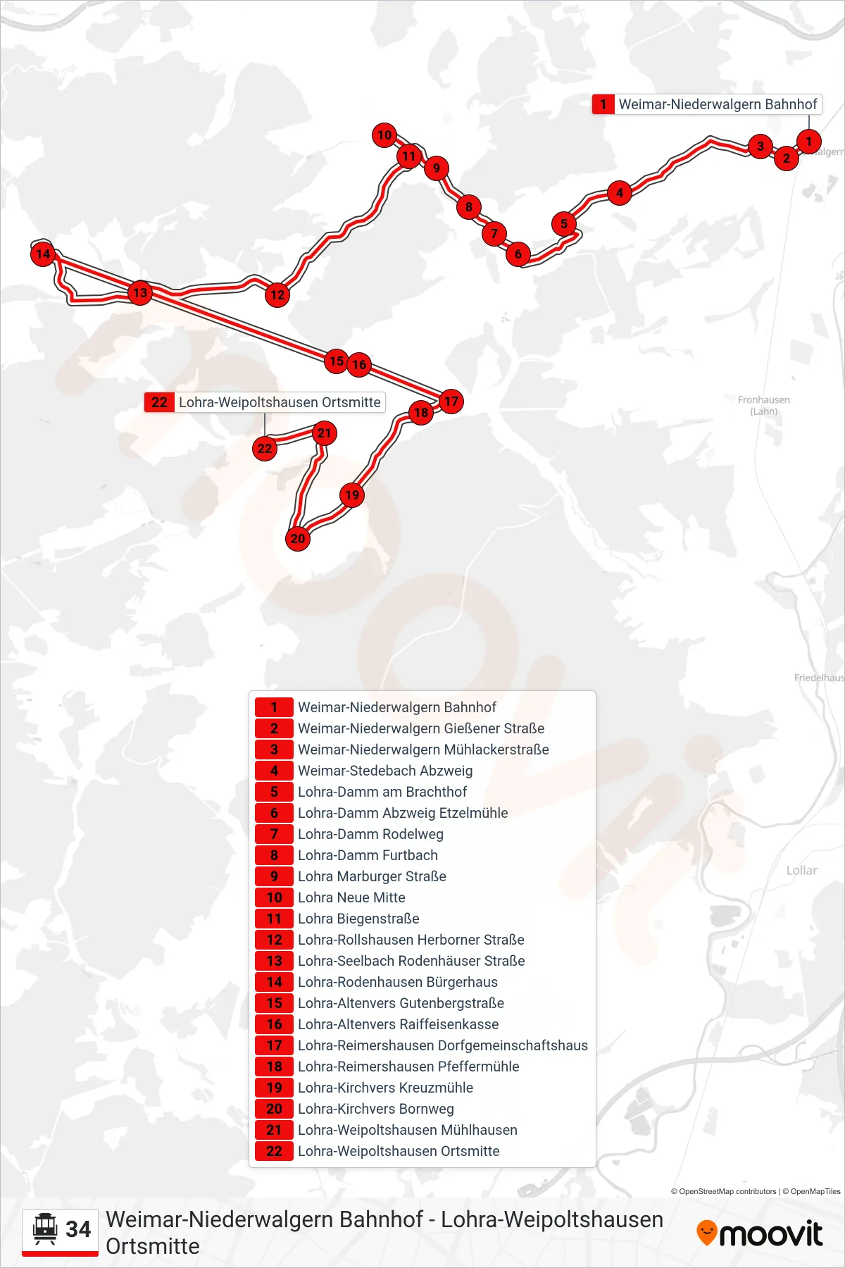
Stops list (34 - Lohra-Weipoltshausen Ortsmitte)
- Weimar-Niederwalgern Bahnhof
- Weimar-Niederwalgern Gießener Straße
- Weimar-Niederwalgern Mühlackerstraße
- Weimar-Stedebach Abzweig
- Lohra-Damm am Brachthof
- Lohra-Damm Abzweig Etzelmühle
- Lohra-Damm Rodelweg
- Lohra-Damm Furtbach
- Lohra Marburger Straße
- Lohra Neue Mitte
- Lohra Biegenstraße
- Lohra-Rollshausen Herborner Straße
- Lohra-Seelbach Rodenhäuser Straße
- Lohra-Rodenhausen Bürgerhaus
- Lohra-Altenvers Gutenbergstraße
- Lohra-Altenvers Raiffeisenkasse
- Lohra-Reimershausen Dorfgemeinschaftshaus
- Lohra-Reimershausen Pfeffermühle
- Lohra-Kirchvers Kreuzmühle
- Lohra-Kirchvers Bornweg
- Lohra-Weipoltshausen Mühlhausen
- Lohra-Weipoltshausen Ortsmitte