
34 Bus Route Map
View the 34 route map and see all 34 stops along the route. The map of 34 shows where the bus travels and the location of each stop, making it easy to understand the entire route at a glance.
Explore NJ Transit routes on the map and see where NJ Transit bus services operate. Use the 34 map to find bus stops and see how the 34 connects different areas along its trip.
All 34 stops on the map are displayed in route order, helping you follow the 34 bus from the first stop to the last.
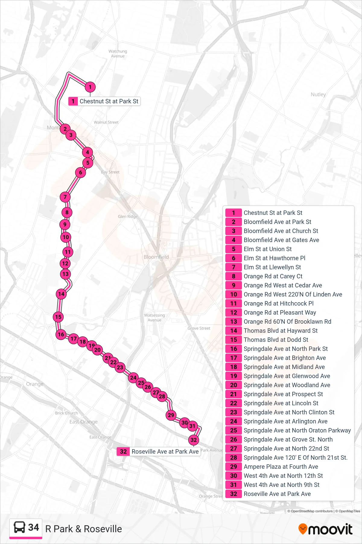
Stops list (34 - R Park & Roseville)
- Chestnut St at Park St
- Bloomfield Ave at Park St
- Bloomfield Ave at Church St
- Bloomfield Ave at Gates Ave
- Elm St at Union St
- Elm St at Hawthorne Pl
- Elm St at Llewellyn St
- Orange Rd at Carey Ct
- Orange Rd West at Cedar Ave
- Orange Rd West 220'N Of Linden Ave
- Orange Rd at Hitchcock Pl
- Orange Rd at Pleasant Way
- Orange Rd 60'N Of Brooklawn Rd
- Thomas Blvd at Hayward St
- Thomas Blvd at Dodd St
- Springdale Ave at North Park St
- Springdale Ave at Brighton Ave
- Springdale Ave at Midland Ave
- Springdale Ave at Glenwood Ave
- Springdale Ave at Woodland Ave
- Springdale Ave at Prospect St
- Springdale Ave at Lincoln St
- Springdale Ave at North Clinton St
- Springdale Ave at Arlington Ave
- Springdale Ave at North Oraton Parkway
- Springdale Ave at Grove St. North
- Springdale Ave at North 22nd St
- Springdale Ave 120' E Of North 21st St.
- Ampere Plaza at Fourth Ave
- West 4th Ave at North 12th St
- West 4th Ave at North 9th St
- Roseville Ave at Park Ave