
34 Cable Car Route Map
View the 34 route map and see all 34 stops along the route. The map of 34 shows where the cable car travels and the location of each stop, making it easy to understand the entire route at a glance.
Explore Rīgas satiksme routes on the map and see where Rīgas satiksme cable car services operate. Use the 34 map to find cable car stations and see how the 34 connects different areas along its trip.
All 34 stops on the map are displayed in route order, helping you follow the 34 cable car from the first station to the last.
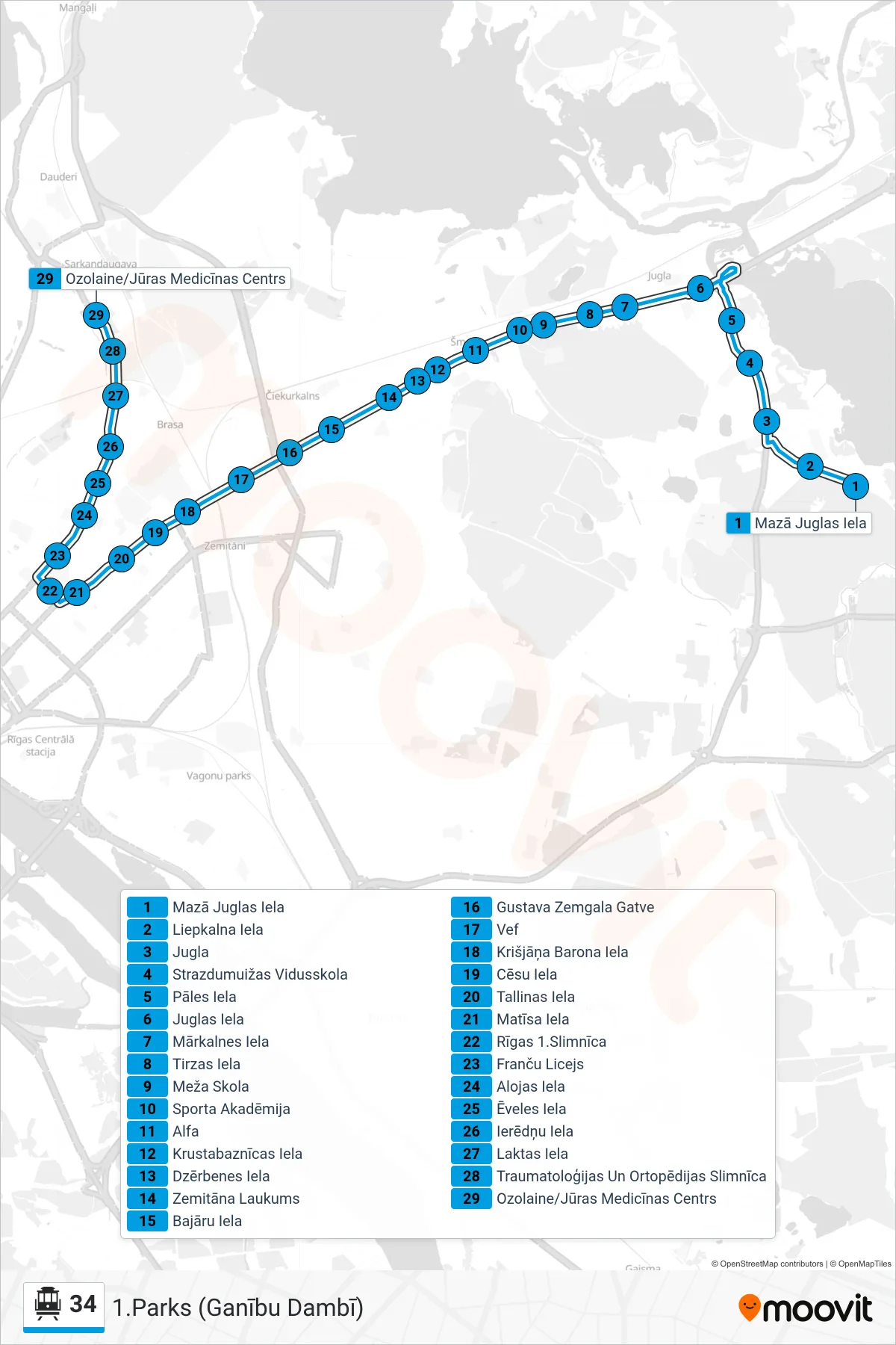
Stops list (34 - 1.Parks (Ganību Dambī))
- Mazā Juglas Iela
- Liepkalna Iela
- Jugla
- Strazdumuižas Vidusskola
- Pāles Iela
- Juglas Iela
- Mārkalnes Iela
- Tirzas Iela
- Meža Skola
- Sporta Akadēmija
- Alfa
- Krustabaznīcas Iela
- Dzērbenes Iela
- Zemitāna Laukums
- Bajāru Iela
- Gustava Zemgala Gatve
- Vef
- Krišjāņa Barona Iela
- Cēsu Iela
- Tallinas Iela
- Matīsa Iela
- Rīgas 1.Slimnīca
- Franču Licejs
- Alojas Iela
- Ēveles Iela
- Ierēdņu Iela
- Laktas Iela
- Traumatoloģijas Un Ortopēdijas Slimnīca
- Ozolaine/Jūras Medicīnas Centrs