
34 Bus Route Map
View the 34 route map and see all 34 stops along the route. The map of 34 shows where the bus travels and the location of each stop, making it easy to understand the entire route at a glance.
Explore Santa Cruz Metro routes on the map and see where Santa Cruz Metro bus services operate. Use the 34 map to find bus stops and see how the 34 connects different areas along its trip.
All 34 stops on the map are displayed in route order, helping you follow the 34 bus from the first stop to the last.
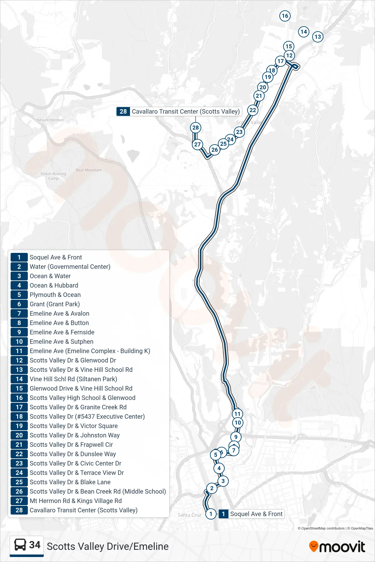
Stops list (34 - Scotts Valley Drive/Emeline)
- Soquel Ave & Front
- Water (Governmental Center)
- Ocean & Water
- Ocean & Hubbard
- Plymouth & Ocean
- Grant (Grant Park)
- Emeline Ave & Avalon
- Emeline Ave & Button
- Emeline Ave & Fernside
- Emeline Ave & Sutphen
- Emeline Ave (Emeline Complex - Building K)
- Scotts Valley Dr & Glenwood Dr
- Scotts Valley Dr & Vine Hill School Rd
- Vine Hill Schl Rd (Siltanen Park)
- Glenwood Drive & Vine Hill School Rd
- Scotts Valley High School & Glenwood
- Scotts Valley Dr & Granite Creek Rd
- Scotts Valley Dr (#5437 Executive Center)
- Scotts Valley Dr & Victor Square
- Scotts Valley Dr & Johnston Way
- Scotts Valley Dr & Frapwell Cir
- Scotts Valley Dr & Dunslee Way
- Scotts Valley Dr & Civic Center Dr
- Scotts Valley Dr & Terrace View Dr
- Scotts Valley Dr & Blake Lane
- Scotts Valley Dr & Bean Creek Rd (Middle School)
- Mt Hermon Rd & Kings Village Rd
- Cavallaro Transit Center (Scotts Valley)