
34 Bus Route Map
View the 34 route map and see all 34 stops along the route. The map of 34 shows where the bus travels and the location of each stop, making it easy to understand the entire route at a glance.
Explore Montgomery County Ride On routes on the map and see where Montgomery County Ride On bus services operate. Use the 34 map to find bus stops and see how the 34 connects different areas along its trip.
All 34 stops on the map are displayed in route order, helping you follow the 34 bus from the first stop to the last.
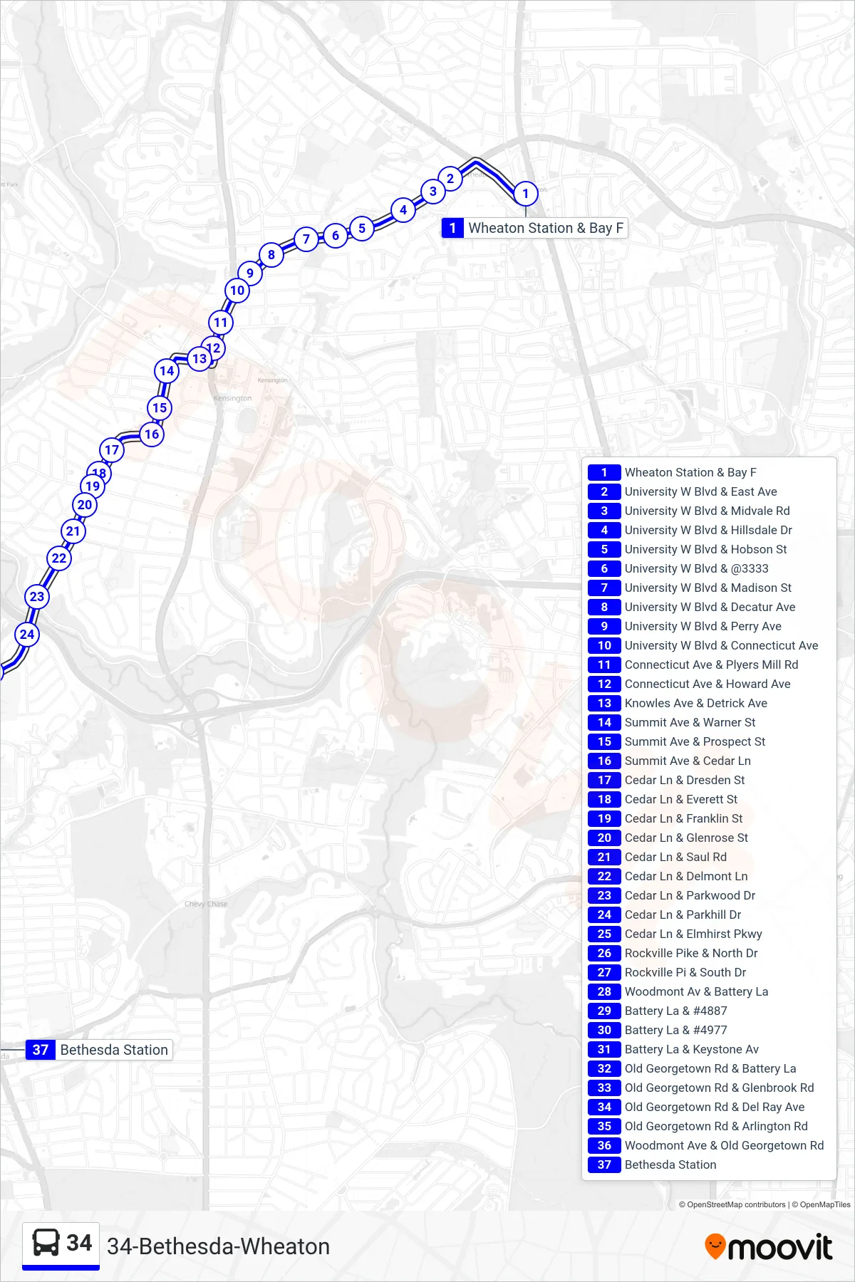
Stops list (34 - Bethesda)
- Wheaton Station & Bay F
- University W Blvd & East Ave
- University W Blvd & Midvale Rd
- University W Blvd & Hillsdale Dr
- University W Blvd & Hobson St
- University W Blvd & @3333
- University W Blvd & Madison St
- University W Blvd & Decatur Ave
- University W Blvd & Perry Ave
- University W Blvd & Connecticut Ave
- Connecticut Ave & Plyers Mill Rd
- Connecticut Ave & Howard Ave
- Knowles Ave & Detrick Ave
- Summit Ave & Warner St
- Summit Ave & Prospect St
- Summit Ave & Cedar Ln
- Cedar Ln & Dresden St
- Cedar Ln & Everett St
- Cedar Ln & Franklin St
- Cedar Ln & Glenrose St
- Cedar Ln & Saul Rd
- Cedar Ln & Delmont Ln
- Cedar Ln & Parkwood Dr
- Cedar Ln & Parkhill Dr
- Cedar Ln & Elmhirst Pkwy
- Rockville Pike & North Dr
- Rockville Pi & South Dr
- Woodmont Av & Battery La
- Battery La & #4887
- Battery La & #4977
- Battery La & Keystone Av
- Old Georgetown Rd & Battery La
- Old Georgetown Rd & Glenbrook Rd
- Old Georgetown Rd & Del Ray Ave
- Old Georgetown Rd & Arlington Rd
- Woodmont Ave & Old Georgetown Rd
- Bethesda Station