
344 Bus Route Map
View the 344 route map and see all 344 stops along the route. The map of 344 shows where the bus travels and the location of each stop, making it easy to understand the entire route at a glance.
Explore BOGESTRA BUS routes on the map and see where BOGESTRA BUS bus services operate. Use the 344 map to find bus stops and see how the 344 connects different areas along its trip.
All 344 stops on the map are displayed in route order, helping you follow the 344 bus from the first stop to the last.
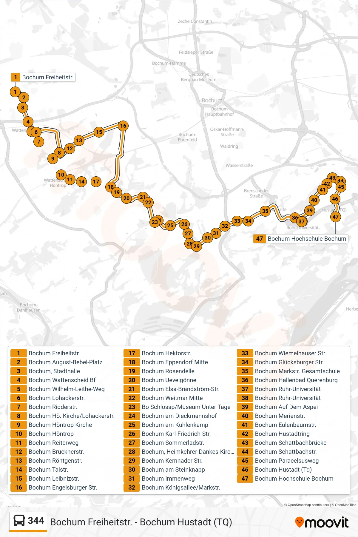
Stops list (344 - Bochum Hochschule Bochum)
- Bochum Freiheitstr.
- Bochum August-Bebel-Platz
- Bochum, Stadthalle
- Bochum Wattenscheid Bf
- Bochum Wilhelm-Leithe-Weg
- Bochum Lohackerstr.
- Bochum Ridderstr.
- Bochum Hö. Kirche/Lohackerstr.
- Bochum Höntrop Kirche
- Bochum Höntrop
- Bochum Reiterweg
- Bochum Brucknerstr.
- Bochum Röntgenstr.
- Bochum Talstr.
- Bochum Leibnizstr.
- Bochum Engelsburger Str.
- Bochum Hektorstr.
- Bochum Eppendorf Mitte
- Bochum Rosendelle
- Bochum Uevelgönne
- Bochum Elsa-Brändström-Str.
- Bochum Weitmar Mitte
- Bo Schlossp/Museum Unter Tage
- Bochum am Dieckmannshof
- Bochum am Kuhlenkamp
- Bochum Karl-Friedrich-Str.
- Bochum Sommerladstr.
- Bochum, Heimkehrer-Dankes-Kirche
- Bochum Kemnader Str.
- Bochum am Steinknapp
- Bochum Immenweg
- Bochum Königsallee/Markstr.
- Bochum Wiemelhauser Str.
- Bochum Glücksburger Str.
- Bochum Markstr. Gesamtschule
- Bochum Hallenbad Querenburg
- Bochum Ruhr-Universität
- Bochum Ruhr-Universität
- Bochum Auf Dem Aspei
- Bochum Merianstr.
- Bochum Eulenbaumstr.
- Bochum Hustadtring
- Bochum Schattbachbrücke
- Bochum Schattbachstr.
- Bochum Paracelsusweg
- Bochum Hustadt (Tq)
- Bochum Hochschule Bochum