
345 Bus Route Map
View the 345 route map and see all 345 stops along the route. The map of 345 shows where the bus travels and the location of each stop, making it easy to understand the entire route at a glance.
Explore BOGESTRA BUS routes on the map and see where BOGESTRA BUS bus services operate. Use the 345 map to find bus stops and see how the 345 connects different areas along its trip.
All 345 stops on the map are displayed in route order, helping you follow the 345 bus from the first stop to the last.
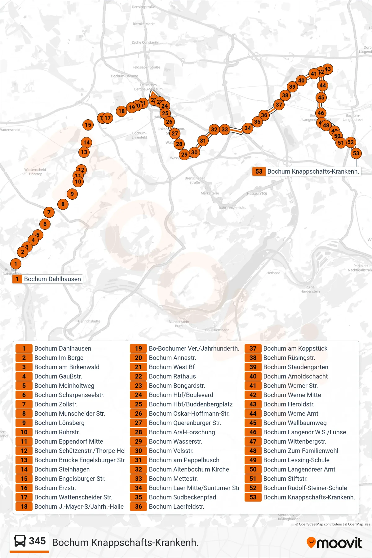
Stops list (345 - Bochum Knappschafts-Krankenh.)
- Bochum Dahlhausen
- Bochum Im Berge
- Bochum am Birkenwald
- Bochum Gaußstr.
- Bochum Meinholtweg
- Bochum Scharpenseelstr.
- Bochum Zollstr.
- Bochum Munscheider Str.
- Bochum Lönsberg
- Bochum Ruhrstr.
- Bochum Eppendorf Mitte
- Bochum Schützenstr./Thorpe Hei
- Bochum Brücke Engelsburger Str
- Bochum Steinhagen
- Bochum Engelsburger Str.
- Bochum Erzstr.
- Bochum Wattenscheider Str.
- Bochum J.-Mayer-S/Jahrh.-Halle
- Bo-Bochumer Ver./Jahrhunderth.
- Bochum Annastr.
- Bochum West Bf
- Bochum Rathaus
- Bochum Bongardstr.
- Bochum Hbf/Boulevard
- Bochum Hbf/Buddenbergplatz
- Bochum Oskar-Hoffmann-Str.
- Bochum Querenburger Str.
- Bochum Aral-Forschung
- Bochum Wasserstr.
- Bochum Velsstr.
- Bochum am Pappelbusch
- Bochum Altenbochum Kirche
- Bochum Mettestr.
- Bochum Laer Mitte/Suntumer Str
- Bochum Sudbeckenpfad
- Bochum Laerfeldstr.
- Bochum am Koppstück
- Bochum Rüsingstr.
- Bochum Staudengarten
- Bochum Arnoldschacht
- Bochum Werner Str.
- Bochum Werne Mitte
- Bochum Heroldstr.
- Bochum Werne Amt
- Bochum Wallbaumweg
- Bochum Langendr.W.S./Lünse.
- Bochum Wittenbergstr.
- Bochum Zum Familienwohl
- Bochum Lessing-Schule
- Bochum Langendreer Amt
- Bochum Stiftstr.
- Bochum Rudolf-Steiner-Schule
- Bochum Knappschafts-Krankenh.