
348 Bus Route Map
View the 348 route map and see all 348 stops along the route. The map of 348 shows where the bus travels and the location of each stop, making it easy to understand the entire route at a glance.
Explore PACE routes on the map and see where PACE bus services operate. Use the 348 map to find bus stops and see how the 348 connects different areas along its trip.
All 348 stops on the map are displayed in route order, helping you follow the 348 bus from the first stop to the last.
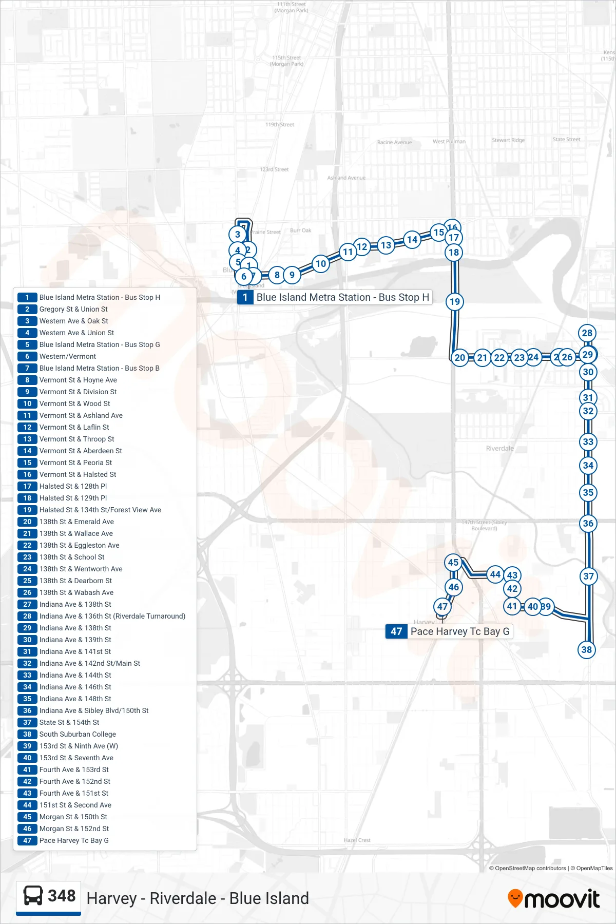
Stops list (348 - Pace Harvey Tc Bay G)
- Blue Island Metra Station - Bus Stop H
- Gregory St & Union St
- Western Ave & Oak St
- Western Ave & Union St
- Blue Island Metra Station - Bus Stop G
- Western/Vermont
- Blue Island Metra Station - Bus Stop B
- Vermont St & Hoyne Ave
- Vermont St & Division St
- Vermont St & Wood St
- Vermont St & Ashland Ave
- Vermont St & Laflin St
- Vermont St & Throop St
- Vermont St & Aberdeen St
- Vermont St & Peoria St
- Vermont St & Halsted St
- Halsted St & 128th Pl
- Halsted St & 129th Pl
- Halsted St & 134th St/Forest View Ave
- 138th St & Emerald Ave
- 138th St & Wallace Ave
- 138th St & Eggleston Ave
- 138th St & School St
- 138th St & Wentworth Ave
- 138th St & Dearborn St
- 138th St & Wabash Ave
- Indiana Ave & 138th St
- Indiana Ave & 136th St (Riverdale Turnaround)
- Indiana Ave & 138th St
- Indiana Ave & 139th St
- Indiana Ave & 141st St
- Indiana Ave & 142nd St/Main St
- Indiana Ave & 144th St
- Indiana Ave & 146th St
- Indiana Ave & 148th St
- Indiana Ave & Sibley Blvd/150th St
- State St & 154th St
- South Suburban College
- 153rd St & Ninth Ave (W)
- 153rd St & Seventh Ave
- Fourth Ave & 153rd St
- Fourth Ave & 152nd St
- Fourth Ave & 151st St
- 151st St & Second Ave
- Morgan St & 150th St
- Morgan St & 152nd St
- Pace Harvey Tc Bay G