
35 Bus Route Map
View the 35 route map and see all 35 stops along the route. The map of 35 shows where the bus travels and the location of each stop, making it easy to understand the entire route at a glance.
Explore Adriabus S.p.A. routes on the map and see where Adriabus S.p.A. bus services operate. Use the 35 map to find bus stops and see how the 35 connects different areas along its trip.
All 35 stops on the map are displayed in route order, helping you follow the 35 bus from the first stop to the last.
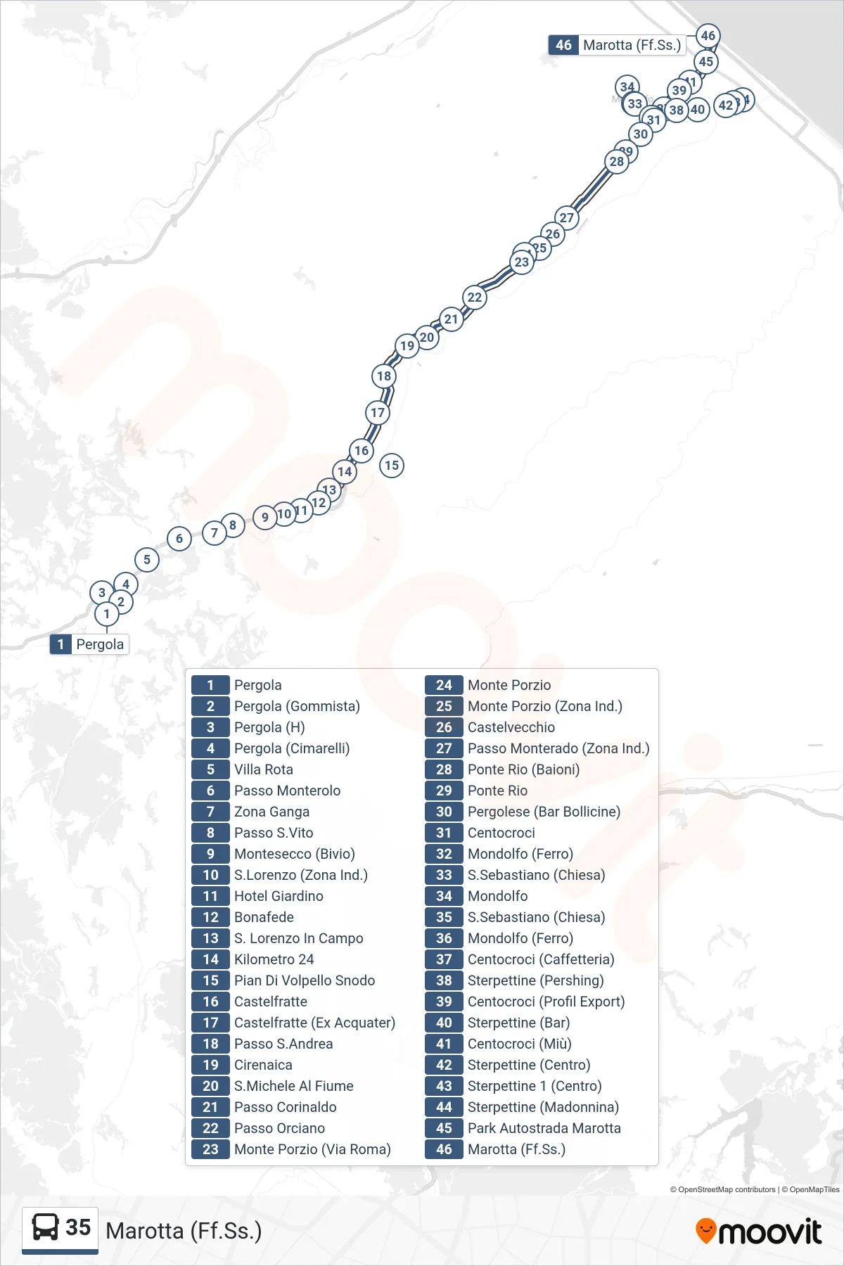
Stops list (35 - Marotta (Train Station))
- Pergola
- Pergola (Tire Shop)
- Pergola (Hospital)
- Pergola (Cimarelli)
- Villa Rota
- Monterolo Pass
- Ganga Zone
- San Vito Pass
- Montesecco (Junction)
- San Lorenzo (Industrial Zone)
- Garden Hotel
- Bonafede
- San Lorenzo In Campo
- Kilometer 24
- Pian Di Volpello Junction
- Castelfratte
- Castelfratte (Former Acquater)
- Sant'Andrea Pass
- Cirenaica
- San Michele Al Fiume
- Passo Corinaldo
- Orciano Pass
- Monte Porzio (Roma Street)
- Monte Porzio
- Monte Porzio (Industrial Zone)
- Castelvecchio
- Passo Monterado (Industrial Zone)
- Ponte Rio (Baioni)
- Ponte Rio
- Pergolese (Bollicine Bar)
- Centocroci
- Mondolfo (Ferro)
- St. Sebastian (Church)
- Mondolfo
- St. Sebastian (Church)
- Mondolfo (Ferro)
- Centocroci (Cafe)
- Sterpettine (Pershing)
- Centocroci (Profil Export)
- Sterpettine (Bar)
- Centocroci (Miù)
- Sterpettine (Center)
- Sterpettine 1 (Center)
- Sterpettine (Madonna)
- Marotta Highway Park
- Marotta (Train Station)