
35 Bus Route Map
View the 35 route map and see all 35 stops along the route. The map of 35 shows where the bus travels and the location of each stop, making it easy to understand the entire route at a glance.
Explore MBTA routes on the map and see where MBTA bus services operate. Use the 35 map to find bus stops and see how the 35 connects different areas along its trip.
All 35 stops on the map are displayed in route order, helping you follow the 35 bus from the first stop to the last.
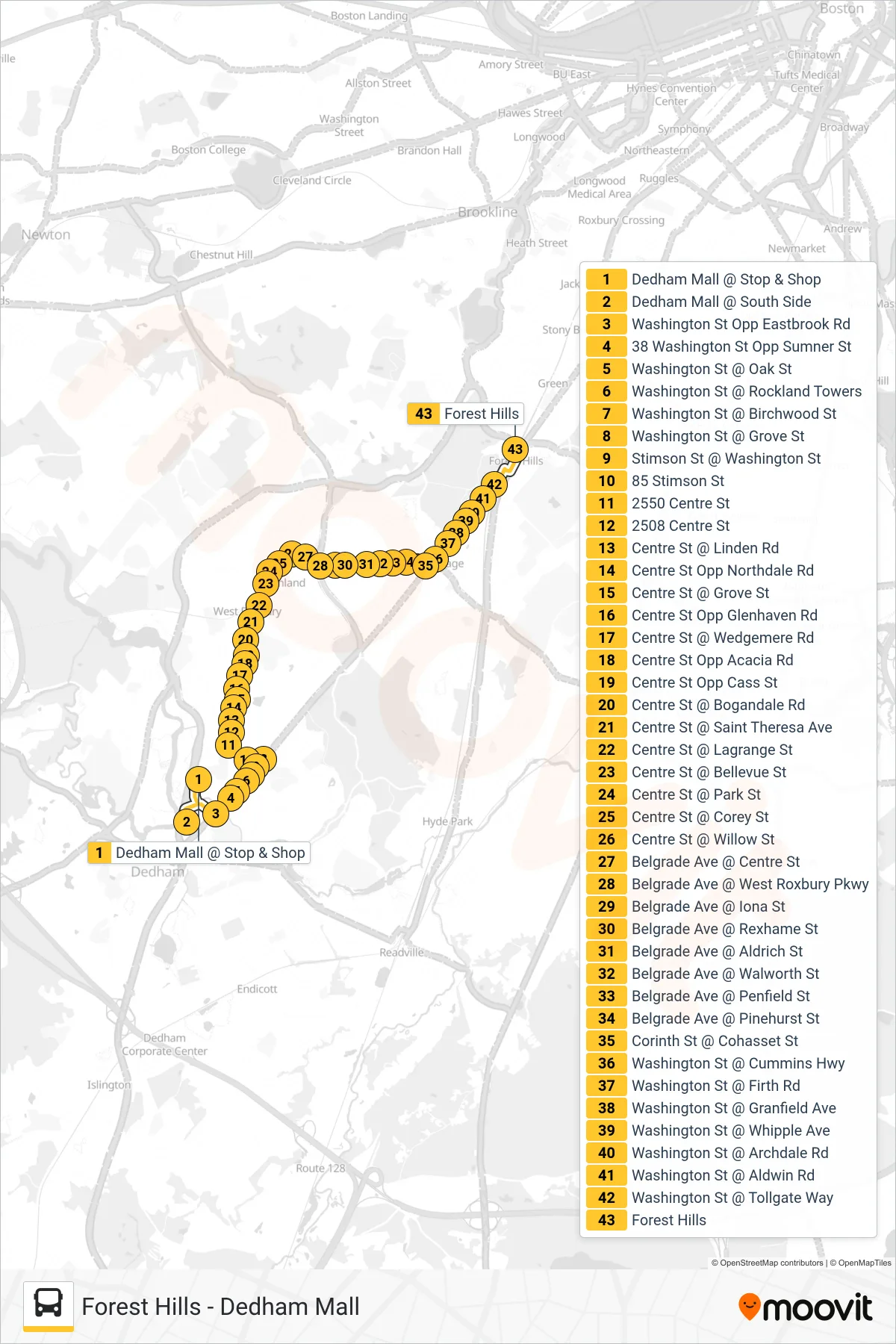
Stops list (35 - Forest Hills)
- Dedham Mall @ Stop & Shop
- Dedham Mall @ South Side
- Washington St Opp Eastbrook Rd
- 38 Washington St Opp Sumner St
- Washington St @ Oak St
- Washington St @ Rockland Towers
- Washington St @ Birchwood St
- Washington St @ Grove St
- Stimson St @ Washington St
- 85 Stimson St
- 2550 Centre St
- 2508 Centre St
- Centre St @ Linden Rd
- Centre St Opp Northdale Rd
- Centre St @ Grove St
- Centre St Opp Glenhaven Rd
- Centre St @ Wedgemere Rd
- Centre St Opp Acacia Rd
- Centre St Opp Cass St
- Centre St @ Bogandale Rd
- Centre St @ Saint Theresa Ave
- Centre St @ Lagrange St
- Centre St @ Bellevue St
- Centre St @ Park St
- Centre St @ Corey St
- Centre St @ Willow St
- Belgrade Ave @ Centre St
- Belgrade Ave @ West Roxbury Pkwy
- Belgrade Ave @ Iona St
- Belgrade Ave @ Rexhame St
- Belgrade Ave @ Aldrich St
- Belgrade Ave @ Walworth St
- Belgrade Ave @ Penfield St
- Belgrade Ave @ Pinehurst St
- Corinth St @ Cohasset St
- Washington St @ Cummins Hwy
- Washington St @ Firth Rd
- Washington St @ Granfield Ave
- Washington St @ Whipple Ave
- Washington St @ Archdale Rd
- Washington St @ Aldwin Rd
- Washington St @ Tollgate Way
- Forest Hills