
35 Bus Route Map
View the 35 route map and see all 35 stops along the route. The map of 35 shows where the bus travels and the location of each stop, making it easy to understand the entire route at a glance.
Explore LNG Fulda routes on the map and see where LNG Fulda bus services operate. Use the 35 map to find bus stops and see how the 35 connects different areas along its trip.
All 35 stops on the map are displayed in route order, helping you follow the 35 bus from the first stop to the last.
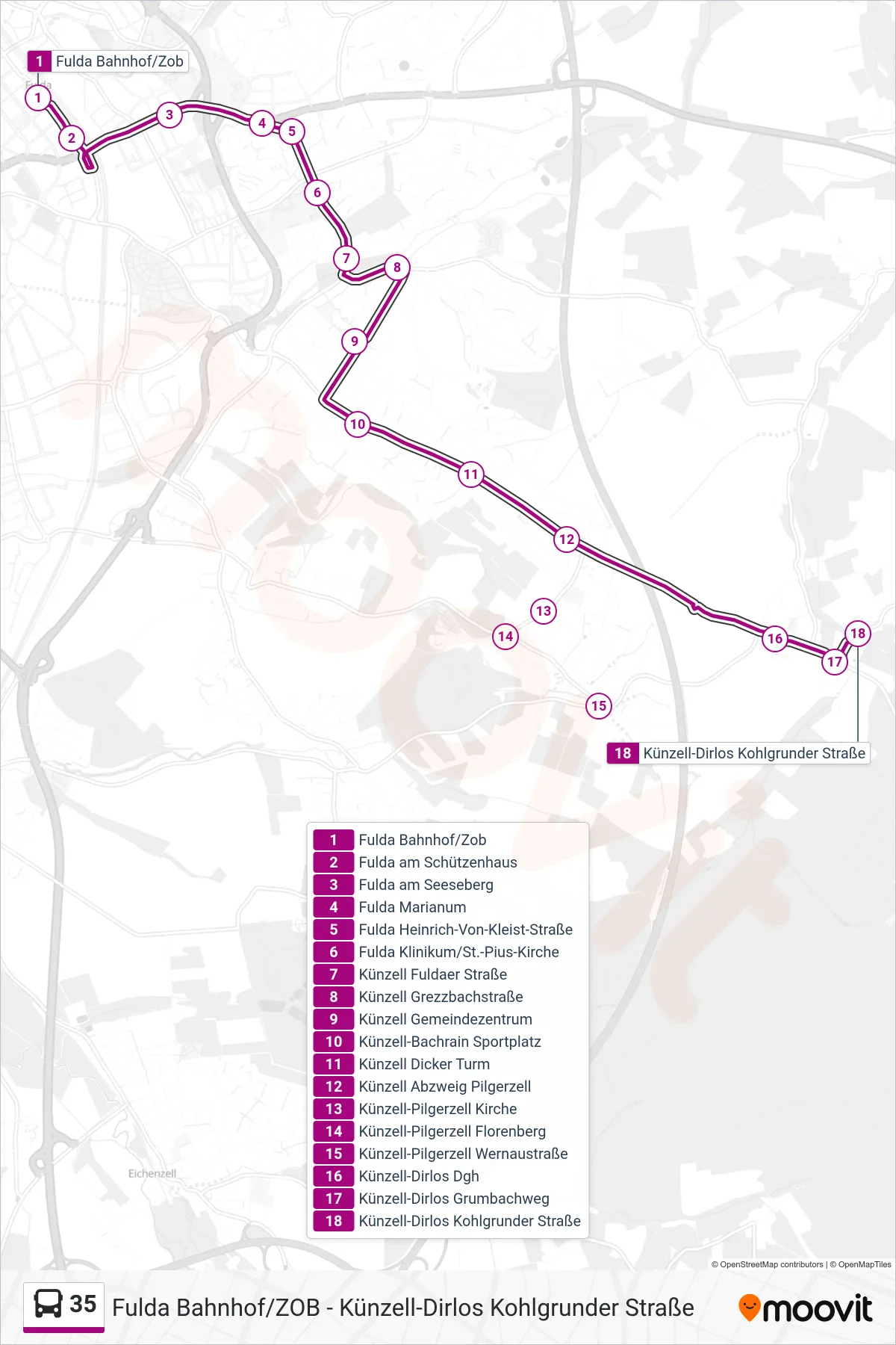
Stops list (35 - Künzell-Dirlos Kohlgrunder Straße)
- Fulda Bahnhof/Zob
- Fulda am Schützenhaus
- Fulda am Seeseberg
- Fulda Marianum
- Fulda Heinrich-Von-Kleist-Straße
- Fulda Klinikum/St.-Pius-Kirche
- Künzell Fuldaer Straße
- Künzell Grezzbachstraße
- Künzell Gemeindezentrum
- Künzell-Bachrain Sportplatz
- Künzell Dicker Turm
- Künzell Abzweig Pilgerzell
- Künzell-Pilgerzell Kirche
- Künzell-Pilgerzell Florenberg
- Künzell-Pilgerzell Wernaustraße
- Künzell-Dirlos Dgh
- Künzell-Dirlos Grumbachweg
- Künzell-Dirlos Kohlgrunder Straße
Change direction
- Route Map - 35 - Ebersburg-Ebersberg Altenmühle
- Route Map - 35 - Künzell-Dirlos Grumbachweg
- Route Map - 35 - Fulda Bahnhof/Zob
- Route Map - 35 - Poppenhausen (Wasserkuppe) Kirche
- Route Map - 35 - Künzell-Dirlos Loheland Schule
- Route Map - 35 - Gersfeld (Rhön)-Obernhausen Wasserkuppe
- Route Map - 35 - Künzell-Dietershausen Gärtnerei
- Route Map - 35 - Poppenhausen (Wasserkuppe)-Abtsroda